

C-map digital nautical chart

Navionics digital nautical chart

Paper nautical chart by publisher

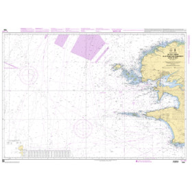
Paper nautical chart by geographic area


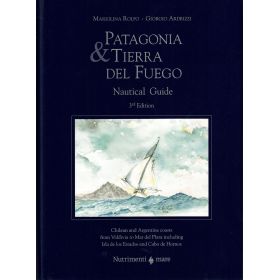
Guide, pilot, almanac, nautical instruction

Chart table

Digital Nautical Chart Selector: easily find the digital chart you need

Paper Nautical Chart Selector: easily find the paper chart you need


















About the Nautic Way Maritime Bookstore
Nautic Way Maritime Bookshop: Specialists in Nautical Charts and Maritime Publications
An Independent Maritime Bookshop and Authorised Agent for Leading Nautical Chart Publishers
Nautic Way Maritime Bookshop is an independent specialist bookshop dedicated to nautical charts, marine cartography and maritime publications. As a European specialist in nautical charts and maritime documentation, we support recreational sailors, offshore cruisers and maritime professionals in preparing their voyages and navigating safely around the world.
With a catalogue of more than 20,000 references, Nautic Way offers a wide selection of publications for coastal navigation, offshore cruising, ocean crossings and round-the-world sailing. Our range includes paper nautical charts, digital marine charts, nautical cruising guides, sailing directions, navigation books, almanacs, ephemerides, regulatory publications and navigation instruments.
We distribute leading international chart collections, including those published by SHOM (the French Hydrographic and Oceanographic Service), Admiralty, Imray and NV Charts, alongside other specialist publishers. We also offer digital nautical charts and electronic charting solutions designed for different navigation systems.
As an authorised agent for several hydrographic services and chart publishers, Nautic Way maintains close professional relationships with its suppliers to provide navigators with suitable, up-to-date publications at competitive prices and within the best possible delivery times.
Our objective is straightforward: to help every customer find the nautical charts, sailing guides and maritime publications they need to prepare their voyages with confidence.
Specialists in Paper and Digital Nautical Charts
Marine cartography is at the heart of Nautic Way's business. Choosing a nautical chart involves more than selecting a product from a catalogue: it requires identifying the geographical area, type of navigation, chart scale and format best suited to the intended voyage.
That is why Nautic Way provides specialist cartographic advice to customers looking for a paper nautical chart for coastal sailing, a complete chart portfolio for a transatlantic crossing or digital charts for navigation software and GPS chartplotters.
Our range includes:
-
- Paper nautical charts for coastal navigation, port approaches, narrow channels and offshore passages.
-
- SHOM nautical charts, as well as charts published by Admiralty, Imray and NV Charts.
-
- Digital nautical charts, including SHOM digital chart products and other publishers' solutions, subject to available formats and system compatibility.
-
- Nautical cruising guides and sailing directions to help plan routes, study harbour approaches and understand the characteristics of specific cruising areas.
-
- Technical and regulatory publications for recreational sailors, maritime professionals and students undertaking nautical training.
Nautic Way's expertise also lies in its knowledge of the different chart collections and their specific characteristics. We help customers identify the publications that correspond to their destinations, itineraries and sailing requirements.
Planning a cruise in the Mediterranean, sailing around the British Isles, crossing the Atlantic, exploring the Caribbean or navigating in polar regions? Nautic Way can help you find nautical charts and sailing publications suited to your intended cruising area.
Our specialist knowledge is particularly valuable when customers need to locate a chart covering a specific harbour, assemble a chart portfolio for an extended voyage or choose digital charts compatible with their electronic navigation equipment.
SHOM Digital Charts, Nautical Guides and Technical Publications
Preparing a voyage requires several complementary sources of information. Nautical charts show depths, hazards, landmarks and other information essential for navigation, while cruising guides and sailing directions provide detailed information about coastlines, ports, anchorages and local conditions.
Nautic Way brings together a carefully selected range of nautical publications to meet these needs, including paper nautical charts, digital cartography, navigation books and technical publications.
Navigators looking for SHOM digital charts, electronic charts for navigation software, cruising guides for an upcoming voyage or sailing directions for a particular area can rely on our specialist knowledge to identify the available options.
We also offer publications covering celestial navigation, marine meteorology, safety at sea, maritime regulations and the preparation of long-distance passages.
By combining cartographic expertise with specialist nautical documentation, Nautic Way enables customers to source many of the publications required to plan a maritime itinerary from a single specialist supplier.
The selection of nautical publications must take into account their edition, currency, geographical coverage and compatibility with the intended equipment. Navigators should also consult official updates and applicable navigational safety information.
Expert Cartographic Advice for Every Cruising Area
Every maritime project has its own requirements. Coastal sailing, Mediterranean cruising, a transatlantic crossing and a round-the-world voyage do not require the same charts or publications.
Nautic Way helps customers identify the documentation best suited to their sailing plans. Our knowledge of publishers, chart collections and geographical coverage enables us to recommend relevant nautical charts and publications for their intended destinations.
Our advice is available to both novice and experienced sailors. We support first-time cruisers, yacht and motorboat owners, crews preparing for ocean passages and maritime professionals who require specialist documentation.
Our aim is to help customers assemble a coherent set of publications, including nautical charts at different scales, cruising guides, sailing directions and additional reference works suited to their voyage.
Choosing Nautic Way means benefiting from the expertise of a specialist nautical chart bookshop that can guide you through international chart collections and recommend publications according to your cruising area.
An Authorised Maritime Bookshop with Established Publisher Relationships
The quality of nautical documentation depends on its origin, currency and suitability for its intended use. Nautic Way works with recognised publishers and hydrographic services to supply nautical charts and maritime publications from specialist collections.
Our status as an authorised agent for several organisations and publishers reflects these professional relationships. It is supported by our detailed knowledge of their catalogues, product references and the specific characteristics of their chart collections.
We assist customers with precise documentation requests, including identifying a particular chart reference, finding charts covering a defined area, comparing available editions and selecting complementary publications for a planned route.
Our expertise is particularly useful when a voyage involves several countries or maritime regions and requires charts from different hydrographic services.
Nautic Way focuses on specialist knowledge, practical advice and an in-depth understanding of its products, with particular attention to matching publications to the actual needs of navigators.
A Supplier of Nautical Charts and Publications for Retailers
Nautic Way Maritime Bookshop serves not only individual customers but also retailers, specialist bookshops, chandlers and other businesses operating in the nautical sector.
With a catalogue of more than 20,000 references, we enable retailers to consolidate orders through a specialist supplier of nautical charts and maritime documentation.
This approach provides access to international chart collections and specialist publications that may be difficult to source through general distribution channels.
Nautic Way also has expertise in print-on-demand cartography. For selected eligible chart references, this service enables nautical charts to be printed on our own large-format plotters, subject to the applicable conditions for each publication.
For retailers, this capability provides a practical way to fulfil specific customer requests without maintaining extensive stocks of every chart and publication available.
Nautic Way therefore supports professional customers with specialist sourcing and supply, taking into account the diversity of publishers, geographical areas and end-customer requirements.
Our Origins in Online Nautical Publishing
The history of Nautic Way Maritime Bookshop is closely linked to Voiles News magazine, a pioneering online nautical magazine launched in 1998.
As the publication and its online shop grew, a dedicated commercial activity developed around nautical charts, navigation books and documentary resources for sailors.
Following the success of the online shop, the business became independent in 2012 under the name Nautic Way Maritime Bookshop.
Since then, Nautic Way has developed specialist expertise in the distribution of nautical charts and maritime publications, drawing on its extensive catalogue and its understanding of navigators' needs.
This history reflects an ongoing evolution: from an online shop originating in digital nautical publishing to an independent maritime bookshop specialising in cartography and navigational documentation for customers in France and internationally.
Librairie Maritime Outremer: Preserving a Historic Maritime Heritage

In 2023, Nautic Way Maritime Bookshop acquired the name Librairie Maritime Outremer, reviving a renowned name in French maritime bookselling.
Founded in 1838, Librairie Maritime Outremer built a recognised reputation over nearly two centuries for supplying nautical charts, sailing books and documentation for maritime professionals.
Located on Rue Jacob in Paris, it was considered one of France's oldest maritime bookshops. It also maintained historic links with SHOM, which was then based nearby, and played an important role in the distribution of hydrographic publications.
Nautic Way's acquisition of the name reflects its commitment to preserving and extending this heritage. It brings together the legacy of a historic institution and a modern maritime bookshop focused on online distribution, digital cartography and the evolving needs of today's navigators.
This connection between tradition and innovation reflects a shared commitment: making maritime documentation accessible to everyone who sails, works or trains in the maritime sector.
A Specialist Bookshop Serving the Entire Maritime Community
Throughout its development, Nautic Way Maritime Bookshop has supported a diverse customer base, including recreational sailors, offshore cruisers, ocean racers, explorers, maritime schools and training centres, public administrations, shipping companies, naval forces and businesses specialising in offshore operations.
These customers have widely varying requirements. Some need a nautical chart for coastal sailing or an anchorage; others must assemble the documentation required for an ocean passage, maritime training or professional operations.
Our catalogue includes nautical charts, cruising guides, technical books, regulatory publications and other specialist resources. We adapt our assistance to the nature of each request.
We also serve enthusiasts of maritime culture through a selection of books, maritime literature and nautical decorative items.
This diversity illustrates Nautic Way's purpose: to be a trusted documentation partner for everyone who sails, plans a voyage, teaches navigation or works professionally at sea.
Nautic Way: Your European Specialist in Nautical Charts
Choosing Nautic Way means working with an independent maritime bookshop that brings together a broad range of paper and digital nautical charts, cruising guides and technical publications, backed by specialist advice and cartographic expertise.
Whether you are looking for a SHOM nautical chart, an Admiralty chart for overseas sailing, a cruising guide for a planned voyage, digital charts compatible with your navigation equipment or specialist publications for an offshore passage, Nautic Way can help you identify the documentation best suited to your project.
Our international catalogue, established relationships with publishers and knowledge of different cruising areas form the foundations of our expertise.
Nautic Way: specialists in nautical charts, SHOM digital charts and maritime publications, serving recreational sailors and maritime professionals.
From French coastal waters to ocean routes, from the Mediterranean to the world's most remote regions, Nautic Way Maritime Bookshop puts its cartographic expertise and passion for the sea at the service of your sailing plans.