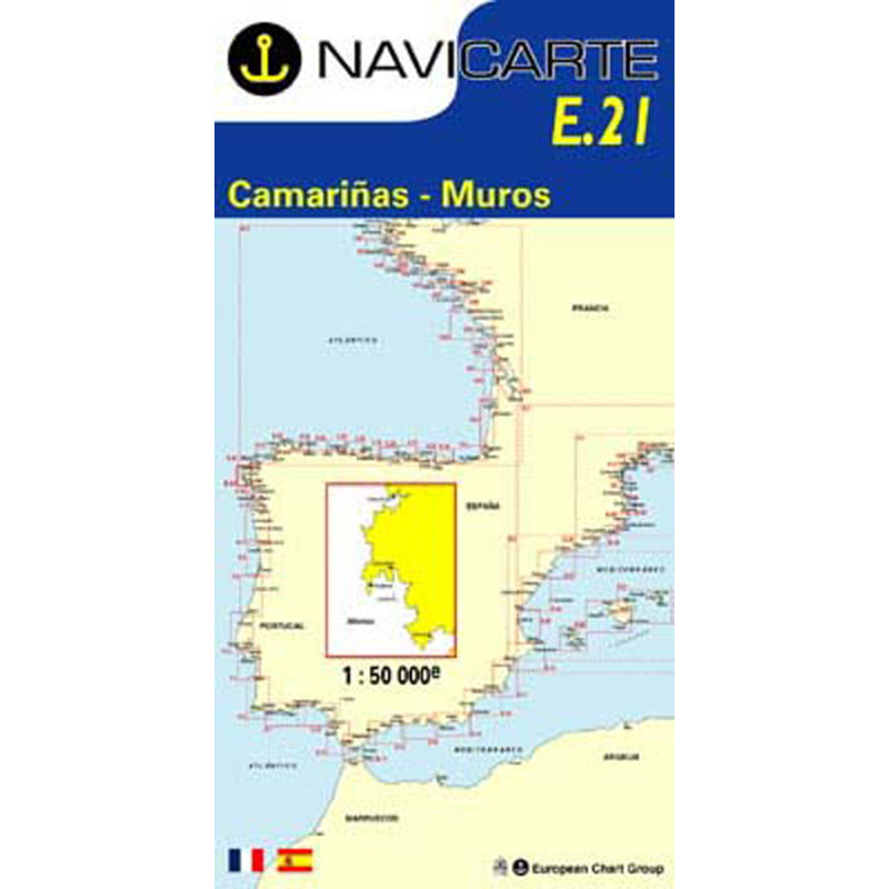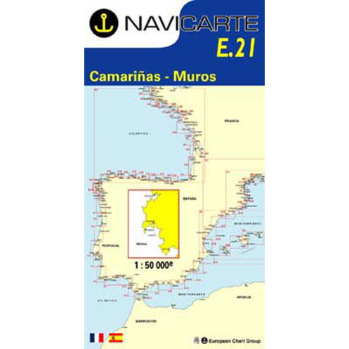






Navicarte nautical chart, coasts of France and Spain.
Data sheet
Specific References
The Navicarte E21 – Camarinas – Muros nautical chart is a paper coastal navigation chart covering part of the Atlantic coast of Galicia, in north-western Spain. It provides a 1:50,000-scale cartographic representation for planning and supporting navigation between the Camariñas and Muros areas.
This Navicarte chart is primarily intended for recreational sailors navigating along the Galician coast, whether aboard a sailing yacht, motorboat or during a coastal cruise. It is also a useful planning chart for longer passages along the Spanish coast, particularly when used together with other Navicarte charts in the series covering Galicia.
The area covered by Navicarte E21 forms part of a particularly interesting coastline for coastal navigation in Spain. Galicia has a highly indented coastline, with numerous rías and complex coastal configurations that require careful chart reading.
The E21 chart allows routes to be planned at a scale of 1:50,000. This scale provides a balance between an overall view of the area and a useful level of detail for coastal navigation. It is suitable for route planning, identifying major geographical landmarks and assessing different navigation options before approaching the coastline.
For sailors planning a cruise in Galicia, the E21 chart can therefore be used to organise a passage between Camariñas and Muros and to determine the sequence of coastal areas to be navigated before completing the preparation with charts covering adjacent areas.
Paper nautical charts retain an important role even when a boat is equipped with a GPS or chartplotter. They provide a simultaneous view of a relatively large maritime area without depending on the zoom level of an electronic screen.
On a chart table, the navigator can plot a route, measure distances, compare different courses and maintain an overall view of the coastline. This approach is particularly useful before coastal navigation in Spain, when several route options need to be assessed according to wind, sea conditions, visibility or possible stops.
The Navicarte E21 can therefore be used before departure to prepare the itinerary and during navigation as a complementary reference document alongside electronic navigation equipment.
A nautical chart at a scale of 1:50,000 allows navigators to work with the main elements required to understand the maritime environment. The navigator must be able to interpret depths, seabed information, buoyage, lights, hazards and the various landmarks shown on the chart.
Reading a paper nautical chart is not simply a matter of following a plotted course. It also makes it possible to anticipate changes in direction, identify coastal features and understand the overall configuration of the area in which the vessel is operating.
For navigation in Galicia, this ability to maintain an overall view is particularly useful when following an indented coastline or when several route options need to be compared.
The Navicarte E21 is not an electronic chart designed to be installed in a GPS or chartplotter. It is a folded paper nautical chart intended for route planning and chart reading on board.
It can, however, be used together with electronic navigation equipment. The GPS provides the vessel's position, while the paper chart allows that position to be placed within an overall representation of the area.
This combination is particularly useful for checking the consistency of the planned route, identifying possible programming errors and maintaining a backup navigation reference in the event of a problem with electronic equipment.
Publisher: Navicarte
Chart number: E21
Area: Camarinas – Muros
Country: Spain
Maritime area: Atlantic Ocean
Type: nautical navigation chart
Use: recreational boating
Navigation: coastal waters
Format: paper
Chart format: folded
Unfolded size: A0, 118.9 × 84.1 cm
Folded size: 166 × 315 mm
Scale: 1:50,000
Languages indicated: French and Spanish
The E21 chart is suitable for planning coastal navigation in Galicia around the Camariñas – Muros area. It can be used during sailing or motorboat cruises and as a planning tool for a coastal itinerary.
It can also be useful for sailors progressively exploring the north-western coast of Spain and looking for chart coverage adapted to each stage of their voyage.
For a longer voyage, it is logical to use it together with Navicarte charts covering the immediately adjacent areas. The selection of charts should always be based on the actual route, the required scale and the area in which the vessel will be navigating.
The Navicarte E21 can also be used as an educational resource. Its 1:50,000 scale makes it suitable for working on the essential principles of nautical chart reading, including positioning, distances, courses, coastal landmarks, depths and buoyage.
For a sailor learning how to plan coastal navigation in Spain, working with a paper chart is a useful complement to GPS navigation. It helps demonstrate that the electronic position of the vessel is only one part of the information required for safe and effective navigation.
What area does the Navicarte E21 cover?
The Navicarte E21 covers the area indicated by its title, between Camarinas and Muros, on the Atlantic coast of Spain.
What is the scale of the Navicarte E21?
The chart is produced at a scale of 1:50,000, which is suitable for coastal navigation and route planning along this part of the Spanish coastline.
Is the Navicarte E21 a paper nautical chart?
Yes. It is a folded paper nautical chart that unfolds to A0 size.
What are the dimensions of the Navicarte E21?
The chart measures 118.9 × 84.1 cm when unfolded, while its folded format is 166 × 315 mm.
Which languages are available on the Navicarte E21?
The product information indicates French and Spanish.
Is the Navicarte E21 suitable for recreational boating?
Yes. The product information classifies it as a navigation chart intended for recreational boating and coastal navigation.
Can the Navicarte E21 be used with a GPS?
Yes. The paper chart can be used alongside a GPS or chartplotter to compare the electronic position with the overall cartographic representation of the area.
Is the Navicarte E21 sufficient on its own to plan a voyage in Galicia?
It provides chart coverage for the relevant area, but a complete navigation plan may require additional nautical documents depending on the route, including information concerning tides, ports, lights, weather conditions and applicable regulations.
Is the Navicarte E21 suitable for sailing along the whole Galician coast?
No. A single chart does not cover the entire Galician coastline. For a longer voyage, several charts covering successive areas should be selected according to the planned route.
You might also like