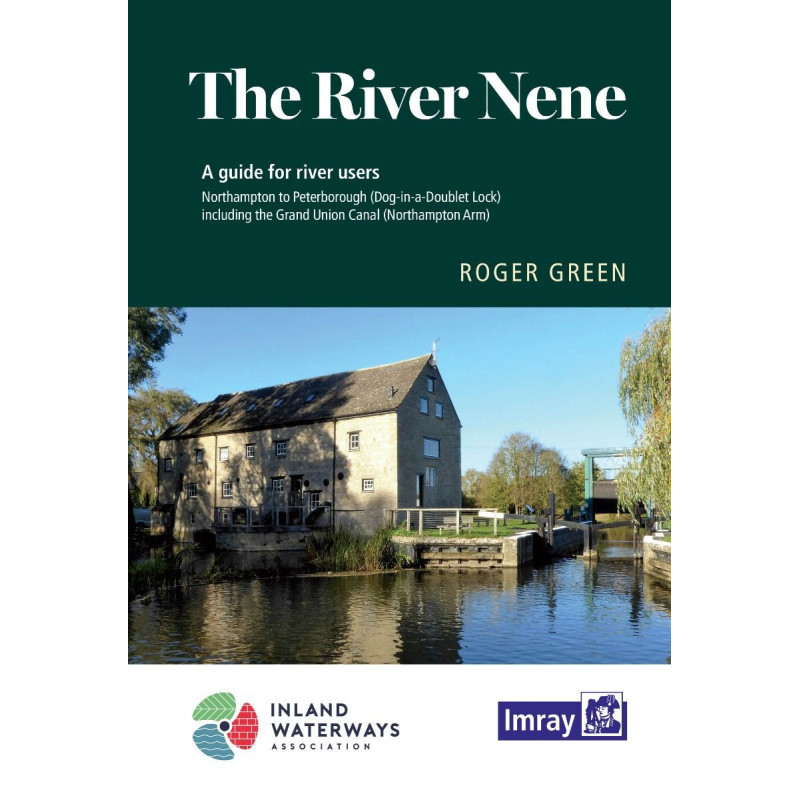


Imray - The River Nene
search
  • googlemap
  • Imray - The River Nene

Imray - The River Nene

€16.15
Tax included
Imray
In English language
Estimated preparation time: 5 to 14 days

Navigate the River Nene with confidence using this spiral-bound guide. Includes precise maps, lock distances, mooring spots, and local points of interest for boaters, paddlers, and explorers.

INL0351

Data sheet

What is the classification?
navigation book
Who is the publisher or the author?
Roger Green
On what digital medium is this nautical chart / book stored?
paper medium
From which year does this nautical chart date?
2020
What type of navigation book is this?
pilot
Picto
In English language

Specific References

UPC
400000055435
EAN13
9781786791634
New
Description détaillée

The River Nene Navigation Guide

Guide in English
Paperback edition

Your Essential Companion for Navigating the River Nene

Explore the scenic waterways of the River Nene with confidence using this comprehensive navigation guide, meticulously crafted for boaters, canoeists, cyclists, and hikers alike. Covering the journey from Northampton to The Wash, including the Northampton Arm of the Grand Union Canal up to Gayton Junction, this guide is your go-to resource for safe and enjoyable navigation. Fully revised and updated in 2020, it combines detailed navigation notes with precise maps, ensuring you never miss a critical waypoint or landmark along the way.

Precision Navigation with Detailed Mapping

Navigate with ease thanks to the guide’s clear and accurate maps, which highlight key navigation features such as locks, bridges, and mooring spots. The spiral-bound format allows for effortless handling on deck, while the detailed notes provide step-by-step guidance for each section of the river. Whether you're planning a short trip or a longer voyage, the included mileage tables and estimated lock times help you optimize your journey, saving you time and effort.

Comprehensive Information for Every Traveler

Beyond navigation, this guide offers a wealth of practical information to enhance your experience. Discover the best mooring spots, updated facilities, and essential services along the route, many of which have been recently improved. Canoeists will appreciate the detailed access points and portage locations, while cyclists and hikers can explore the scenic trails that run parallel to the waterway. The guide also delves into the rich local history, providing fascinating insights into the regions you’ll pass through, all complemented by stunning photographs that capture the beauty of the River Nene.

Designed for Practicality and Durability

Weighing just 600 grams, this guide is lightweight yet durable, making it ideal for use on the water. The spiral binding ensures the pages stay flat, even in windy conditions, while the high-quality paper resists wear and tear. Whether you're a seasoned boater or a first-time explorer, this guide is an indispensable tool for making the most of your time on the River Nene. Plan your trip, navigate with confidence, and uncover the hidden gems along this historic waterway.

Unlock the River Nene’s Hidden Gems with This Expert Navigation Guide
Whether you're steering a narrowboat, paddling a canoe, or exploring on foot, this navigation guide is your ultimate companion for mastering the River Nene. Spanning from Northampton to The Wash, including the Northampton Arm of the Grand Union Canal, this 2020 edition is packed with up-to-date information to ensure a seamless and enjoyable journey. Designed for practicality, the spiral-bound format allows for easy handling on deck, while the detailed maps and navigation notes provide unparalleled accuracy for every stretch of the waterway.

Plan Your Journey with Precision
This guide goes beyond basic navigation by offering mileage tables and estimated lock times, allowing you to plan your trip down to the minute. The clear, step-by-step notes highlight critical waypoints, hazards, and points of interest, ensuring you stay on course and make the most of your time on the water. With updates on recently improved mooring spots, facilities, and services, you’ll always have access to the latest information for a stress-free voyage.

More Than Just a Navigation Tool
Ideal for boaters, canoeists, cyclists, and hikers, this guide is a treasure trove of practical insights. Discover canoe launch points, portage locations, and scenic walking or cycling routes that run alongside the river. Dive into the local history with engaging narratives and stunning photographs that bring the River Nene’s rich heritage to life. Whether you're looking for a weekend adventure or a longer exploration, this guide ensures you won’t miss a thing.

This 2020 edition of the River Nene navigation guide is a spiral-bound paperback, weighing 600 grams for easy portability. Written in English by Roger Green, it covers the waterway from Northampton to The Wash, including the Northampton Arm of the Grand Union Canal up to Gayton Junction. The guide features detailed maps, navigation notes, mileage tables, lock timings, mooring information, and insights into local history, facilities, and recreational activities.

With decades of experience in maritime and inland waterway navigation, this publisher is renowned for producing high-quality guides that boaters, sailors, and outdoor enthusiasts trust. Their publications are celebrated for their accuracy, practicality, and attention to detail, making them indispensable tools for safe and enjoyable exploration.

  • This guide offers unmatched precision with detailed maps and navigation notes, ensuring safe and efficient travel on the River Nene.
  • Its spiral-bound design allows for easy handling on deck, while the mileage tables and lock timings help you plan your journey with confidence.
  • Beyond navigation, it provides insights into mooring spots, facilities, canoe access points, and local history, making it a versatile resource for boaters, canoeists, cyclists, and hikers alike.
What is the coverage area of this navigation guide?

The guide covers the river from Northampton to The Wash, including the Northampton Arm of the Grand Union Canal up to Gayton Junction.

Are there detailed maps included in the guide?

Yes, the guide features precise navigation charts with key navigation markers and detailed maps of the canal and river.

Does the guide provide estimated travel times between locks?

Yes, it includes useful tables with mileage and estimated travel times between locks to help plan your journey.

Are there any updates on mooring and service facilities?

The guide provides updated information on moorings, facilities, and services, many of which have been recently improved.

Is this guide suitable for canoeists and kayakers?

Yes, it includes access points for canoe launches and portage locations along the route.

Does the guide include information for cyclists and hikers?

Yes, it features walking and cycling routes, along with local history and points of interest.

What is the weight of the guide?

The guide weighs approximately 600 grams, making it easy to carry on board or during outdoor activities.

Loading...