
The Difference Between an Orthodromic Chart and a Gnomonic Chart
Understanding, Choosing, and Using the Right Charts in Maritime Navigation
Introduction
In the world of maritime navigation, a chart is far more than a graphical aid: it is a decision-making, safety, and performance tool. Whether for offshore sailing, professional navigation, ocean racing, or nautical training, understanding the different types of charts is essential.
Among the concepts often considered complex—but absolutely fundamental—are the orthodromic chart and the gnomonic chart. These two notions are closely linked to routes on the Earth’s spherical surface and play a key role in calculating the shortest and most efficient paths at sea.
This technical yet accessible article offers a clear and comprehensive explanation, including:
- Precise definitions
- Geometric principles
- Concrete maritime navigation examples
- Practical onboard use
- Detailed comparisons
- Advice on choosing charts and navigation books
1. Understanding the Earth as a Sphere: the Fundamental Principle
Before exploring the charts themselves, it is essential to recall a basic fact:
🌍 The Earth is (almost) spherical.
This means:
- The shortest path between two points is not a straight line on a flat map
- Route calculations must take the curvature of the Earth into account
This is precisely where the concepts of orthodromy and gnomonic projection come into play.
2. What Is an Orthodromic Route?


2.1 Definition of Orthodromy
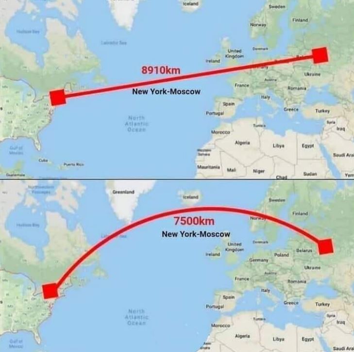
An orthodromic route is the shortest path between two points on a sphere.
In practical terms:
- It corresponds to an arc of a great circle
- A great circle is a circle whose center coincides with the center of the Earth
- The Equator and all meridians are great circles
👉 Any orthodromic route is therefore geometrically optimal in terms of distance.
2.2 Orthodromy in Maritime Navigation
In offshore navigation:
- An orthodromic route minimizes sailing distance
- It is preferred for long ocean crossings
- It is widely used in professional maritime and aeronautical navigation
Example
A route from Europe to North America will curve northward, sometimes close to Greenland, even though this seems counterintuitive on a conventional flat map.
2.3 How an Orthodromic Route Appears on Charts
- On a globe: a natural curve
- On most flat charts (Mercator, Lambert): a curved line
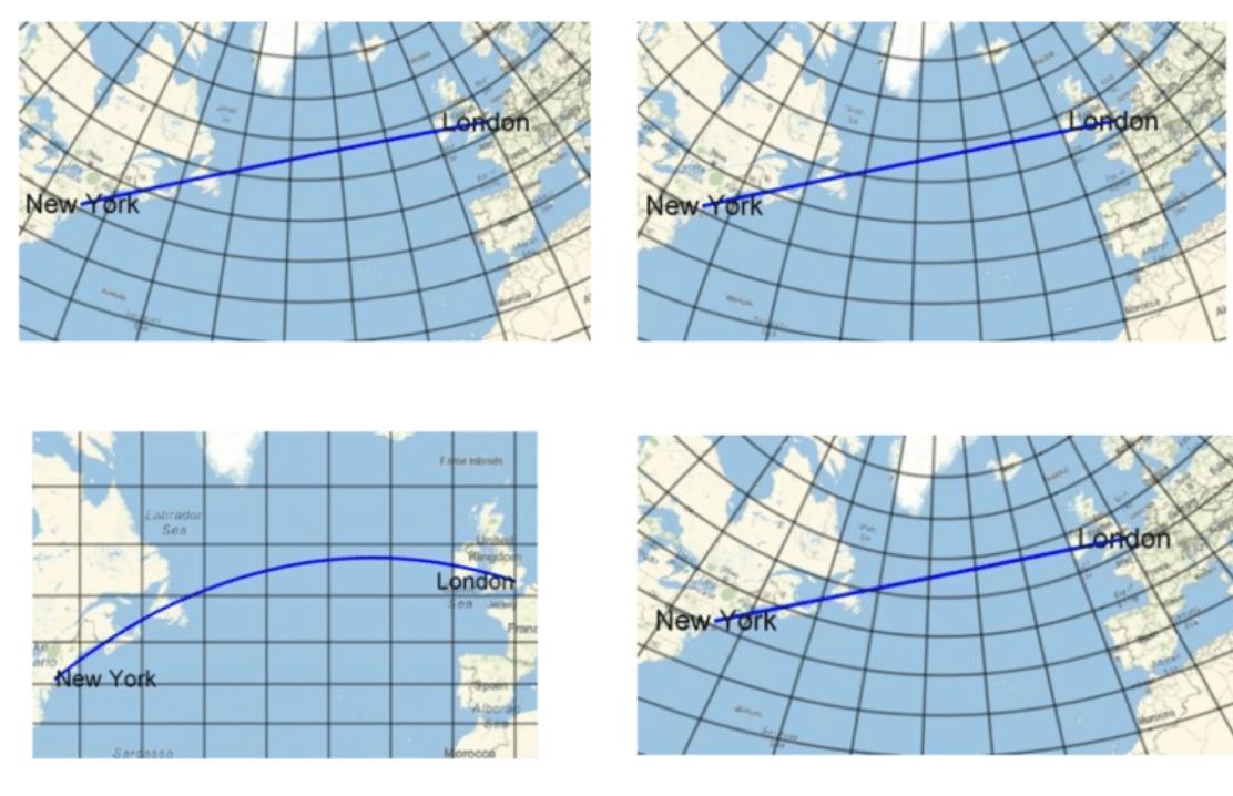
- On a gnomonic chart: a straight line
👉 Orthodromy is a mathematical and navigational concept, not a specific type of chart.
3. What Is a Gnomonic Chart?
3.1 Definition of the Gnomonic Projection
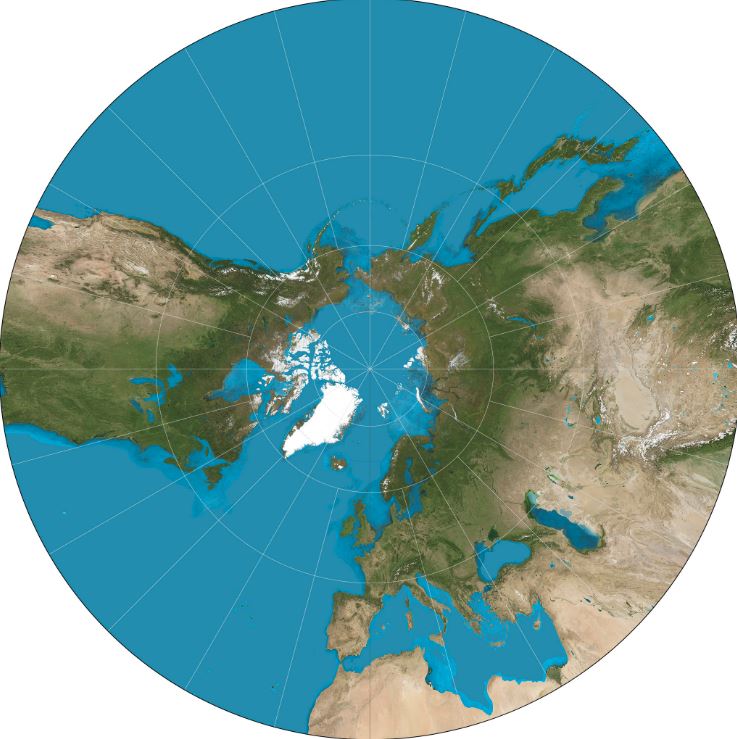
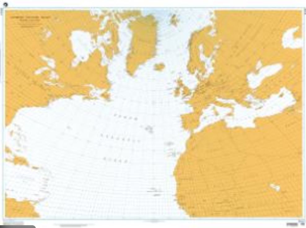
A gnomonic chart is a map projection created by projecting points on the Earth’s surface from the center of the Earth onto a tangent plane.
The result:
- All great circles are represented as straight lines
- Other routes become highly distorted
3.2 Essential Property
📐 Every orthodromic route appears as a straight line on a gnomonic chart
This is the only map projection with this property.
👉 It makes the gnomonic chart the ideal tool for drawing orthodromic routes.
3.3 Limitations of Gnomonic Charts
- Extreme distortion far from the point of tangency
- Impossible to represent the entire globe
- Angles, distances, and areas are highly distorted
For this reason, the gnomonic chart is:
- ❌ unsuitable for day-to-day navigation
- ✅ invaluable for initial route planning
4. The Fundamental Difference Between Orthodromic and Gnomonic Charts
|
Aspect |
Orthodromic Route |
Gnomonic Chart |
|
Nature |
Real trajectory |
Map projection |
|
Function |
Shortest path |
Display great circles |
|
Status |
Mathematical concept |
Graphical support |
|
Appearance |
Usually curved |
Straight line |
|
Purpose |
Route optimization |
Route plotting |
👉 A common misconception:
The gnomonic chart does not create the orthodromic route—it simply reveals it.
5. Orthodromy vs Rhumb Line (Loxodrome)
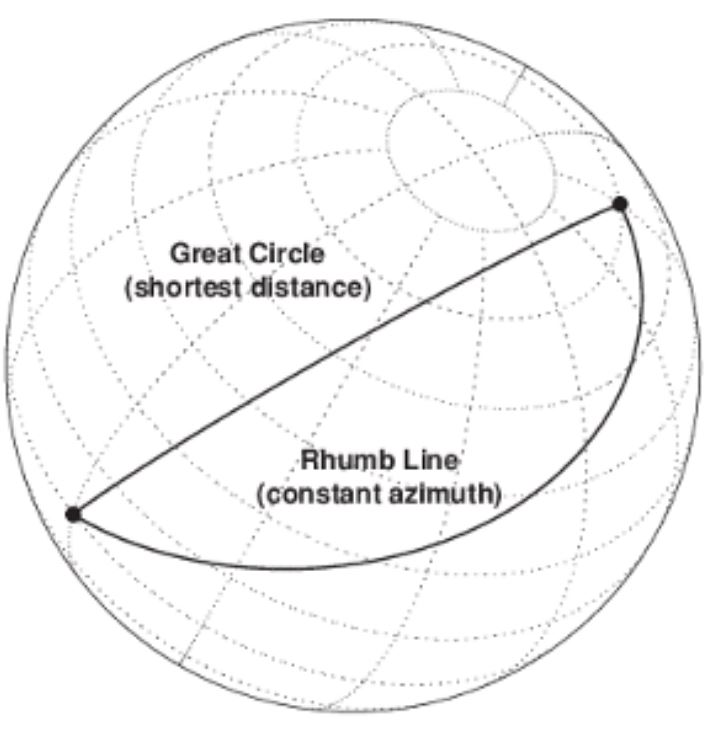

5.1 The Rhumb Line
A rhumb line (loxodrome) is a route that crosses all meridians at a constant angle.
- It appears as a straight line on a Mercator chart
- It is easier to steer with a constant compass heading
- Over long distances, it is longer than an orthodromic route
5.2 Choosing Between Orthodromic and Rhumb Line Routes
|
Situation |
Recommended Route |
|
Long ocean passage |
Orthodromic |
|
Coastal navigation |
Rhumb line |
|
Simple compass steering |
Rhumb line |
|
Fuel or time optimization |
Orthodromic |
6. Practical Onboard Use
6.1 Traditional Paper Method
- Plot the route on a gnomonic chart
- Divide the route into manageable segments
- Transfer these segments onto a Mercator chart
- Sail each leg with its corresponding course
📚 This classical method is explained in detail in offshore navigation manuals available from Nautic Way.
6.2 Modern Electronic Navigation
- Navigation software automatically calculates orthodromic routes
- GPS plotters display optimized tracks
- Theoretical understanding remains essential for safety and redundancy
👉 Paper charts are still vital in the event of electronic failure.
7. Why These Concepts Still Matter Today
Even in the age of GPS:
- Nautical training programs require understanding projections
- Maritime examinations include these topics
- Safe navigation relies on knowledge redundancy
8. Choosing Nautical Charts and Books from Nautic Way
8.1 Recommended Nautical Charts
- Ocean-scale Mercator charts
- Offshore routing charts
- World navigation atlases
👉 Ideal for plotting and following orthodromic routes.
8.2 Essential Technical Books
- Offshore navigation manuals
- Marine cartography references
- Ocean passage planning guides
📘 These books cover:
- Orthodromic calculations
- Map projections
- Real-world navigation case studies
8.3 Why Buy from Nautic Way?
- Specialized maritime selection
- Professional and educational resources
- Authoritative paper charts
- Expertise of a dedicated nautical bookstore
Conclusion
The orthodromic chart and the gnomonic chart are neither competitors nor interchangeable tools.
One represents the true shortest path on the Earth’s surface, while the other provides the essential cartographic medium to plot it accurately.
Mastering these concepts allows sailors to:
- Navigate more efficiently
- Better understand their tools
- Increase safety at sea
- Make informed choices when selecting charts and navigation books
⚓ At Nautic Way, we believe that a good sailor is first and foremost a sailor who understands their charts.