
Still essential despite GPS, paper nautical charts demand care and precision. From humidity to manual corrections, their upkeep directly impacts the navigator’s safety.
Paper charts: a reliable ally
With the widespread use of plotters and mobile apps, some sailors neglect paper. Yet nautical charts remain a regulatory requirement and serve as a backup in case of electronic failure. But they must be accurate and legible.
Protecting against salt and moisture
Onboard, charts are exposed to spray, salt, and repeated handling. To avoid stains and tears, it is best to keep them in a plastic tube or on a chartboard. Useful extracts for restricted sailing areas can also be laminated.
Folding and handling: a discipline
Folding is a frequent cause of damage. Specialists recommend always folding in the same direction and avoiding multiple creases. For areas consulted regularly, it may be useful to cut out the chart and make a laminated sheet.
Updating charts: are you up to date?
Maintaining a chart is not just about protecting it physically—it also means keeping it updated.
The French Hydrographic and Oceanographic Service (Shom) and the United Kingdom Hydrographic Office (Admiralty) publish online all corrections to be applied since January 1, 1999.
For Shom, these corrections are freely available via the online service Groupe d’Avis aux Navigateurs (GAN).
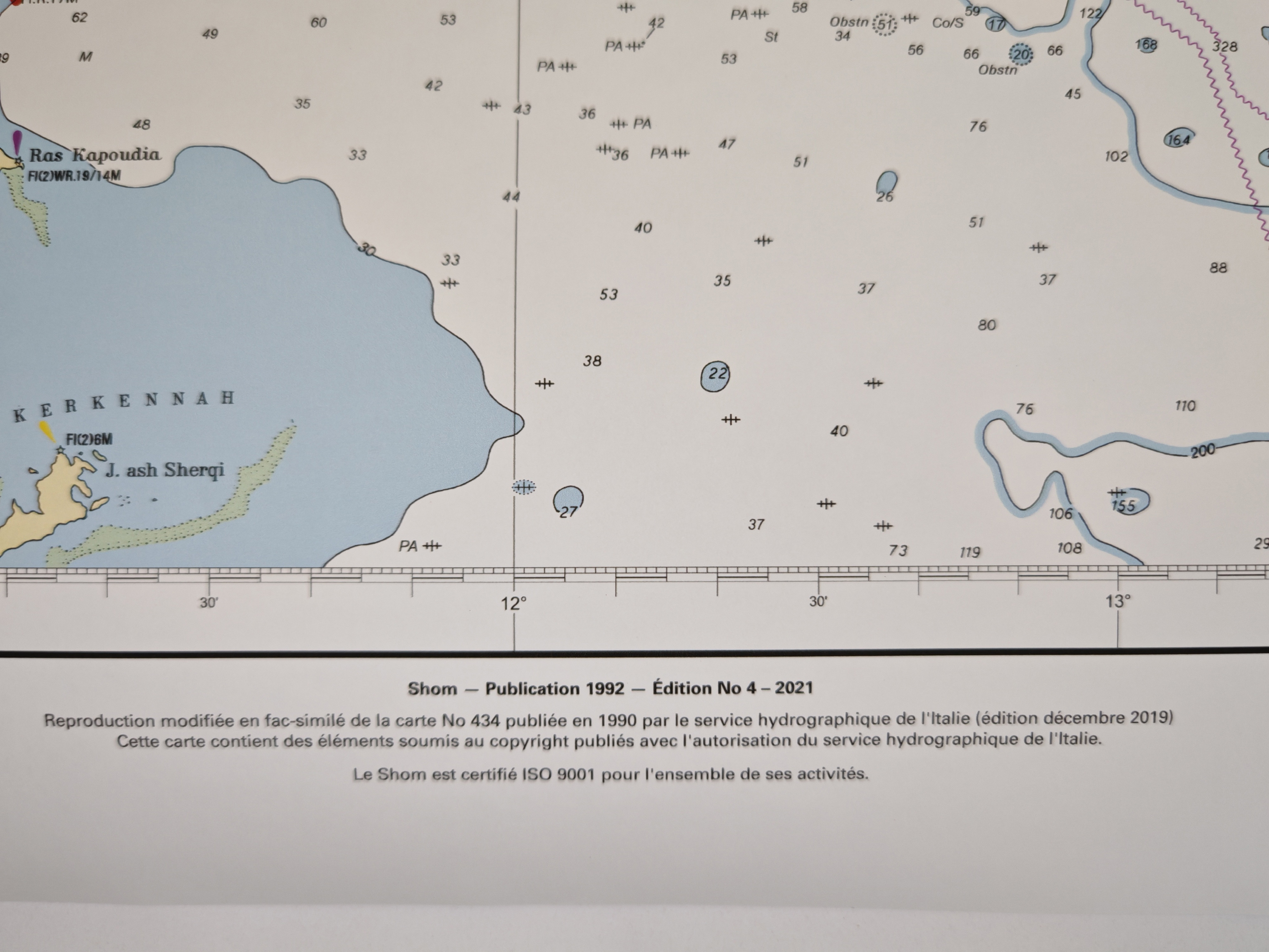
Always check the publication date and edition number of your chart.
Then verify the correction number.
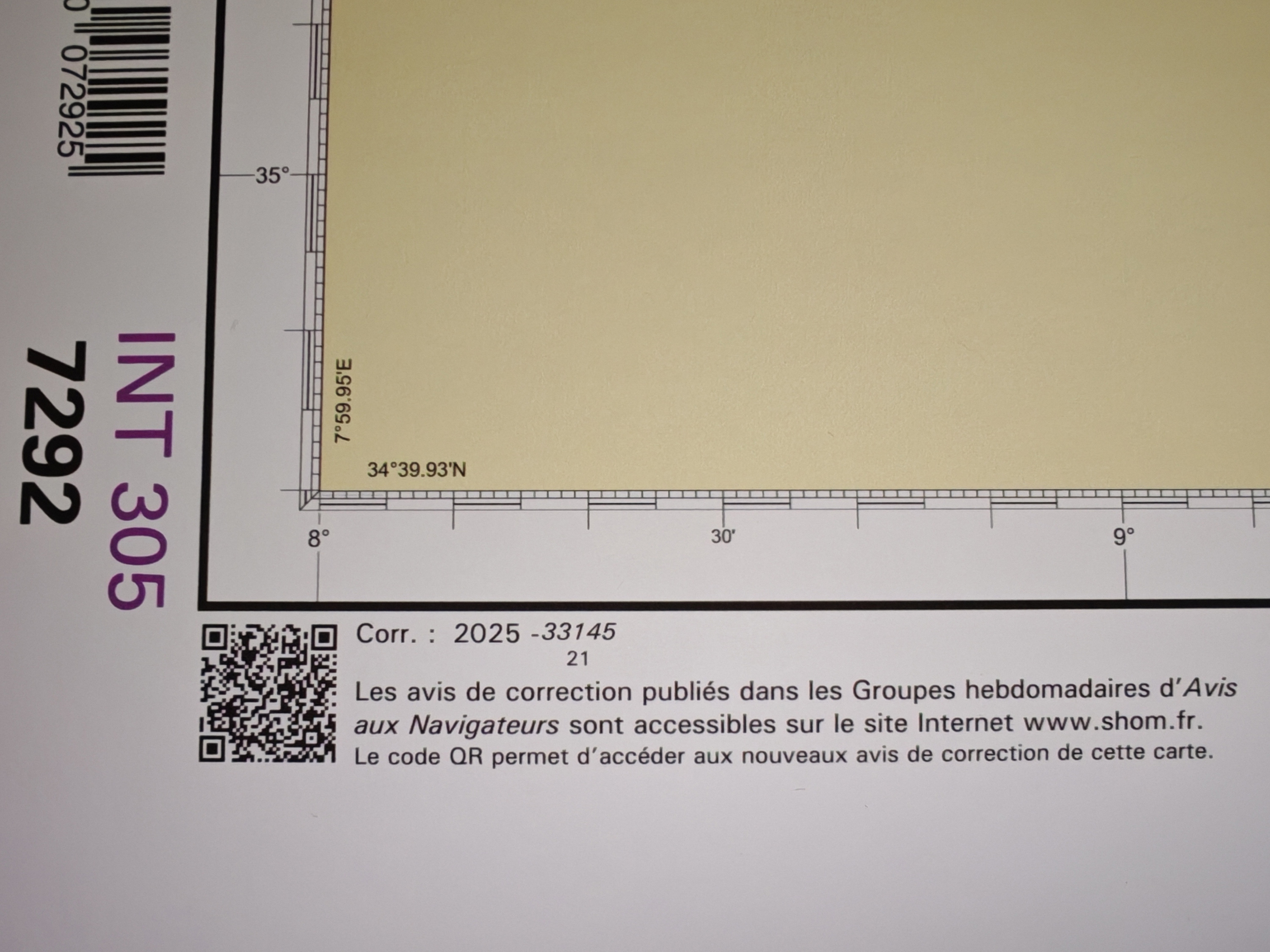
⚠️ Note: Some Shom corrections require downloading specific fonts (available on the Shom website’s “Warning” page) to ensure that symbols display properly.
Shom provides corrections for:
-
nautical charts;
-
sailing directions;
-
light lists;
-
radio signal publications;
-
other technical works.
ℹ️ Important: editions available only in digital format no longer have separate corrections. Updates are made by downloading a new version, free for one year after purchase.
For Admiralty charts, corrections are available through the Admiralty Notice to Mariners.
There is no complete list of all Admiralty charts and publications showing current editions. However, a complete list of charts exists, with details of the current edition and the latest Notice to Mariners correction. This list is updated weekly. A similar list exists for the state of the Sailing Directions collection.
For Light Lists, no such list is available.
For the Canadian Hydrographic Service (CHS), corrections for paper and digital charts, as well as for nautical publications, are issued through the Notices to Mariners published by the Canadian Coast Guard. These notices also include updates on CHS and Coast Guard publications, and more.
Corrections: a matter of precision
On paper, corrections must be added directly to the chart. A few basic rules apply:
-
draw a fine, clean line with a Mars® Matic pencil to indicate a change in buoyage or limits;
-
use a chart correction template (normograph) to add new symbols (buoys, lights, dangers) following chart conventions;
-
use red or purple ink, colors reserved for corrections;
-
strike through outdated indications instead of erasing them, to preserve the historical trace.
To assist in corrections, the following manuals are useful:
-
Shom – 001-DNOA – Symbols and Abbreviations on French Nautical Charts
-
Admiralty – NP133A – The Maintenance Record for Paper Charts (2008)
-
Admiralty – NP294 – How to Correct (Updating Your Charts)
-
Admiralty – NP5011 – Symbols and Abbreviations Used on Admiralty Paper Charts
It is recommended to date each update and keep a correction log for your charts and nautical publications.
Storage and archiving
Ashore, charts should be stored flat in a dry, ventilated place. Heat and direct sunlight will fade inks. Regular sailors keep a correction binder and an unmarked spare chart, to cross-check or restart from a clean base.
Tradition and safety
Maintaining charts means honoring a maritime heritage. As one navigation instructor puts it:
“A well-corrected chart is invisible safety. It doesn’t move the boat forward, but it can keep you from losing it.”