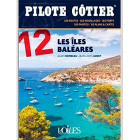

Your go-to guide for cruising the Mediterranean from Marseille to Genoa. Includes detailed maps, safety tips, and insider knowledge to make every voyage smooth and unforgettable.
Data sheet
Specific References
Unlock the Secrets of the Mediterranean Coastline
Embark on a journey along one of the most scenic and diverse stretches of the Mediterranean with this essential coastal pilot guide. Covering nearly 100 nautical miles from Marseille to Genoa, this guide is your key to unlocking the beauty, challenges, and hidden treasures of this iconic sailing region. Whether you're a weekend sailor or a seasoned navigator, this guide provides everything you need to plan, execute, and enjoy your voyage with confidence.
Comprehensive Coverage for Every Sailor
This guide is designed to be your all-in-one resource for navigating the Mediterranean coastline. It includes detailed descriptions of key landmarks, hazards, and points of interest, ensuring you have a clear understanding of what to expect along your route. From the rugged cliffs of Marseilleveyre to the serene islands of Hyères, every segment of the journey is covered with precision. The guide also provides practical advice on local weather patterns, such as the behavior of the mistral, which loses intensity as you head east, making your voyage smoother and more predictable.
Expertly Crafted for Clarity and Accuracy
With 280 pages of meticulously researched content, this guide is packed with up-to-date information to support your navigation. The latest edition features modernized layouts, high-quality photos, and detailed maps that make planning and executing your trip effortless. The guide’s authors, who have spent decades sailing these waters, bring their unparalleled expertise to every page, offering insights that go beyond basic navigation. Whether you're navigating by day or night, this guide ensures you have the knowledge and tools to do so safely and efficiently.
Your Trusted Companion for Memorable Cruises
More than just a navigation tool, this coastal pilot is designed to help you create unforgettable cruising experiences. It includes recommendations for the best anchorages, scenic routes, and must-see destinations, allowing you to tailor your journey to your preferences. The guide’s clear, concise commentary and well-organized structure make it easy to find the information you need, whether you're planning a short excursion or an extended voyage. With this guide in hand, you’ll be ready to explore the Mediterranean’s most stunning coastal landscapes with confidence and ease.
This coastal pilot guide is a comprehensive resource for navigating the Mediterranean coastline from Marseille to Genoa. With 280 pages of detailed information, it covers nearly 100 nautical miles and includes the latest updates on local conditions, hazards, and points of interest. The guide features high-quality photos, modernized layouts, and precise maps to enhance usability. Published in 2023, it is the most up-to-date edition available, ensuring you have the most accurate and reliable data for your journey.
For over four decades, this series has been a trusted name in coastal navigation, renowned for its accuracy, reliability, and depth of local knowledge. Each guide is crafted by experienced sailors who bring their firsthand expertise to every page, ensuring that both novice and seasoned mariners have the tools they need to navigate safely and confidently. The series is regularly updated to reflect the latest changes in navigation aids, port facilities, and local regulations, making it a go-to resource for sailors exploring the Mediterranean.
The guide covers a 100-mile stretch of the Mediterranean coast from Marseille to Cap Dramont, including detailed navigation along the French shoreline.
Yes, this is the latest 2023 edition, fully revised and updated with current navigation data, photos, and plans.
The guide provides precise, well-documented comments on harbors, anchorages, and coastal features, including hazards and landmarks for safe navigation.
Yes, it includes all necessary information and advice for navigating both day and night along the covered coastline.
The guide measures 19.5 x 22 cm and weighs 602 grams, making it portable yet comprehensive for onboard use.
Yes, it provides latitude and longitude coordinates for critical points along the route, ensuring accurate navigation.
Yes, the authors have extensive firsthand knowledge of the coastline, gained through countless navigations in the area.
You might also like