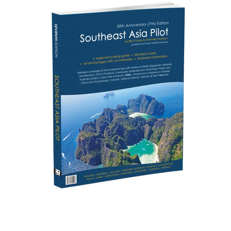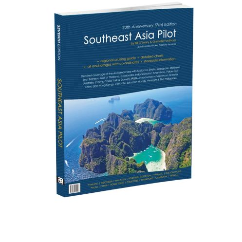



Navigate Southeast Asia’s breathtaking waters with the 2024 edition of this trusted pilot guide. Featuring 600+ locations, updated resorts, and expert tips for seamless sailing adventures.
Data sheet
Specific References
Navigate the world’s most breathtaking cruising grounds with confidence. This comprehensive cruising guide unlocks over 600,000 square miles of pristine waters, from the Andaman and Nicobar Islands to the Gulf of Thailand, extending to Cairns, Vanuatu, the Solomon Islands, China, Palau, Raja Ampat, and the Cape York Peninsula. Whether you're planning a coastal passage or an extended voyage, this guide delivers unparalleled insights for safe and unforgettable adventures.
Compiled over two decades by seasoned sailors Bill O’Leary and Andy Dowden, with contributions from Grenville Fordham and other experienced navigators, this guide is a treasure trove of practical knowledge. It features over 600 meticulously documented locations, including:
Covering Thailand, Myanmar, Malaysia, Singapore, Vietnam, Cambodia, and India’s Andaman Islands, this guide provides in-depth details for each destination. Major updates in the 7th edition include:
With 300 pages of easy-to-reference content, this guide is tailored for cruisers who demand reliability. Its user-friendly layout ensures quick access to vital information, whether you're plotting a course or seeking the best onshore experiences. The 2024 edition marks its 20th anniversary, reflecting decades of refinement and real-world testing by the sailing community.
Available in a high-quality printed format and as an interactive eBook, this guide adapts to your needs. The printed version is durable and weather-resistant, ideal for onboard use, while the eBook offers searchable content and digital updates for seamless navigation.
Explore Southeast Asia’s Waters with Unmatched Precision
This cruising guide is the definitive resource for sailors venturing into one of the planet’s most diverse and challenging maritime regions. Spanning from the Andaman Sea to the Coral Sea, it covers a vast expanse of over 600,000 square miles, offering detailed insights into seven countries and hundreds of islands, coves, and coastal communities. Whether you're a seasoned sailor or embarking on your first long-distance voyage, this guide equips you with the knowledge to navigate safely and explore confidently.
Two Decades of Expertise in Every Page
The 7th edition of this guide is the result of over 20 years of firsthand experience from authors Bill O’Leary and Andy Dowden, along with contributions from Grenville Fordham and other seasoned navigators. This collective expertise ensures that every anchorage, marina, and shore facility is vetted for accuracy and relevance. With 300 pages of content, including over 600 locations, it’s the most comprehensive tool available for cruising Southeast Asia’s waters.
Stay Updated with the Latest Maritime Intelligence
This edition includes critical post-tsunami updates, ensuring that even the most remote or affected areas are accurately represented. It also features new additions like the Anambas Islands in Indonesia, expanded coverage of Malaysia’s marina network, and refreshed details on Thailand’s coastal infrastructure. Whether you're planning a short coastal hop or a transoceanic passage, this guide keeps you informed with the most current data.
Built for Sailors, by Sailors
Designed with practicality in mind, the guide’s layout is intuitive and easy to navigate. Each location is presented with clear coordinates, depth soundings, and notes on local hazards, making it simple to plan your route and avoid surprises. The 2024 edition also introduces enhanced sections on shore-based amenities, from resorts and restaurants to repair facilities, ensuring you’re prepared for every aspect of your journey.
Versatile Formats for Every Need
Available in both a high-quality printed edition and an interactive eBook, this guide adapts to your preferences. The printed version is durable and weather-resistant, perfect for onboard use, while the eBook offers searchable content and digital updates, ideal for quick reference on the go. No matter how you choose to navigate, this guide is your trusted companion for exploring Southeast Asia’s waters.
This 7th edition (2024) of the Southeast Asia Cruising Guide spans 300 pages and covers over 600 locations across seven countries, from the Andaman Islands to the Gulf of Thailand and beyond. Weighing 1.6 kg, it is available in a durable paperback format, with coordinates provided for precise navigation. The guide is authored by Bill O’Leary and Andy Dowden, with contributions from Grenville Fordham, ensuring expert insights for every voyage.
With a legacy of providing trusted maritime resources, this publisher specializes in creating detailed and practical guides for sailors. Their publications are renowned for their accuracy, reliability, and real-world applicability, making them a go-to choice for cruisers exploring some of the world’s most challenging and rewarding waters.
The printed guide weighs 1.6 kg, making it portable yet comprehensive for onboard navigation.
Yes, the guide includes precise latitudes and longitudes for over 600 locations across Southeast Asia and beyond.
This edition covers seven main countries in detail: Thailand, Myanmar, Malaysia, Singapore, Vietnam, Cambodia, and the Andaman Islands of India.
Yes, the eBook version is interactive, allowing for easy navigation and access to updated information on the go.
The 7th edition includes major updates for Thailand, Malaysia, Indonesia (including the Anambas Islands), Cambodia, and post-2004 tsunami corrections.
Absolutely, it covers approximately 600,000 square miles, from the Andaman Islands to the Gulf of Thailand and beyond, including routes to Australia and the South Pacific.
Yes, the guide includes updated recommendations for marinas, resorts, restaurants, and shore facilities at over 600 locations.
You might also like