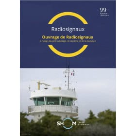
Radio Signals Guide
Introduction
The Radio Signals Guide brings together nautical publications dedicated to maritime radiocommunications, radio navigation, safety services, radio stations, distress systems and port communications. These documents form an important technical reference for understanding and using the communication and information services available at sea.
Unlike a nautical chart, which primarily represents the geographical and hydrographic characteristics of an area, a radio signals guide provides operational information about radio stations, frequencies, communication services, radio aids to navigation, NAVTEX, Maritime Safety Information, VHF, GMDSS, AIS, radio beacons, Racons, pilotage services and reporting systems.
The Radio Signals Guide category at Nautic Way Maritime Bookshop is intended for professional navigators as well as recreational sailors, offshore crews, merchant navy officers, maritime training centres and anyone requiring accurate information about maritime communications and nautical information transmitted by radio.
What is a Radio Signals Guide used for?
The main purpose of a radio signals guide is to allow navigators to determine which radio services are available, where they are located, how they operate and in what circumstances they should be used.
Depending on the publication, information may cover:
-
maritime radio stations;
-
VHF services;
-
coast stations;
-
communication frequencies and channels;
-
meteorological services;
-
navigational warnings;
-
NAVTEX services;
-
EGC services;
-
NAVAREA areas;
-
rescue coordination centres;
-
pilotage services;
-
Vessel Traffic Services or VTS;
-
mandatory and voluntary reporting systems;
-
Racon stations;
-
AIS stations;
-
radio beacons and radio navigation aids;
-
time signals;
-
Maritime TeleMedical Assistance Services.
The guide therefore constitutes a comprehensive maritime communication and information reference.
SHOM Radio Signals Publications
The SHOM – French Hydrographic and Oceanographic Service publishes several works dedicated to radio signals.
The French collection includes publications dealing with maritime radio navigation, maritime radio stations, the Global Maritime Distress and Safety System (GMDSS), port radiocommunications and reporting systems, as well as Maritime Safety Information.
These publications cover the means used to distribute information required for navigation and safety.
The maritime radio navigation guide, for example, deals with radio and electronic aids such as GPS, Galileo, Loran C, Racon, AIS and radio time signals.
SHOM radio signals publications are currently supplied in digital PDF format, facilitating their updating and consultation.
Maritime Radio Navigation
Radio navigation encompasses techniques used to obtain or supplement position, time and navigation information through radio signals.
Navigators may encounter systems such as:
-
GPS;
-
Galileo;
-
Loran C;
-
Racon;
-
AIS;
-
radio beacons;
-
time signals;
-
radio navigation aids.
GPS and Galileo are now fundamental components of modern maritime positioning. Nevertheless, navigators need to understand the characteristics of the different systems and identify the services available in the area being navigated.
Racons, installed on certain navigation aids, may also appear in radio navigation documentation. Their presence and characteristics can help identify a landmark or navigation aid using marine radar.
Maritime Radio Stations
Radio stations are an essential part of the maritime communication network.
A radio signals guide allows navigators to identify the stations available in a particular area and understand the services associated with them.
During coastal navigation, this information can be particularly useful when operating near major ports such as Le Havre, Cherbourg, Brest, Dunkirk, Marseille, Toulon or Ajaccio.
In the English Channel and North Sea, the density of maritime traffic and the proximity of numerous port facilities make communications particularly important.
The same principle applies in the Atlantic around La Rochelle, Bordeaux, Bayonne, Lisbon or Vigo, as well as in the Mediterranean around Genoa, Barcelona, Palma, Naples or Gibraltar.
Port Radiocommunications and Reporting Systems
Maritime communications do not only concern exchanges between vessels and coast stations.
When approaching a port, a navigator may need to communicate with different services, including pilotage, Vessel Traffic Services, port authorities or monitoring services.
Publications dedicated to port radiocommunications provide information about the relevant services and communication procedures.
They are particularly relevant when approaching high-traffic ports such as Rotterdam, Antwerp, Southampton, Le Havre, Marseille or Gibraltar.
Reporting systems may also require vessels to transmit information at specific points or within designated areas. Navigators should therefore understand the applicable procedures before entering the relevant area.
GMDSS – Global Maritime Distress and Safety System
The GMDSS, or Global Maritime Distress and Safety System, is a fundamental component of modern maritime safety.
It organises communication systems used for the transmission of distress alerts, coordination of search and rescue operations and distribution of Maritime Safety Information.
GMDSS documentation helps explain:
-
the general organisation of the system;
-
available communication methods;
-
distress procedures;
-
search and rescue services;
-
Maritime Safety Information services;
-
areas of responsibility;
-
radio services used within the system.
This documentation is relevant to both coastal navigation and ocean passages.
Maritime Safety Information
Maritime Safety Information, or MSI, comprises information necessary for the safety of navigation.
It may include:
-
navigational warnings;
-
meteorological warnings;
-
information distributed by the relevant authorities;
-
information concerning new or temporary hazards;
-
information required by vessels operating within a particular area.
Receiving this information is particularly important during a voyage because some information may concern recent events that have not yet been incorporated into permanent nautical documentation.
NAVTEX and Safety Information
NAVTEX is an automatic system for transmitting maritime and meteorological information.
It can provide information concerning:
-
navigational warnings;
-
weather forecasts;
-
safety information;
-
certain navigation-related information for a specific area.
A radio signals guide allows navigators to understand the available broadcasting services, their coverage areas and the characteristics of their transmissions.
For navigation in the English Channel, North Sea, Bay of Biscay, Mediterranean Sea or Atlantic Ocean, understanding the available information services contributes to better voyage preparation and navigational watchkeeping.
VHF, Weather and Safety Communications
Marine VHF remains an essential means of short- and medium-range communication.
It can be used for communication with:
-
other vessels;
-
coast stations;
-
port authorities;
-
Vessel Traffic Services;
-
pilot stations;
-
rescue coordination services.
In port areas such as Brest, Le Havre, Marseille, Rotterdam or Gibraltar, understanding the available radio services facilitates communication with the relevant authorities and maritime services.
Weather information transmitted by radio is also an important component of navigational watchkeeping, particularly before coastal passages or longer voyages.
Navigation in the English Channel and North Sea
The English Channel and North Sea are among the maritime areas where communications play a particularly important role.
High traffic density, traffic separation schemes, numerous port approaches and changing weather conditions require careful preparation.
Ports such as Dunkirk, Calais, Boulogne-sur-Mer, Le Havre, Cherbourg, Portsmouth, Southampton, Rotterdam and Antwerp are associated with extensive maritime communication networks.
Radio signals publications help navigators prepare communications with the different services encountered during a passage.
Atlantic Ocean and Major European Ports
In the Atlantic, communication requirements change as a vessel moves farther from the coast.
A voyage between Brest, La Rochelle, Bayonne, Vigo, Lisbon, Cadiz and Gibraltar may require successive use of different radio services.
For a passage towards the Canary Islands or the Caribbean, information about coast stations, Maritime Safety Information services and available communication systems also becomes important.
Nautical charts used in these areas may be supplied by SHOM, Admiralty, NV Charts or other national hydrographic offices depending on the region.
Mediterranean Sea and International Navigation
In the Mediterranean, communications may involve very different maritime environments.
A navigator may successively sail in French, Italian, Spanish, Greek, Croatian or Turkish waters.
Ports such as Marseille, Toulon, Nice, Ajaccio, Bastia, Genoa, Cagliari, Barcelona, Palma, Naples, Split, Dubrovnik and Athens illustrate this diversity.
Radio signals documentation provides a structured overview of radio services and associated procedures across these different areas.
Radiocommunication information therefore complements the cartographic information provided by SHOM, Admiralty, NV Charts and national hydrographic offices.
Offshore Navigation and Ocean Crossings
During an ocean passage, communications take on a different dimension.
A navigator may be far from coast stations for several days and needs to understand the means available to receive safety and weather information, communicate when necessary and organise emergency procedures.
This is relevant to routes between Europe, the Canary Islands, Cape Verde and the Caribbean, as well as passages across the South Atlantic, Indian Ocean or Pacific Ocean.
In the Caribbean, information may concern areas around Martinique, Guadeloupe, Saint Martin, Antigua, Grenada or Saint Vincent.
For major ocean passages, radio signals publications therefore constitute an important technical complement to nautical charts and other navigation documents.
Admiralty List of Radio Signals
The Admiralty List of Radio Signals is a major international reference for maritime radiocommunications.
The Admiralty collection is organised into six main volumes:
-
Volume 1: Maritime Radio Stations;
-
Volume 2: Radio Aids to Navigation, DGPS, legal time, radio time signals and electronic position-fixing systems;
-
Volume 3: Maritime Safety Information Services;
-
Volume 4: Meteorological Observation Stations;
-
Volume 5: Global Maritime Distress and Safety System;
-
Volume 6: Pilot Services, Vessel Traffic Services and Port Operations.
This organisation makes it possible to find information corresponding to a specific need, from a maritime radio station to a port procedure or safety service.
Admiralty also provides digital versions, with search functions and regular updates.
Complementing Nautical Charts
A radio signals guide does not replace a nautical chart.
A chart represents the vessel's position, depths, hazards, navigational aids and geographical features.
The radio signals guide provides another dimension: communication services, radio systems, procedures and information transmitted by radio.
This complementarity is particularly important for professional navigation, offshore passages and complex port approaches.
Who are Radio Signals Guides Intended For?
Radio signals guides may be useful to:
-
merchant shipping;
-
professional navigators;
-
offshore recreational sailors;
-
skippers;
-
sailing and motorboat crews;
-
commercial fishermen;
-
maritime schools and training centres;
-
deck officers and crew;
-
users of VHF, AIS and electronic navigation equipment;
-
sailors preparing ocean crossings.
They also provide valuable background for understanding the international organisation of maritime communications.
Why Use Regularly Updated Documentation?
Radio information can change.
A station may modify its characteristics, a port service may change its procedures, a frequency or channel may be reorganised, and maritime safety systems may evolve.
Keeping documentation up to date is therefore essential.
For digital publications, this is particularly important: SHOM radio signals publications are designed to be updated during their period of validity, while Admiralty publications are maintained through specific updating procedures.
Navigators should always check the edition and correction status of the document being used.
Conclusion
The Radio Signals Guide is an important technical reference for understanding communications and information systems used at sea.
From radio stations to VHF services, from radio navigation to GMDSS, from NAVTEX to Maritime Safety Information, and from port radiocommunications to reporting systems, these publications cover a significant part of the communication requirements of modern navigation.
SHOM provides a French collection covering maritime radio navigation, radio stations, GMDSS, port radiocommunications and Maritime Safety Information. The Admiralty List of Radio Signals provides structured international coverage across six major areas.
From the English Channel and North Sea to the Atlantic Ocean, from the Mediterranean to the Caribbean and onward to major ocean routes, radio signals guides allow navigators to better understand available services and prepare their communications.
Used together with appropriate nautical charts, they contribute to more comprehensive voyage preparation and better control of the communication and information resources available on board.
FAQ – Radio Signals Guide
What is a Radio Signals Guide used for?
It provides technical information about radio stations, frequencies and channels, communication services, radio navigation, Maritime Safety Information, GMDSS, NAVTEX, pilotage and Vessel Traffic Services.
What is maritime radio navigation?
Radio navigation encompasses techniques using radio signals to provide positioning, timing or navigation assistance. It includes systems such as GPS, Galileo, Racon, AIS and specialised radio systems.
What is GMDSS?
The Global Maritime Distress and Safety System organises communication systems used for distress, search and rescue, and the distribution of Maritime Safety Information.
What is NAVTEX?
NAVTEX is an automatic system for transmitting maritime and meteorological information, including navigational warnings and certain safety information.
What are port radiocommunications used for?
They are used for communication with pilotage services, Vessel Traffic Services, port authorities and certain reporting systems.
What is a Racon?
A Racon is a radar beacon that allows a navigation aid or landmark to be identified through a specific response detectable by marine radar.
Are Radio Signals Guides intended only for merchant shipping?
No. They can also be useful to recreational sailors, skippers, offshore crews, fishermen, maritime schools and navigators using VHF, AIS or other communication equipment.
Does a Radio Signals Guide replace a nautical chart?
No. The two documents have different functions. A nautical chart represents the navigational environment, while the radio signals guide primarily describes radio services, communications and associated procedures.
Are Radio Signals Guides useful for an Atlantic crossing?
Yes. They help prepare communication systems and the reception of safety information during voyages between Europe, the Canary Islands, Cape Verde and the Caribbean.
Which publishers produce Radio Signals Guides?
SHOM publishes several French publications dedicated to radio signals. Admiralty also publishes the Admiralty List of Radio Signals, providing international coverage.
Are Radio Signals Guides useful for Mediterranean navigation?
Yes. They help prepare communications with coastal, port, pilotage and Vessel Traffic Services in French, Italian, Spanish, Croatian and Greek waters.
Why must Radio Signals Guides be kept up to date?
Because stations, services, procedures and safety information can change. Up-to-date documentation ensures that navigators have access to information corresponding to the latest navigation conditions.