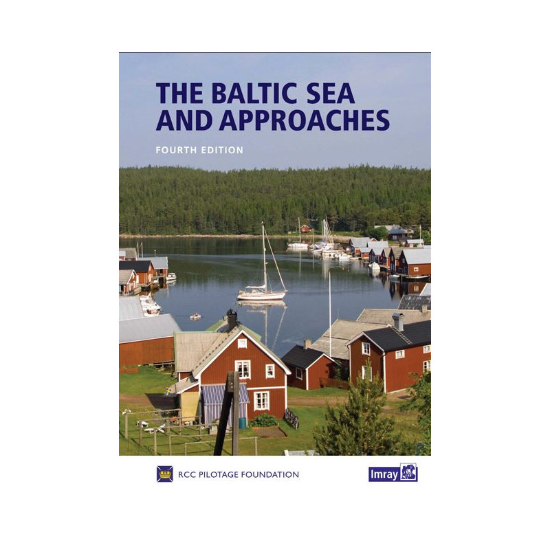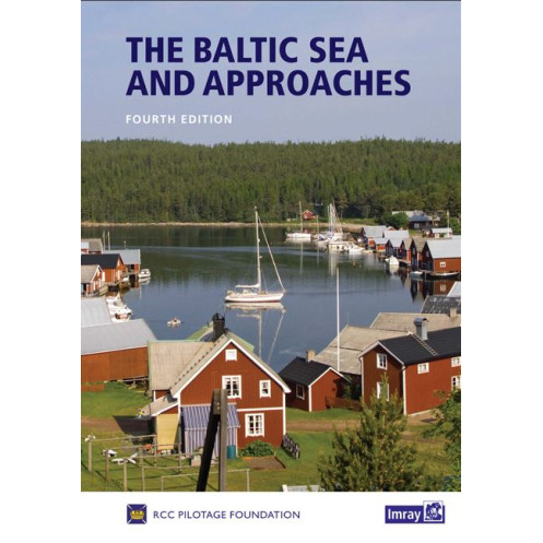


Imray - The Baltic Sea and approaches
search
  • googlemap
  • Imray - The Baltic Sea and approaches
  • Imray - The Baltic Sea and approaches
  • Imray - The Baltic Sea and approaches

Imray - The Baltic Sea and approaches

€66.40
Tax included
Imray
In English language
Estimated preparation time: 0 to 2 days

This expert guide covers the Baltic Sea’s nine countries, offering updated charts, port details, and sailing tips. Perfect for planning and navigation, with 376 pages of essential data.

PIL0688
2 Items

Data sheet

What is the classification?
navigation book
Who is the publisher or the author?
RCCPF
On what digital medium is this nautical chart / book stored?
paper medium
From which year does this nautical chart date?
2017 - 4th edition
What type of navigation book is this?
pilot
Picto
In English language

Specific References

UPC
400000064161
EAN13
9781846236891
New
Description détaillée

The Baltic Sea and Approaches

Guide in English
Paperback edition

Your Essential Companion for Baltic Cruising Adventures

Navigate the Baltic Sea with confidence using this comprehensive cruising guide, meticulously updated to provide the most accurate and practical information for sailors. Covering all nine countries bordering the Baltic—Germany, Denmark, Sweden, Finland, Poland, Kaliningrad, Lithuania, Latvia, and Estonia—this guide is your ultimate resource for exploring one of Europe’s most diverse and rewarding cruising grounds. Whether you're planning a short coastal hop or an extended voyage, this book delivers selective yet detailed insights to help you make the most of your journey.

Expertly Curated for Sailors, by Sailors

Produced by a team of experienced sailors from the Royal Cruising Club, this guide combines firsthand knowledge with meticulous research. The latest edition features substantial updates, including revised text, newly drawn plans, and additional photographs to enhance your navigation experience. The coverage of Finland has been reorganized for better clarity, while the sections on the Baltic States and Poland have seen significant improvements, ensuring you have the most relevant and up-to-date information at your fingertips.

Plan with Precision, Sail with ConfidenceThis guide goes beyond basic navigation, offering invaluable advice for every stage of your trip. From pre-departure planning—such as boat preparation, route selection, and timing—to on-the-ground insights like country overviews and port details, it equips you with everything you need for a seamless voyage. For countries with abundant information, such as Germany, Denmark, Sweden, and Finland, key ports are highlighted, while for others, a broader range of smaller harbors is covered in detail. With over 200 relevant websites and internet access points in major ports, you’ll always stay connected and informed.

Discover Hidden Gems and Iconic Destinations

The Baltic Sea is a treasure trove of cruising experiences, from secluded anchorages and picturesque canals to lively marinas and historic cities. This guide doesn’t just point you to the obvious stops—it reveals the hidden gems that make cruising here so special. Whether you’re seeking solitude in a quiet cove or the vibrant atmosphere of a coastal town, you’ll find inspiration and practical advice to tailor your journey to your preferences.

Built for Durability and Convenience

Designed for life on the water, this guide is printed in a sturdy A4 hardcover format, ensuring it withstands the rigors of marine environments. With 376 pages of detailed information, it’s a robust yet portable resource that belongs in every sailor’s chart table. The full-color layout enhances readability, making it easy to reference charts, plans, and photographs while underway.

Stay Ahead with the Latest Updates

First published in 2017, this fifth edition reflects the most current navigational data and cruising trends. Whether you’re a seasoned Baltic sailor or embarking on your first voyage to the region, this guide ensures you’re prepared for the challenges and rewards of cruising these waters. With its blend of practical advice, expert insights, and stunning visuals, it’s more than just a guide—it’s your passport to an unforgettable Baltic adventure.

Unlock the Baltic’s Best-Kept Secrets with This Expert Cruising Guide
Embark on your Baltic adventure with the most trusted and comprehensive cruising guide available. Spanning nine countries and over 376 pages, this meticulously updated edition is your key to navigating one of Europe’s most captivating maritime regions. Whether you’re charting a course through Denmark’s scenic fjords, exploring Sweden’s archipelagos, or discovering the historic ports of Poland and the Baltic States, this guide provides the precise, actionable information you need to sail with confidence.

Tailored for Sailors, Backed by Experience
Crafted by the Royal Cruising Club, this guide is more than just a collection of charts—it’s a distillation of decades of sailing expertise. The latest edition introduces newly drawn plans, updated text, and fresh photographs, ensuring you have the most accurate and relevant data at your disposal. With a focus on practicality, it includes essential details like internet access points in major ports, over 200 useful websites, and selective port information to streamline your planning process.

From Planning to Execution, Every Detail Covered
This guide is designed to support you at every stage of your journey. Before you set sail, use it to prepare your boat, map out your route, and time your voyage for optimal conditions. Once underway, rely on its country overviews, port details, and navigational tips to make informed decisions. For countries with extensive cruising infrastructure, such as Germany and Finland, key ports are highlighted, while smaller, lesser-known harbors are covered in greater detail for those seeking off-the-beaten-path experiences.

Built to Withstand the Demands of the Sea
Engineered for durability, this guide features a hardcover A4 format that resists wear and tear, making it ideal for use on deck or in the chart table. Its full-color layout enhances readability, ensuring you can quickly reference charts, plans, and photographs even in challenging conditions. Weighing in at 1900 grams, it’s substantial enough to provide comprehensive coverage without being cumbersome.

This cruising guide is a robust A4-sized hardcover book, weighing 1900 grams and spanning 376 pages. Published in July 2017, it is the fifth edition of this trusted resource, offering full-color charts, plans, and photographs to enhance navigation. Designed for durability and ease of use, it includes detailed coverage of latitudes ranging from 53.5°N to 66.6°N and longitudes from 9.1°E to 31.0°E, encompassing the entire Baltic Sea region.

With a legacy spanning over two centuries, this publisher is renowned for producing high-quality nautical charts and cruising guides trusted by sailors worldwide. Their publications are celebrated for their accuracy, durability, and practical insights, making them an indispensable resource for both recreational and professional mariners navigating global waters.

  • This guide stands out for its unparalleled depth of information, combining expertly curated port details, navigational tips, and practical advice tailored specifically for Baltic cruising. Its selective yet comprehensive coverage ensures you have the most relevant data without overwhelming you with unnecessary details. The inclusion of over 200 websites and internet access points in major ports keeps you connected, while the newly drawn plans and updated text provide the latest navigational insights. Designed for durability with a hardcover format, it’s built to last through countless voyages, making it an essential tool for any sailor exploring the Baltic Sea.
What is the weight of the guide and how does it affect portability?

The guide weighs 1900 grams, making it relatively heavy for frequent handheld use. It is best suited for onboard reference rather than carrying during shore excursions.

How many pages does this edition contain and what is the page size?

This edition contains 376 pages, printed in A4 format, providing ample space for detailed charts, descriptions, and photographs.

Are the charts and plans in this edition newly drawn?

Yes, this edition includes many newly drawn plans, along with updated text and additional photographs for improved accuracy and clarity.

Does the guide cover all countries bordering the Baltic Sea?

Yes, it covers all nine countries bordering the Baltic Sea, including Germany, Denmark, Sweden, Finland, Poland, Kaliningrad, Lithuania, Latvia, Estonia, and Russia.

Are there recommendations for internet access in major ports?

Yes, the guide includes information on internet access points in major ports, along with over 200 relevant websites for additional planning and local details.

What type of binding does the guide use?

The guide features a hardcover binding, ensuring durability for frequent use in marine environments.

Does this edition include suggestions for isolated anchorages?

Yes, it describes beautiful isolated anchorages, scenic canals, lively marinas, and dramatic cities for a variety of cruising experiences.

Loading...