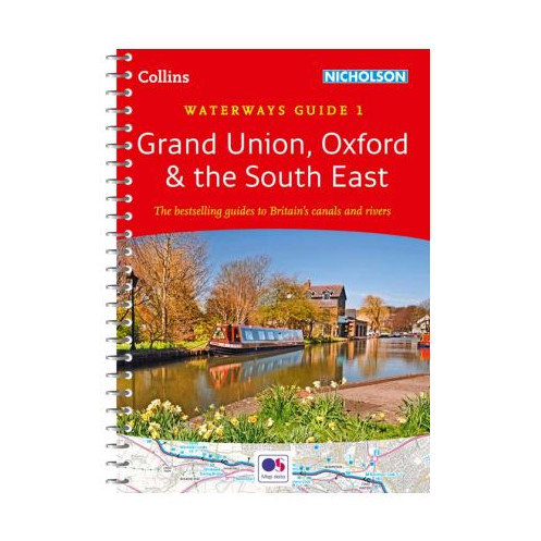




Your essential guide to navigating the waterways between London and Birmingham, featuring detailed maps, navigation tips, and key points of interest for boaters, hikers, and cyclists.
Data sheet
Specific References
Navigate the heart of England’s waterways with confidence using this trusted guide, covering the canals and rivers between London and Birmingham. Whether you're cruising the Grand Union Canal, exploring the historic Oxford Canal, or venturing along the River Thames, this book provides everything you need for a seamless journey. Designed for boaters, walkers, cyclists, and visitors, it combines detailed maps, practical navigation notes, and insider tips to enhance your experience on the water.
This guide features large-scale maps—2 inches to 1 mile (3 cm to 1 km)—from Collins and Ordnance Survey, ensuring clarity and precision for planning your route. Each map is accompanied by descriptive text, highlighting key landmarks, pubs, water points, and other essential stops along the way. Navigation notes include critical details like maximum dimensions, low bridges, mileages, and potential hazards, so you can avoid surprises and travel safely. Authorities and contact information are also provided for quick reference.
Engineered for on-the-go use, this guide comes in a convenient A5 format with a lie-flat spiral binding, allowing you to keep your hands free while consulting the maps. The back cover includes a built-in bookmark flap, so you’ll never lose your place. Lightweight yet sturdy, it’s designed to withstand the rigors of life on the water, making it the perfect companion for both seasoned boaters and first-time explorers.
Published by Collins Nicholson, this guide has been the go-to resource for inland waterway enthusiasts for more than five decades. Its reputation for accuracy, reliability, and ease of use makes it an indispensable tool for anyone looking to explore the Grand Union, Oxford Canal, River Thames, and beyond. Whether you're planning a weekend getaway or a longer voyage, this guide ensures you have all the information you need at your fingertips.
Unlock the Best of England’s Waterways with the Ultimate Navigation Guide
Discover the most comprehensive and practical guide to navigating the canals and rivers of the Southeast, including the Grand Union Canal, Oxford Canal, and River Thames. This essential resource is packed with detailed maps, expert navigation notes, and insider tips to help you plan and enjoy your journey with ease. Whether you're a seasoned boater, a weekend explorer, or a first-time visitor, this guide provides everything you need to make the most of your time on the water.
Precision Mapping for Effortless Navigation
Featuring large-scale maps at 2 inches to 1 mile (3 cm to 1 km), this guide offers unparalleled clarity and detail. The maps, sourced from Collins and Ordnance Survey, are accompanied by descriptive text that highlights key landmarks, water points, pubs, and other points of interest. Navigation notes include critical information such as maximum dimensions, low bridges, mileages, and potential hazards, ensuring you can navigate safely and confidently. Authorities and contact details are also provided for quick reference.
Designed for Boaters, by Boaters
This guide is built to meet the needs of waterway enthusiasts, with a practical A5 format and a lie-flat spiral binding that makes it easy to use on the go. The back cover includes a handy bookmark flap, so you can keep your place without fumbling with loose pages. Lightweight yet durable, it’s designed to withstand the demands of life on the water, making it the perfect companion for any journey.
A Legacy of Trust and Reliability
With over 50 years of publication history, this guide is a trusted resource for boaters, walkers, cyclists, and visitors alike. Its reputation for accuracy, ease of use, and comprehensive coverage makes it the go-to choice for exploring the waterways of the Southeast. Whether you're planning a short trip or a longer adventure, this guide ensures you have all the information you need to navigate with confidence.
This guide is packed with essential features to enhance your navigation experience. It includes 200 pages of detailed maps, descriptive text, and navigation notes, all presented in a convenient A5 format (148 x 210 mm). The lie-flat spiral binding ensures easy handling, while the back cover features a built-in bookmark flap for quick reference. Weighing just 2 kg, it’s lightweight and portable, making it ideal for use on the water or on the go.
With a legacy spanning decades, this publisher is renowned for producing high-quality navigation guides and maps that cater to the needs of boaters, travelers, and outdoor enthusiasts. Their commitment to accuracy, practicality, and user-friendly design has made their guides a trusted resource for generations of explorers.
The guide covers canals and waterways between London and Birmingham, including Chelmer & Blackwater Navigation, Grand Union Canal, Lee & Stort Navigations, River Medway, Oxford Canal, and the River Thames.
The maps are detailed at a scale of 2 inches = 1 mile (3 cm = 1 km), using Collins or Ordnance Survey maps.
Yes, it provides complete navigation notes, including maximum dimensions, low bridges, mileages, potential hazards, and contact details for navigation authorities.
Yes, it is designed for both experienced boaters and beginners, as well as walkers, cyclists, and visitors.
The guide features a spiral binding that allows it to lay flat, with a flap on the back cover for use as a bookmark.
The guide contains 200 pages of detailed maps, descriptive text, and navigation information.
The latest edition was published on February 11, 2016.