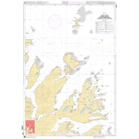
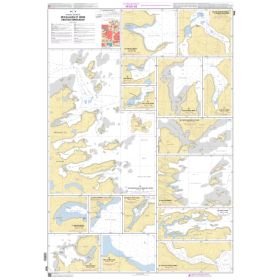
Shom C Nautical Chart – Rolled Paper Chart
Shom C nautical chart: the paper chart for coastal and offshore navigation
The Shom C nautical chart is a flat paper nautical chart, generally supplied rolled in a tube, produced by Shom, the French Hydrographic and Oceanographic Service. It is one of the main formats of paper nautical charts used for coastal navigation, offshore navigation and professional route planning.
Designed to be spread out on a chart table, the Shom C chart provides a direct view of the entire area represented. It allows navigators to study a coastline, plan a maritime route, identify hazards, measure distances and visualise the main features required for navigation.
Shom C charts are generally printed on 120 g/m² paper and supplied in a format close to A0 or in a smaller format depending on the reference. The flat presentation avoids folds across the cartographic information and facilitates work over a large surface.
What is a Shom C nautical chart?
A Shom C chart is a paper nautical chart designed to represent a maritime area with the information required for navigation. Depending on its scale, it may cover a relatively limited coastal area or a much larger maritime region.
The chart may include:
-
depths and soundings;
-
depth contours;
-
rocks, shoals and other hazards;
-
wrecks;
-
buoys and navigation marks;
-
lights and their characteristics;
-
channels;
-
anchorages;
-
ports and harbour facilities;
-
certain currents;
-
regulatory boundaries and restricted areas;
-
various landmarks useful for navigation.
This information is organised according to Shom cartographic conventions, enabling the navigator to quickly understand the configuration of a maritime area.
The Shom C chart is therefore more than a geographical representation of the coastline. It is a specialised nautical document linking the vessel’s position to depths, hazards, aids to navigation and the various characteristics of the marine environment.
Shom C rolled chart: why choose a flat chart?
The main advantage of the Shom C chart is its flat presentation. Unlike a folded chart, it is designed to be unfolded on a chart table and consulted across its entire surface.
This format is particularly suitable when the navigator needs to:
-
plan a maritime route;
-
plot positions;
-
measure distances;
-
plot bearings;
-
study several successive courses;
-
visualise a large section of coastline;
-
compare different routes;
-
prepare a coastal or harbour approach.
The format close to A0 provides a large reading surface. A Shom C chart can therefore be particularly practical on boats equipped with a sufficiently large chart table.
The rolled packaging also helps protect the chart during storage and transport.
Shom nautical chart C and scale
Scale is an essential factor when choosing a Shom C chart. Two charts covering the same region may provide different levels of detail depending on their scale.
A small-scale chart represents a large area and is more suitable for an overall view or offshore navigation. A larger-scale chart covers a more limited area but allows more detail to be represented.
For a complete voyage, several levels of cartography may therefore be required:
-
a general chart for planning the itinerary;
-
a passage chart for offshore navigation;
-
a coastal chart for following a coastline;
-
a large-scale chart for approaching a harbour;
-
a detailed chart for certain channels, roads or anchorages.
For example, a voyage between Brest and La Rochelle does not necessarily require the same chart scale as an approach to Brest harbour. A Shom C chart covering Brest harbour may, for example, be published at a detailed scale such as 1:22,500, illustrating the importance of scale for harbour and coastal areas.
Main differences between Shom C, L, G, Z and Raster charts
Shom charts exist in several formats. They are not interchangeable: each meets a specific use or presentation requirement.
| Shom type | Format | Presentation | Main feature | Main use |
|---|---|---|---|---|
| Shom C | Paper | Flat, rolled | Standard nautical chart | Coastal and offshore navigation, route planning and approaches |
| Shom L | Paper | Folded to A4 size | Standard nautical chart in a compact format | Navigation and onboard storage |
| Shom G | Paper | Folded to A4 size | Additional information on seabed characteristics | Fishing, seabed study and marine environment |
| Shom Z | Paper | Flat, rolled | Overlay showing exercise and firing areas | Navigation in the areas concerned |
| Shom Raster | Digital | GeoTIFF | Georeferenced digital reproduction of a nautical chart | Use with certain compatible software |
Shom C and Shom Z are therefore flat, rolled paper charts, while Shom L and Shom G are folded. Shom Raster corresponds to digital use of the cartography.
Shom C or Shom L: what is the difference?
The difference between Shom C and Shom L mainly concerns presentation.
The Shom C is a flat, generally rolled chart designed to be spread out on a chart table. The Shom L is folded to A4 size and can be easier to store where space is limited.
Once unfolded, a Shom L provides a large cartographic surface. It can therefore meet the same general cartographic requirements as the corresponding chart while offering a different form of packaging.
For a boat with a large chart table, the rolled presentation of the Shom C can be particularly convenient when working directly on the entire chart.
Shom C or Shom G: nautical chart or seabed information?
The Shom G is a sedimentological chart. It contains conventional cartographic information and provides additional indications concerning the nature of the seabed.
It can show the distribution of different types of sediments, such as sand, gravel or stones. This information may be important for fishing and certain studies of the marine environment.
The Shom G does not therefore simply replace a Shom C: it meets a different and complementary documentary requirement.
Shom C or Shom Z: what is the difference?
The Shom Z, or Zonex chart, retains the conventional information of a nautical chart and includes an additional overlay showing the boundaries and designations of exercise and firing areas used by maritime forces.
This information makes it possible to identify areas concerned by specific activities. It should be considered together with nautical information and Notices to Mariners.
Like the Shom C, the Shom Z is a flat, rolled paper chart.
Shom C charts and navigation along the French coast
Shom C charts are particularly suitable for navigation around the French coastline. They may cover the English Channel, Brittany, the Atlantic coast, the Bay of Biscay, the Mediterranean and various French maritime areas and areas of French interest.
In the English Channel, navigation may involve Dunkirk, Calais, Dieppe, Le Havre, Cherbourg, Saint-Malo or approaches to the Channel Islands.
In Brittany, charts may be used around Brest, Ushant, Morlaix, Saint-Brieuc, Saint-Malo, Lorient, Concarneau or Quimper.
Along the Atlantic coast, they may support navigation around La Rochelle, Rochefort, Royan, Bordeaux, Arcachon, Bayonne or the Bay of Biscay.
In the Mediterranean, they cover areas including Marseille, Toulon, Hyères, Cannes, Nice, Port-Cros, Ajaccio, Bastia and approaches to Corsica.
These examples show why the Shom C reference must always be selected according to the exact area, scale and type of navigation being planned.
Shom C charts for offshore navigation
The Shom C nautical chart is not limited to coastal areas. Some references cover much larger maritime areas and may be used to prepare offshore routes or ocean passages.
In this context, the chart can be used to visualise:
-
the departure and arrival points of a passage;
-
major maritime routes;
-
successive coastal areas;
-
distances between waypoints;
-
different stages of a voyage;
-
areas requiring more detailed charts at a later stage.
For example, an Atlantic crossing may require general cartography for route planning, followed by more detailed charts for approaches to the Canary Islands, Cape Verde, Martinique, Guadeloupe or other destinations.
The Shom C paper chart in modern navigation
The widespread use of GPS systems, chartplotters and navigation software has not eliminated the usefulness of paper charts. A Shom C chart makes it possible to retain an overall view of the area being navigated and to plan a route independently of a screen.
It can be used to:
-
plan a voyage before departure;
-
work on a maritime route;
-
check an electronic route;
-
study hazards;
-
examine approaches to a harbour;
-
prepare stopovers;
-
measure distances;
-
maintain an overall representation of the navigation area.
Paper and digital cartography can therefore be regarded as complementary methods of representing a navigation area.
How to choose a Shom C nautical chart?
Before selecting a Shom C chart, several criteria should be checked:
-
Geographical area: English Channel, Brittany, Atlantic, Mediterranean, overseas territory or international area.
-
Shom reference: each chart corresponds to a specific area.
-
Scale: it must be appropriate to the navigation phase.
-
Type of navigation: coastal, offshore, professional, fishing or passage planning.
-
Format: the Shom C is designed to be used flat and supplied rolled.
-
Edition date and corrections: the chart’s up-to-date status should be checked before use.
The official Shom catalogue allows paper nautical charts to be searched by name, chart number, area or route. Paper charts described in this catalogue are distributed through authorised outlets.
Conclusion
The Shom C rolled nautical chart is a paper cartographic document designed for consultation flat on a chart table. Its format close to A0, rolled presentation and detailed nautical information make it suitable for route planning, coastal navigation, offshore navigation and maritime approaches.
The choice of a Shom C chart must nevertheless be based on the area, scale and intended use. A chart intended for Brest harbour will not meet the same requirement as a general chart of the Atlantic or a chart covering an offshore navigation area.
The distinction between Shom families is also important: the Shom C is the standard rolled paper chart, the Shom L is the folded version, the Shom G provides information about seabed characteristics, the Shom Z indicates exercise and firing areas, while Shom Raster is a digital representation of Shom cartography.
When preparing navigation in the English Channel, Brittany, the Bay of Biscay, the Mediterranean or on an offshore route, the Shom C chart provides a cartographic support for working with a broad, precise and structured representation of the maritime area.
FAQ – Shom C Rolled Nautical Charts
What is a Shom C nautical chart?
A Shom C is a flat paper nautical chart, generally supplied rolled in a tube. It contains the nautical information required for navigation and is available for different areas and scales.
What is the format of a Shom C chart?
Shom C charts are generally close to A0 format or smaller depending on the reference. They are printed flat and supplied rolled. The paper is generally 120 g/m².
Why is a Shom C chart supplied rolled?
Rolled packaging makes it possible to preserve a large cartographic surface without creating permanent folds across the document. The chart can then be spread out on a chart table.
What is the difference between a Shom C and a Shom L chart?
The Shom C is flat and rolled, while the Shom L is folded to A4 size. The main difference concerns the presentation and storage of the chart.
What is a Shom C chart used for?
It can be used for coastal navigation, offshore navigation, route planning, passages, coastal approaches and certain harbour approaches depending on its scale.
Which Shom C chart should I choose for Brest?
The exact area and required scale must first be determined. A detailed chart of Brest harbour, for example, does not meet the same requirement as a general chart covering part of the Atlantic. Some Shom C references covering Brest harbour are available at a detailed scale such as 1:22,500.
Which Shom C chart should I choose for an Atlantic crossing?
For a passage, the charts covering the entire route must be identified, distinguishing offshore navigation requirements from coastal and harbour approaches.
What is the difference between Shom C and Shom G?
The Shom C is a standard nautical chart. The Shom G is a sedimentological chart that additionally provides information about the nature and distribution of seabed sediments.
What is the difference between Shom C and Shom Z?
The Shom Z retains the information of a nautical chart and adds an overlay relating to exercise and firing areas used by maritime forces.
What is the difference between Shom C and Shom Raster?
The Shom C is a flat, rolled paper chart. Shom Raster is a digital version, notably in GeoTIFF format, intended for certain navigation and charting software.
Is a Shom C chart suitable for professional navigation?
Nautical documents must always be selected according to the regulations applicable to the type of vessel and navigation concerned. For professional use, the applicable regulatory requirements and nautical documents should be checked.
Which ports can be covered by Shom C charts?
Depending on the references, Shom C charts may cover Brest, Saint-Malo, Cherbourg, Le Havre, Dieppe, Calais, Lorient, Concarneau, La Rochelle, Bordeaux, Bayonne, Marseille, Toulon, Cannes, Nice, Ajaccio and Bastia.
Why is scale important on a Shom C chart?
Scale determines the level of detail and the area represented. A general chart covers a large area, while a large-scale chart provides more detail for coastal navigation or a harbour approach.
Can a Shom C chart complement a GPS or chartplotter?
Yes. A paper chart can be used alongside electronic charting to plan a route, maintain an overall view of the area and provide a charting medium independent of electronic equipment.