

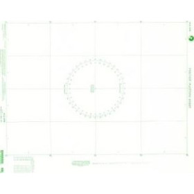
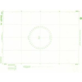
Nautical Navigation Calculator / Nomogram
Introduction
A nautical abacus, also known as a navigation calculator or graphical calculator, is a practical tool used in marine navigation to solve certain calculations required when planning and monitoring a route. Depending on its design, it can graphically represent relationships between different navigation parameters such as distance, speed, time, course, current, leeway, fuel consumption or unit conversions.
At the chart table, a nautical abacus complements traditional navigation instruments such as a Breton plotter or parallel ruler, a pair of dividers and a nautical protractor. It simplifies calculations that could otherwise be performed manually, while providing an approach that is particularly useful when learning navigation.
Nautical calculation aids are used in yachtmaster and navigation training, coastal navigation, offshore navigation and maritime education. They make it easier to understand the relationship between the different quantities used at sea and provide a quick way of checking whether a calculation is consistent.
What is a nautical navigation abacus?
An abacus is a graphical representation that makes it possible to obtain a result from several input values without having to perform a complete mathematical calculation every time. In marine navigation, different types of abacus or graphical calculators can be used depending on the problem being solved.
A nautical navigation abacus can, for example, be used to determine:
-
navigation time from distance and speed;
-
distance travelled over a given period;
-
average speed;
-
course correction;
-
leeway caused by wind or current;
-
estimated fuel consumption;
-
conversions between different units;
-
certain parameters required when planning a route.
The main advantage of a nautical abacus is therefore that it makes calculations quick, visual and easy to check. It is particularly useful when working with traditional paper charts and when learning the principles of marine navigation.
Nautical navigation calculator for distance, speed and time
One of the simplest applications concerns the relationship between distance, speed and time.
In marine navigation, speed is generally expressed in knots and distance in nautical miles. One knot corresponds to one nautical mile per hour.
The basic relationships are:
-
Time = distance ÷ speed
-
Distance = speed × time
-
Speed = distance ÷ time
For example, a 30-nautical-mile route sailed at an average speed of 6 knots has a theoretical passage time of 5 hours.
A nautical calculator or graphical abacus can provide this value directly by combining the distance and speed scales. This method is particularly convenient when several successive calculations are required during route planning.
The result should nevertheless be regarded as an estimate. Actual speed over the ground can vary according to wind, current, sea conditions, the route followed and the vessel's operating conditions.
Using a nautical abacus to plan a route
The nautical abacus is primarily useful during the route-planning stage. After defining the various waypoints on a nautical chart, the navigator can measure distances, determine courses and estimate the time required for each leg.
A route plan may therefore include:
-
the departure point;
-
waypoints;
-
courses to steer;
-
distances between waypoints;
-
average speeds;
-
estimated departure and arrival times;
-
possible current corrections;
-
refuge ports and alternative options.
Combining this information makes it possible to establish a coherent estimate of the voyage.
For example, when planning a passage between La Rochelle and Bilbao, the navigator can divide the route into several legs, measure each distance and use a navigation calculator to determine the theoretical passage time.
For a longer itinerary between Marseille, Ajaccio and Bonifacio, the same method can be used to compare different route scenarios.
Nautical abacus, current and leeway
Some nautical calculation aids are designed for more complex problems, particularly when current has to be taken into account.
A vessel steering a given course does not necessarily move in the desired direction over the seabed. A current can alter both the course made good and the speed made good. The navigator therefore needs to distinguish between the vessel's movement through the water and its actual movement relative to the seabed.
This is particularly important in areas such as:
-
the English Channel;
-
the Alderney Race;
-
the approaches to Cherbourg;
-
the Brittany coast;
-
the Channel Islands;
-
the Strait of Dover;
-
the approaches to Saint-Malo;
-
tidal channels and passages affected by strong currents.
A current calculator or graphical navigation aid can simplify this type of problem by relating the vessel's heading, speed, current direction and the required course over the ground.
It does not, however, replace the actual current information and nautical data required for safe navigation in an area subject to significant tidal variations.
Nautical abacus and offshore navigation
For yachtmaster and offshore navigation training, nautical calculation aids can be used in a variety of chartwork exercises. They make it possible to work with the relationships between different route parameters and to check results obtained through manual calculations.
Offshore navigation requires the navigator to be able to:
-
measure distances in nautical miles;
-
determine a true course;
-
convert true course to magnetic course and then to compass course;
-
take magnetic variation into account;
-
allow for leeway;
-
allow for current;
-
calculate speed or passage time;
-
determine an estimated time of arrival.
A Breton plotter or parallel ruler is used to plot courses and bearings on a nautical chart. Dividers are used to measure distances using the latitude scale. A nautical abacus or graphical calculator complements these methods by simplifying certain calculations.
This combination of graphical plotting, traditional navigation instruments and mathematical reasoning provides a practical understanding of dead reckoning and marine navigation.
Nautical abacus and coastal navigation
The use of a nautical calculator is not limited to offshore navigation training. It can also be useful for coastal navigation when a navigator needs to estimate a passage time quickly or compare different route options.
For example, on a passage between Brest and Audierne, the theoretical sailing time depends on the distance selected and the vessel's average speed. Between Toulon and Saint-Tropez, the same method can be used to estimate the passage time before taking account of detours, restricted areas or actual weather conditions.
In port approaches, calculations may also be used to organise a sequence of waypoints between a channel entrance, a buoy, a leading line and the harbour entrance.
The nautical abacus provides a rapid calculation method, but the result must always be assessed against the actual conditions and characteristics of the planned navigation.
Navigation calculators for different cruising areas
Calculation requirements can vary according to the cruising area.
In the English Channel and North Sea, current and tidal calculations are particularly important. Ports such as Cherbourg, Le Havre, Dunkirk and Ostend are located in environments where changes in water level and tidal streams can have a significant effect on navigation planning.
In the Atlantic, a passage between Lorient, La Rochelle, Bilbao or A Coruña may require a combination of distance, average speed, weather and current calculations.
In the Mediterranean, between Marseille, Toulon, Ajaccio, Bonifacio or Genoa, route calculations remain essential even though current patterns differ from those encountered in the English Channel.
For longer passages, the same principles apply. A route from the Canary Islands to the Caribbean, for example, requires consideration of distance, average speed, passage duration and prevailing wind and current conditions.
The charts and navigational publications produced by major hydrographic and nautical publishers, including SHOM, Admiralty and Imray, are used for navigation planning in these regions.
Nautical abacus and marine charts
A nautical abacus is particularly useful when used together with a nautical chart.
The chart provides information on coastlines, depths, hazards, navigation marks, channels, ports, anchorages and other features required for navigation. The navigator can then measure a distance, plot a route and use a nautical calculator to determine the required passage time or perform another associated calculation.
SHOM charts are widely used for navigation around the French coastline, including the English Channel, Atlantic coast and Mediterranean. Admiralty charts cover a wide range of international waters and are extensively used for coastal and offshore navigation. Imray also publishes numerous charts and navigation products for leisure sailing, particularly in the Mediterranean, Caribbean, Atlantic and European cruising areas.
The nautical abacus should therefore not be considered an isolated document. It forms part of a coherent set of traditional navigation tools.
Nautical abacus and digital navigation
Today's navigators have access to many digital tools capable of automatically calculating distance, speed, course and time. GPS chartplotters, navigation software and applications can provide an estimated result almost instantly.
The nautical abacus nevertheless remains useful.
It can be used to:
-
understand the principle behind a calculation;
-
check a digital result;
-
work independently of electronic equipment;
-
learn traditional navigation techniques;
-
perform quick calculations at the chart table;
-
retain an independent method in the event of electronic equipment failure.
The combination of traditional navigation methods and electronic navigation is particularly relevant when preparing an offshore passage.
How to use a nautical navigation abacus correctly
To use a nautical abacus effectively, first identify the quantities available and the quantity that needs to be calculated.
A simple method is to:
-
identify the type of navigation calculator being used;
-
check the units shown on the scales;
-
locate the first value on the appropriate scale;
-
combine it with the second value;
-
read the result;
-
check whether the order of magnitude is reasonable;
-
compare the result with a conventional calculation if necessary.
Checking the units is essential. A distance expressed in kilometres cannot be directly combined with a speed expressed in knots without first converting the units. In marine navigation, the nautical mile and the knot are the standard units used for many route calculations.
Who uses a nautical abacus?
A nautical navigation calculator can be useful for a wide range of users:
-
candidates preparing for offshore navigation qualifications;
-
coastal sailors;
-
offshore sailors;
-
students and maritime trainees;
-
navigation instructors;
-
sailors who want to check a calculation quickly;
-
navigators using a traditional chart table.
It is particularly valuable for anyone who wants to understand the principles of navigation rather than simply obtain an automatically generated result.
Conclusion
A nautical abacus is a simple but highly useful navigation tool for understanding and performing a range of marine calculations. Distance, speed, time, current, leeway and course corrections can all be approached using graphical methods designed to make navigation calculations easier to understand.
Used together with a nautical chart, a Breton plotter or parallel ruler, dividers and the appropriate navigational data for the cruising area, a nautical abacus is a valuable route-planning aid. It is equally relevant to offshore navigation training and to the preparation of coastal passages or ocean crossings.
From the English Channel to the Mediterranean, and from the Atlantic to the Caribbean, the fundamental principles remain the same: measure, calculate, check and anticipate. A nautical abacus helps transform navigation data into practical information that can be used to plan a maritime route.
FAQ – Nautical Navigation Abacus
What is a nautical navigation abacus?
A nautical navigation abacus is a graphical or graduated navigation aid used to solve certain marine calculations quickly. Depending on its design, it can be used to determine distance, speed, passage time, corrections or other route-related parameters.
What is a nautical abacus used for?
It is mainly used to simplify and speed up certain calculations required when planning or monitoring a passage. It can also be used to check a calculation made manually or with electronic equipment.
Is a nautical abacus useful for offshore navigation training?
Yes. Nautical calculation aids can be used in various chartwork exercises, particularly when working with distance, speed and time or with calculations involving current and leeway.
What is the difference between a nautical abacus and a Breton plotter?
A Breton plotter or parallel ruler is primarily a plotting and measuring instrument used on a nautical chart. A nautical abacus is designed to solve certain mathematical or navigational relationships graphically. The two tools therefore serve complementary purposes.
Can a nautical abacus be used with SHOM charts?
Yes. A nautical abacus can be used together with SHOM nautical charts to perform calculations based on distances, courses and other information taken from the chart.
Is a nautical abacus still useful when using GPS?
Yes. Although electronic equipment can automate many calculations, a nautical abacus helps the navigator understand the underlying principles, check certain results and retain a method that does not depend on electronic equipment.
Which units are used with a nautical abacus?
The most common units are nautical miles for distance and knots for speed. Depending on the type of calculator, other units may also be used, including kilometres or kilometres per hour.
Can a nautical abacus be used to calculate passage time?
Yes, when it is designed for distance-speed-time calculations. The principle is to relate the distance to be covered to the vessel's average speed in order to obtain a theoretical passage time.
Can a nautical abacus take current into account?
Some navigation calculators are specifically designed to solve current and leeway problems. They can relate the vessel's speed, current direction and the required course over the ground.
Is a nautical abacus sufficient to plan a passage?
No. It is a calculation tool rather than a complete navigational document. Proper passage planning also requires appropriate charts, navigational information, weather forecasts, tides, currents and the regulations applicable to the area.