Accessory
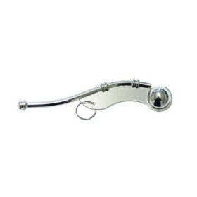
The Accessories category includes practical nautical supplies designed to complement navigation equipment and the preparation of documents on board. It includes, in particular, the marine whistle, a sound-signalling accessory useful for manoeuvring, safety drills and certain navigation situations in restricted visibility. These accessories are intended for recreational sailors, navigators, navigation students and instructors, merchant navy professionals and users of paper nautical charts. They are useful when planning routes in the English Channel, North Sea, Mediterranean, Atlantic or when approaching ports such as Brest, Le Havre, Marseille, Toulon or La Rochelle. These supplies complement the use of hydrographic publications and nautical documents produced by Shom, Admiralty and other hydrographic organisations.

Accessories
Introduction
The Accessories category covers practical nautical supplies designed to complement navigation equipment and facilitate the preparation, use and storage of nautical documents on board. These accessories meet a wide range of needs, from traditional work on paper nautical charts to the day-to-day organisation of navigation documents on a chart table.
Both professional navigation and recreational sailing require many small items that do not constitute a navigation system in themselves but contribute directly to its effective use. Rules, plotting instruments, measuring tools, signalling equipment, chart supplies, writing materials and document-storage accessories enable navigators to prepare a route, transfer a position, measure a distance, apply corrections and keep documents in good condition.
These nautical accessories are useful on sailing yachts and motorboats as well as on merchant ship bridges, in maritime schools and in professional navigation training centres.
What are nautical accessories used for?
A nautical accessory is generally designed to perform a specific function related to navigation, safety, documentation or onboard organisation.
It may be used to:
-
measure a distance on a nautical chart;
-
transfer a course or bearing;
-
plot a true or magnetic course;
-
determine or check a position;
-
interpret charted information correctly;
-
apply corrections to a paper chart;
-
protect charts from moisture and repeated handling;
-
organise navigation documents;
-
keep charts and publications accessible during a watch;
-
provide an audible signalling means;
-
facilitate routine onboard tasks.
The function of an accessory should always be considered in relation to the type of navigation being performed. A chart plotting instrument does not have the same purpose as a safety accessory or a document-storage product.
Paper chart navigation instruments
Traditional navigation on paper nautical charts relies on several simple but essential instruments.
Dividers, also known as navigation dividers, can be used to measure or transfer distances between two points on a chart. They can also be used to transfer a measured distance to the latitude scale.
A parallel ruler is a traditional navigation instrument used to transfer a direction or course across different areas of a chart while maintaining a constant orientation.
A nautical protractor can be used to measure an angle or plot a direction. It may be useful when determining a bearing, course or orientation on a nautical chart.
Depending on the navigation method, these instruments can be used separately or together.
Preparing a route on a nautical chart
Even when a vessel is equipped with ECDIS, GNSS or an electronic chart plotter, understanding traditional plotting methods remains important for many navigators and maritime professionals.
Preparing a route on a paper nautical chart may involve:
-
identifying departure and destination points;
-
checking the chart scale;
-
identifying navigational hazards;
-
plotting successive courses;
-
measuring distances;
-
determining headings;
-
identifying regulated areas;
-
taking depths and navigational aids into account;
-
plotting waypoints;
-
checking the overall consistency of the route.
Navigation accessories make these graphical operations easier and allow the navigator to work directly on nautical documents.
Charts produced by Shom, Admiralty, NGA and other hydrographic offices use standardised symbols, abbreviations and chart conventions. Proper knowledge of nautical chart representation is therefore essential when using plotting instruments.
Accessories for chart updating
Paper nautical charts must be maintained up to date in accordance with applicable procedures.
Corrections may concern depths, wrecks, buoys, lights, port installations, regulated areas or other information relevant to navigational safety.
Plotting and correction accessories may be required to transfer certain amendments accurately and legibly onto paper documents.
Admiralty uses Notices to Mariners to distribute applicable corrections to its charts and publications. Shom also provides update information for its nautical documents, while NGA publishes correction information for its charts and publications.
Accessories used for this purpose should enable accurate, clear work without unnecessarily damaging the document.
Accessories for nautical documents
Voyage preparation often involves handling numerous charts and publications, including general charts, coastal charts, approach charts, harbour plans, sailing directions, lists of lights, tide tables, radio-navigation publications and complementary nautical references.
Storage and protection accessories can help keep these documents organised.
Proper chart storage is particularly important on board. Charts must remain readable and accessible despite humidity, frequent handling and limited space in the navigation area.
Chart cases, document holders, protective folders and storage systems can therefore contribute to maintaining an organised navigation documentation system.
Measuring and plotting accessories
Measuring and plotting accessories represent an important group of nautical supplies.
They may include:
-
navigation dividers;
-
parallel rulers;
-
nautical protractors;
-
graduated rulers;
-
plotting instruments;
-
distance-measuring accessories;
-
pencils and writing supplies;
-
erasers and correction materials;
-
chart-work supports.
These instruments are particularly useful for navigators who regularly use paper charts or who want to maintain an independent graphical navigation capability alongside electronic systems.
They are also useful in coastal navigation, offshore navigation and maritime examination training.
Audible signalling accessories
Nautical accessories can also include simple equipment designed for signalling.
A marine whistle is a typical example. It provides an audible signal in situations where short-range sound signalling may be useful.
A whistle can be used during certain manoeuvres, training exercises, to attract attention or when verbal communication is difficult.
Sound signals form part of fundamental maritime navigation knowledge and are governed by the International Regulations for Preventing Collisions at Sea.
The use of a signalling accessory does not replace statutory equipment required for the particular vessel.
Chart-table accessories
The chart table remains an important working area on many vessels.
Even on a sailing yacht equipped with an electronic chart plotter, it can be used to consult paper charts, prepare a route, record information, compare different sources or store navigation documents.
An organised chart table reduces unnecessary handling and keeps essential instruments readily available.
Accessories can therefore help create a functional navigation workstation containing:
-
navigation instruments;
-
nautical documents;
-
pencils and writing materials;
-
chart supports;
-
storage equipment;
-
protective accessories;
-
measuring tools.
Accessories and electronic navigation
Modern navigation relies extensively on electronic systems such as GNSS, GPS, ECDIS, radar, AIS and electronic chart plotters.
However, nautical accessories remain useful.
Electronic navigation does not eliminate the need for paper documentation, note-taking, document organisation or certain traditional methods of navigation verification.
Shom publications on navigation methods and instruments address both modern navigation equipment and traditional navigation methods adapted to different operating conditions.
Accessories should therefore be regarded as complementary tools rather than replacements for electronic navigation systems.
Accessories for maritime training
Nautical supplies are also important in navigation education.
Navigation students learn how to use nautical charts, measure distances, plot courses, determine headings, take bearings and interpret chart symbols.
Simple, suitable equipment makes these skills easier to learn and practise.
Accessories can be used in maritime schools, training centres, navigation courses and recreational sailing instruction.
They allow students to work on fundamental navigation principles without relying exclusively on electronic equipment.
Use according to the type of navigation
Accessory requirements vary according to the vessel and navigation being undertaken.
On a cruising yacht sailing between La Rochelle, Brest, the Channel Islands or the English Channel, chart instruments can be used for coastal route planning.
In the Mediterranean, around Marseille, Toulon, Ajaccio or Nice, they may be used to prepare coastal routes and check information represented on charts.
On a professional vessel, accessories can support bridge documentation, voyage planning and paper-chart work.
For offshore and ocean navigation, plotting instruments can also complement route preparation on small-scale charts.
Quality and accuracy of nautical accessories
The accuracy of a navigation accessory matters because an error in measurement or plotting may affect route preparation.
Instruments should be appropriate for the type of chart being used and sufficiently robust for normal onboard conditions.
Graduation readability, ruler stability, point accuracy and ease of handling are important considerations.
For professional users, accessories should also support repeatable and sufficiently precise work compatible with the vessel’s navigation methods and procedures.
Who is the Accessories category for?
This category is relevant to:
-
recreational sailors;
-
yacht owners;
-
motorboat users;
-
coastal navigators;
-
offshore sailors;
-
merchant shipping professionals;
-
bridge officers;
-
deck cadets;
-
maritime schools and training centres;
-
instructors and trainers;
-
users of paper nautical charts.
It addresses the practical needs of anyone using nautical documents or requiring complementary tools for voyage preparation and navigation checks.
Conclusion
Nautical accessories are a collection of simple but useful supplies that support navigation and the preparation of nautical documents. They complement electronic equipment, facilitate paper chart work, enable courses to be measured and plotted, support chart corrections, organise the chart table and help protect nautical publications.
Dividers, parallel rulers, protractors, measuring instruments, correction supplies, document-storage accessories and signalling equipment each serve a specific purpose.
In modern navigation, where electronic charts, ECDIS, GNSS, radar and AIS operate alongside traditional navigation methods, these accessories retain an important complementary role. They support systematic voyage preparation and help maintain an independent working capability with nautical charts and publications from Shom, Admiralty, NGA and other hydrographic organisations.
FAQ – Nautical Accessories
What are nautical accessories used for?
They complement navigation equipment and facilitate work with nautical charts and documents, including measuring, plotting, correcting, protecting and organising documents on board.
What are the main accessories for using a paper nautical chart?
Common instruments include navigation dividers, parallel rulers, nautical protractors, graduated rulers and various plotting and writing supplies.
What are navigation dividers used for?
They can be used to measure and transfer distances on a nautical chart, for example between two points or between a route point and a position.
What is a parallel ruler used for?
It is used to transfer a direction or course across a nautical chart while maintaining a constant orientation.
Why are paper-chart navigation instruments still used?
They provide a way to prepare or check a route independently of electronic systems and remain useful for training, backup navigation and certain professional procedures.
Are nautical accessories useful with ECDIS?
Yes. ECDIS provides electronic navigation, while accessories remain useful for paper documentation, note-taking, preparation, verification and certain backup procedures.
Which accessories are useful for updating paper charts?
Accurate plotting instruments, suitable pencils and other correction supplies can be used to apply chart updates in accordance with the applicable chart-correction procedures.
Is a marine whistle a navigation accessory?
Yes. It is an audible signalling accessory that can be useful in certain onboard situations, including attracting attention or during drills. It does not replace statutory equipment required for the vessel.
Are nautical accessories useful for maritime training?
Yes. They are particularly useful for learning course plotting, distance measurement, nautical chart work and traditional navigation methods.
Which documents can be used with these accessories?
They can be used with nautical charts and publications from Shom, Admiralty, NGA and other hydrographic organisations, depending on the navigation requirements.
Are nautical accessories only intended for recreational sailing?
No. They can also be used by merchant shipping professionals, bridge officers, deck cadets and maritime training institutions.
Why is the chart table still important?
It provides a dedicated working area for consulting charts and publications, preparing routes, taking measurements, recording notes and keeping essential navigation documents readily accessible.