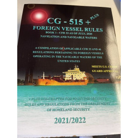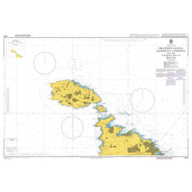



This 718-page guide is indispensable for mariners, covering lights, radio aids, and fog signals across the Western Pacific, Indian Ocean, Persian Gulf, and Red Sea. Updated annually for precision.
Data sheet
Specific References
Navigate with Confidence Using the Most Authoritative Nautical Reference for the Western Pacific and Indian Oceans
The *US Pub. 112 List of Lights, Radio Aids and Fog Signals* is the gold standard for mariners requiring precise, up-to-date navigational data in one of the world’s most critical maritime regions. Covering the Western Pacific and Indian Oceans—including high-risk areas like the Persian Gulf and Red Sea—this publication provides exhaustive details on over 700 pages, ensuring vessels can safely traverse even the most challenging waters. Unlike generic nautical charts, this guide offers expanded information on lights, radio beacons, and fog signals, making it an indispensable resource for commercial shipping, offshore operations, and maritime safety protocols.
Annual Updates Ensure Unmatched Accuracy
Published annually with a data cutoff of February 15, 2026, this 2026 edition reflects the latest verified information from the National Geospatial-Intelligence Agency (NGA). Each entry is meticulously reviewed to provide mariners with the most reliable data available, reducing the risk of navigational errors in high-traffic corridors like the Strait of Hormuz or the Bay of Bengal. The 8.5 x 11-inch paperback format, printed on durable 50# paper, is designed for frequent onboard use, while its 1.8 kg weight ensures portability without sacrificing durability.
Designed for Professional Mariners and Regulatory Compliance
This publication is not just a reference—it’s a requirement for vessels operating under international maritime regulations. Insurers and port authorities often mandate the use of up-to-date guides like the *US Pub. 112* to ensure compliance with safety standards. With detailed entries on light characteristics, radio beacon frequencies, and fog signal audibility, this guide enhances situational awareness, helping crews avoid hazards and optimize routing. The 2026 edition is available in both print and e-Book formats, offering flexibility for modern maritime operations.
The *US Pub. 112 List of Lights, Radio Aids and Fog Signals* is a 718-page paperback publication, measuring 8.5 x 11 inches and weighing 1.8 kg. Printed in English on durable 50# paper, this 2026 edition features a data cutoff of February 15, 2026, ensuring the most current navigational information for the Western Pacific and Indian Oceans, including the Persian Gulf and Red Sea. Available in both print and e-Book formats, it is designed for professional use in commercial shipping and offshore operations.
For over a century, this agency has been the backbone of global maritime navigation, providing critical geospatial intelligence to commercial fleets, naval operations, and international regulatory bodies. Their publications are trusted by mariners worldwide for their unparalleled accuracy, rigorous verification processes, and commitment to safety in even the most complex waterways. With a focus on real-time data and annual updates, their resources set the standard for navigational reliability in the maritime industry.
The data in the 2026 edition is current up to February 15, 2026, based on the latest available information at the time of publication.
No, the publication is only available in English.
The printed version uses 50# paper, ensuring durability and readability.
The publication is updated annually, with each new edition released to reflect the most recent navigational data.
Yes, the publication is available both as a printed book and in e-Book format.
This edition covers the Western Pacific and Indian Oceans, including the Persian Gulf and the Red Sea.
The publication provides more detailed information on navigation aids than what is typically shown on marine charts.
You might also like