
 Click here to open our interactive map and select your charts


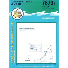
Shom L Nautical Chart – Folded Chart
A compact paper nautical chart for practical navigation
The Shom L nautical chart is the folded version of the official French paper nautical chart published by the Shom, the French Hydrographic and Oceanographic Service. Designed to provide detailed nautical information while remaining easy to store and handle, the Shom L is particularly practical when space is limited on board.
Folded to approximately A4 size, the chart can be stored easily in a chart portfolio, navigation bag or protective case. Once unfolded, it provides a large-format chart close to A0 size, allowing the navigator to access detailed information on depths, hazards, aids to navigation, coastlines, ports, anchorages, channels and regulated areas.
The Shom L range covers many French coastal areas as well as offshore routes and overseas territories. It includes charts for the English Channel, Atlantic Ocean, Mediterranean, Caribbean and other areas covered by the Shom catalogue.
What is a Shom L nautical chart?
The Shom L is a paper nautical chart printed on a resistant support and folded into an A4 format of approximately 21 × 29.7 cm. Once unfolded, the chart measures approximately 84 × 119 cm, corresponding to an A0-type format.
The folded presentation does not mean that the chart contains less navigational information than the corresponding large-format paper chart. It is designed to combine detailed cartographic information with easier storage and handling.
A Shom L chart may be used for coastal navigation, harbour approaches, passage planning and route preparation. Depending on the chart number and geographical area, different scales are available, from detailed coastal charts to charts covering wider offshore areas.
The Shom L range therefore includes several types of navigation requirements:
-
coastal navigation;
-
harbour approaches;
-
navigation between ports;
-
coastal cruising;
-
offshore route preparation;
-
passage planning;
-
navigation around islands and archipelagos;
-
preparation of longer passages.
A folded A4 chart that unfolds to A0 size
The main advantage of the Shom L is its format.
When folded, the chart occupies approximately the same space as an A4 document. This makes it much easier to store than a large rolled chart. It can be kept in a navigation bag or chart case and transported without requiring a long tube.
Once opened, however, the chart regains a large cartographic surface. With an unfolded size of approximately 84 × 119 cm, the navigator can work on a detailed geographical area while retaining the advantages of a large paper nautical chart.
This combination of compact storage and large-scale reading is particularly useful on smaller boats, where the available chart-table space may be limited.
The folding system also makes it possible to consult a specific section of the chart without necessarily having to spread the entire sheet across the navigation table.
What information can be found on a Shom L chart?
A Shom L contains the essential cartographic information required for marine navigation.
Depending on the geographical area and scale, the chart may show:
-
soundings and depth contours;
-
underwater relief;
-
rocks and shoals;
-
wrecks;
-
isolated dangers;
-
coastlines;
-
landmarks;
-
buoys and other aids to navigation;
-
lights and light characteristics;
-
channels and fairways;
-
harbour entrances;
-
anchorages;
-
restricted or regulated areas;
-
maritime boundaries;
-
tidal and current information where represented;
-
port and harbour information;
-
chart insets providing more detailed views.
The scale is a key element when selecting a Shom L chart. A detailed coastal chart is appropriate for navigation close to shore, while a smaller-scale chart provides a wider geographical overview for offshore passages.
Shom L for coastal navigation
Coastal navigation requires charts with sufficient detail to identify hazards, channels, navigation marks and approaches to ports.
The Shom L range includes numerous charts covering the French coastline. Examples include areas around Dunkirk, Calais, Boulogne-sur-Mer, Dieppe, Le Havre, Cherbourg and Barfleur in the English Channel.
Further west, Shom L charts cover areas around Saint-Malo, Brest, Ouessant, the Iroise Sea, Lorient, Groix, Belle-Île, Quiberon and the Gulf of Morbihan.
On the Atlantic coast, the range includes areas around Saint-Nazaire, La Rochelle, Rochefort, Royan, Bordeaux, Arcachon, Bayonne, Saint-Jean-de-Luz and Hendaye.
These charts can therefore be used to prepare coastal passages, harbour approaches, anchorages and navigation between neighbouring ports.
Shom L for the Atlantic and offshore passages
The Shom L catalogue is not limited to detailed coastal charts.
It also includes charts covering wider areas of the Atlantic, including offshore routes and passages between Europe and the Caribbean. Some charts cover routes such as Lisbon to Freetown or the North Atlantic route between France and the French West Indies.
This makes the Shom L format suitable for route preparation when a navigator needs to combine compact storage with a large geographical coverage.
For a long passage, several charts at different scales may be required. A general or offshore chart provides the overall route, while larger-scale coastal charts are used when approaching land, islands, channels or ports.
Shom L in the Caribbean and French West Indies
The Shom L range also includes numerous charts covering the Caribbean and the French West Indies.
Examples include the approaches to Fort-de-France, Pointe-à-Pitre, Les Saintes, Marie-Galante and La Désirade, as well as other islands and coastal areas of the Lesser Antilles.
These charts can be useful for coastal cruising, island-to-island passages, harbour approaches and anchorage planning.
As with mainland France, the appropriate chart should be selected according to the exact sailing area and required scale.
Shom L compared with other Shom chart formats
The Shom catalogue includes several paper and digital chart formats. They do not all have the same purpose.
| Type | Support | Presentation | Main characteristic | Typical use |
|---|---|---|---|---|
| Shom C | Paper | Flat, rolled | Large-format nautical chart | Chart table, route planning, detailed navigation |
| Shom L | Paper | Folded A4 | Large-format chart folded for easy storage | Coastal navigation, cruising, limited space on board |
| Shom G | Paper | Folded A4 | Nautical chart with sedimentological information | Study of seabed characteristics, fishing and specialised uses |
| Shom Z | Paper | Flat, rolled | Nautical chart with exercise and firing-zone information | Navigation in areas concerned by military activities |
| Shom Raster | Digital | Digital file | Digital reproduction of a Shom chart | Navigation and cartography software |
The Shom L therefore occupies a specific position between the large rolled paper chart and digital navigation products.
Shom L or Shom C: which format should you choose?
The main difference between the Shom L and Shom C is the physical presentation of the paper chart.
The Shom C is supplied flat and generally rolled into a tube. It is particularly convenient when the chart is going to remain open on a large chart table.
The Shom L is folded into A4 format. It is therefore easier to store, transport and organise, while still providing a large cartographic surface when unfolded.
For a boat with a large chart table, a rolled chart can be convenient for continuous route plotting.
For a smaller boat, a sailing yacht, a motorboat or any vessel where storage space is limited, the folded Shom L can be easier to handle.
The choice therefore depends less on the cartographic quality of the two formats than on the way the chart will be stored, transported and used on board.
Shom L and chart scale
Choosing the correct scale is essential.
A large-scale chart shows a relatively small geographical area in greater detail. It is particularly useful when approaching a harbour, navigating close to the coast or entering a channel.
A smaller-scale chart covers a larger geographical area and provides a better overview for route planning and offshore navigation.
For example, a navigator preparing a coastal passage along Brittany may need an offshore or coastal chart for the general route and a larger-scale chart for the approaches to Brest, Lorient, Saint-Nazaire or another port.
The same principle applies in the Mediterranean, the Atlantic and the Caribbean.
The chart number, title and scale should therefore always be checked against the precise navigation area.
Shom L, paper navigation and electronic navigation
Digital navigation systems are now widely used, but paper charts remain useful as an independent navigation medium and as a planning tool.
A paper Shom chart provides a physical overview of the sailing area. The navigator can mark a route, identify hazards, compare alternative tracks and visualise the relationship between ports, islands, headlands, channels and offshore areas.
A Shom L can also complement an electronic navigation system. The paper chart provides a separate source of cartographic information and allows the navigator to maintain a geographical overview that may be less obvious on a small electronic display.
For serious passage planning, the choice between paper and digital navigation should therefore not necessarily be considered an either-or decision. Depending on the vessel, navigation system and sailing programme, the two approaches can complement each other.
How to choose the right Shom L chart?
Before selecting a Shom L, check several elements:
-
the exact geographical area;
-
the chart number;
-
the chart title;
-
the scale;
-
the type of navigation planned;
-
the ports and anchorages concerned;
-
whether the chart covers the complete intended route;
-
the edition and update status.
The same coastline can require several charts because the scales and geographical coverage differ.
For coastal navigation, it is particularly important to distinguish between a chart covering the general coastline and a more detailed chart dedicated to harbour approaches or a specific bay.
Why choose a Shom L folded nautical chart?
The Shom L combines detailed official nautical cartography with a compact physical format.
Its main advantages are:
-
folded A4 storage;
-
large-format cartography when unfolded;
-
practical handling on board;
-
easy transport;
-
detailed nautical information;
-
coverage of coastal and offshore areas;
-
availability for many French and overseas sailing areas;
-
suitability for route planning and coastal navigation;
-
compatibility with traditional paper navigation methods.
The Shom L is therefore particularly interesting for navigators who want the advantages of a large paper chart without the storage constraints of a permanently rolled document.
Conclusion
The Shom L folded nautical chart is a practical format for navigators who need detailed official marine cartography while keeping their charts easy to store and transport.
Folded to approximately A4 size and unfolding to approximately 84 × 119 cm, it combines compact storage with a large working surface. Its range covers numerous French coastal areas, the English Channel, the Atlantic, the Mediterranean and overseas territories including the Caribbean.
Whether used for coastal navigation, harbour approaches, cruising, route preparation or offshore passages, the choice of Shom L should always be based on the precise geographical area and required scale.
For sailors comparing Shom C, Shom L, Shom G, Shom Z and Shom Raster, the essential distinction is the relationship between cartographic content, physical format, specialised information and intended use.
FAQ – Shom L nautical charts
What is a Shom L nautical chart?
A Shom L is a paper nautical chart published by the Shom and folded to approximately A4 size. When unfolded, it provides a large-format chart of approximately 84 × 119 cm.
What is the difference between a Shom L and a Shom C?
The main difference is the presentation. The Shom L is folded into A4 format, while the Shom C is supplied flat and generally rolled. Both are paper nautical charts intended for navigation, with the choice depending mainly on storage and onboard use.
What size is a Shom L chart when unfolded?
A Shom L is approximately 84 × 119 cm when unfolded, corresponding to an A0-type format.
Is a Shom L suitable for coastal navigation?
Yes. The Shom L range includes numerous coastal charts at different scales, allowing navigation close to the coast, preparation of harbour approaches and planning of coastal passages.
Does the Shom L range cover the Atlantic Ocean?
Yes. The catalogue includes many Shom L charts covering the French Atlantic coast as well as wider Atlantic routes.
Are there Shom L charts for the Caribbean?
Yes. The Shom L range includes charts covering areas of the Caribbean and French West Indies, including areas around Martinique, Guadeloupe, Les Saintes, Marie-Galante and La Désirade.
What information is shown on a Shom L chart?
Depending on the chart and scale, it may show depths, depth contours, rocks, wrecks, shoals, lights, buoys, channels, ports, anchorages, regulated areas and other information required for marine navigation.
How should I choose the scale of a Shom L?
The scale should correspond to the type of navigation. A larger scale provides more detail for coastal navigation and harbour approaches, while a smaller scale is more suitable for offshore route planning and wider geographical coverage.
Can a Shom L be used alongside electronic navigation?
Yes. Paper and electronic charts can complement each other. A paper chart provides a large-scale physical overview and can be used for route preparation and as an independent navigation reference.
What is the difference between a Shom L and a Shom G?
The Shom L is a conventional nautical chart. The Shom G includes additional sedimentological information showing the nature and distribution of seabed sediments.
What is a Shom Z chart?
A Shom Z is a nautical chart that includes additional information identifying military exercise and firing areas. It is supplied in a flat, rolled format.
What is a Shom Raster chart?
A Shom Raster is a digital reproduction of a Shom paper chart, intended for use with compatible navigation and cartography software.