
 Click here to open our interactive map and select your charts

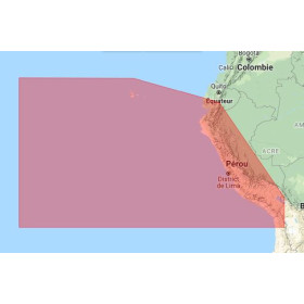
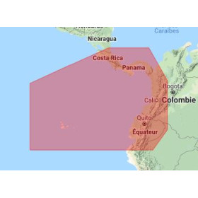
C-MAP 4D on SD / microSD Card
C-MAP 4D digital marine cartography on an SD or microSD card is designed for sailors using a navigation system compatible with C-MAP cartography. It allows nautical and cartographic information required for navigation planning and monitoring to be displayed on electronic equipment, including coastlines, depths, soundings, depth contours, ports, channels, navigation aids, obstacles and other data depending on the geographical area and chart reference.
The C-MAP 4D range is designed to provide detailed digital representation of the covered areas. Depending on the selected reference, it can meet different navigation requirements, from coastal recreational boating to planning a more extensive cruise.
The SD or microSD format is an important part of the selection process. It must be compatible with the GPS chartplotter or navigation system used onboard. It is therefore essential to check both the geographical coverage of the C-MAP 4D chart and its technical compatibility with the equipment.
What is a C-MAP 4D marine chart?
C-MAP 4D is a range of digital marine cartography designed for compatible navigation equipment. The charting allows the navigator to display an electronic representation of the navigable area on the chartplotter screen.
The cartographic data may include information about:
-
coastlines and land contours;
-
depths and soundings;
-
depth contours;
-
ports and marinas;
-
channels and waterways;
-
navigation aids;
-
charted obstacles and hazards;
-
certain specific or regulated areas;
-
information required for route planning.
The exact content depends on the C-MAP 4D reference and the geographical area concerned. It is therefore important to distinguish the C-MAP 4D range from each individual chart reference available.
C-MAP 4D on an SD or microSD card
C-MAP 4D charts may be supplied on SD or microSD media depending on the reference and the equipment for which they are intended.
The physical media allows the cartography to be used directly in equipment equipped with the corresponding card reader. The digital chart is then recognized by the compatible navigation system and the cartographic data can be displayed on the chartplotter screen.
The choice of media depends in particular on:
-
the GPS chartplotter model;
-
the available card reader;
-
the format supported by the equipment;
-
the navigation system version;
-
the C-MAP reference being used.
A microSD card should therefore not be considered automatically compatible with every device equipped with an SD card reader. It is recommended to check the manufacturer's specifications before selecting a chart.
What is a C-MAP 4D marine chart used for?
C-MAP 4D cartography is primarily used to plan, visualize and monitor electronic navigation.
It can be used to:
-
prepare a route before departure;
-
monitor the vessel's position using GPS;
-
view depths;
-
identify ports and marinas;
-
analyze channels;
-
identify charted hazards;
-
prepare waypoints;
-
study an area before a coastal approach;
-
support recreational boating or cruising.
For example, a navigator preparing a coastal cruise can use C-MAP 4D cartography to study the route, identify ports of call and view the available depths along the planned route.
How do you choose a C-MAP 4D chart?
Choosing a C-MAP 4D digital marine chart is mainly based on three criteria: geographical area, equipment and required coverage.
1. Determine the navigation area
The first question to ask is: where will I be navigating?
The required coverage may correspond to:
-
a specific coastal area;
-
a maritime region;
-
part of a country;
-
several neighbouring areas;
-
a wider cruising area.
A C-MAP 4D chart intended for a local area will not necessarily cover an entire long-distance route.
For a cruise involving several stages, it is therefore important to examine the exact geographical coverage of the selected reference.
2. Check the chartplotter model
Compatibility with the GPS chartplotter is essential.
Before choosing a C-MAP 4D chart, it is advisable to identify:
-
the chartplotter brand;
-
the exact model;
-
the generation of the equipment;
-
the system or software used;
-
the supported chart format.
A C-MAP 4D chart should not be selected simply because its physical format matches the chartplotter's card reader. System compatibility with the cartography must also be checked.
3. Choose the SD or microSD format
The media format is another important consideration.
Depending on the product and equipment, the cartography may be supplied on an SD or microSD card. The format must correspond to the specifications of the navigation system.
A physical adapter alone does not guarantee electronic compatibility with the chart. The chartplotter manufacturer's recommendations should therefore be checked.
C-MAP 4D for coastal navigation
Coastal navigation is one of the main uses of electronic cartography.
Close to the coast, the navigator needs to analyze depths, identify channels, locate ports and take into account the various hazards shown on the chart.
A compatible C-MAP 4D chart allows this information to be displayed directly on the chartplotter.
For example, when navigating between several ports, the navigator can prepare a route before departure, define waypoints and examine different navigation areas. During the voyage, GPS can then be used to display the vessel's position on the digital chart.
This type of use is particularly suitable for recreational boating, coastal cruising and certain professional applications using compatible navigation systems.
C-MAP 4D for cruise planning
For a cruise, digital cartography plays an important role from the planning stage.
The navigator can:
-
study the different stages;
-
locate ports and marinas;
-
identify shallow-water areas;
-
analyze channels;
-
prepare routes;
-
define waypoints;
-
check available chart coverage.
For example, when planning a Mediterranean cruise, the chart can be used to prepare navigation between several ports and anticipate the different coastal areas along the route.
For navigation in another region, the same principle applies: the C-MAP 4D reference must cover the area actually being navigated.
Depths, soundings and bathymetry
Bathymetric data are an important component of digital marine cartography.
Depths and depth contours make it possible to visualize the configuration of the seabed and identify variations in depth.
This information can be useful for:
-
planning a route;
-
analyzing a navigation area;
-
identifying shoals;
-
preparing an approach;
-
studying an anchorage area;
-
gaining a better understanding of seabed configuration.
However, chart data should not be considered a guarantee of the actual depth at a given moment. Navigators must take into account real conditions, tides where relevant, chart updates and official nautical information.
C-MAP 4D and GPS position monitoring
One of the main advantages of a digital marine chart is its integration with the vessel's GPS positioning.
On a compatible chartplotter, the vessel's position can be displayed directly on the chart. This allows the navigator to monitor progress in relation to the planned route.
This is particularly useful for:
-
monitoring a coastal route;
-
navigating between two waypoints;
-
approaching a port;
-
monitoring the vessel's position;
-
comparing the planned route with the actual track.
The exact operation naturally depends on the GPS chartplotter and its available functions.
C-MAP 4D for fishing
Digital cartography can also be used for fishing.
Depth and underwater relief data can help analyze an area and identify variations in seabed configuration.
Depending on the equipment and available data, navigators can use the chart to:
-
identify changes in depth;
-
study underwater relief;
-
prepare a fishing area;
-
save specific locations using waypoints;
-
monitor their position while navigating.
The chart remains a navigation and area-analysis aid. It does not replace the navigator's knowledge or other information available onboard.
C-MAP 4D and inland navigation
Some C-MAP 4D references may be intended for specific environments, including lakes or inland waters. This includes charting products with names such as C-MAP 4D Lakes Regional.
In this context, the cartography can display depths, contours, navigable areas and other information available for the covered inland waters.
The choice should always be based on the specific area and compatibility with the equipment being used.
Can C-MAP 4D be used on a computer or tablet?
A C-MAP 4D chart on an SD or microSD card intended for a chartplotter is not automatically usable on a computer, smartphone or tablet.
Compatibility depends on the product, system and application or equipment concerned.
It is therefore useful to distinguish between:
-
physical C-MAP cartography intended for a GPS chartplotter;
-
a C-MAP software solution intended for another environment;
-
cartography integrated directly into a navigation system.
The SD or microSD format alone does not determine compatibility.
C-MAP 4D and paper nautical charts
Digital cartography and paper nautical charts can be complementary.
Electronic cartography makes it easier to monitor the vessel's position and prepare a route on the chartplotter. A paper chart provides an overall and independent view of the navigation area.
For coastal or offshore navigation, many sailors use several sources of information to plan their route and maintain complementary options in the event of an electronic equipment failure.
Digital cartography also does not replace the need to consult appropriate nautical documents and information for the area being navigated.
Why should you check C-MAP 4D chart compatibility?
A selection error can have several causes: incorrect geographical coverage, wrong format, incompatible chartplotter model or unsuitable software version.
Before choosing a C-MAP 4D chart on SD or microSD, it is therefore recommended to check:
-
the exact geographical area;
-
the C-MAP reference;
-
the GPS chartplotter model;
-
the SD or microSD format;
-
system compatibility;
-
any requirements specified by the manufacturer.
This check is particularly important when a chart is intended for international navigation or a route covering several regions.
C-MAP 4D: digital cartography for planning and monitoring navigation
C-MAP 4D cartography on an SD or microSD card is an electronic navigation tool that allows sailors to plan a route, analyze an area and monitor the vessel's progress on compatible equipment.
Its value comes from the combination of cartography, GPS positioning and the functions available on the chartplotter.
For coastal navigation, cruising, fishing or certain inland navigation applications, the chart allows sailors to use the available data for the covered area and incorporate it into route planning.
The choice of reference nevertheless remains essential: a digital marine chart is only useful if it covers the required area and works with the equipment used onboard.
Conclusion
C-MAP 4D on an SD or microSD card is a digital marine cartography solution designed for sailors using compatible equipment. It displays cartographic and nautical information useful for planning and monitoring navigation, including depths, soundings, depth contours, coastlines, ports, channels, navigation aids and hazards depending on the selected reference.
When choosing a C-MAP 4D chart, it is essential to check the geographical area, coverage, chartplotter model and supported SD or microSD format at the same time.
Whether for coastal navigation, cruising, fishing or inland navigation, digital cartography is a particularly useful planning and monitoring tool when correctly matched to the equipment and combined with other available nautical information.
FAQ – C-MAP 4D on SD / microSD Card
What is a C-MAP 4D marine chart?
C-MAP 4D is a range of digital marine cartography designed for compatible navigation equipment. It displays information such as depths, soundings, coastlines, ports, channels, navigation aids and other data depending on the covered area.
Is C-MAP 4D available on SD or microSD cards?
Some C-MAP 4D references are available on SD or microSD cards. The format depends on the reference and the navigation equipment for which it is intended.
Which C-MAP 4D chart should I choose for my GPS chartplotter?
You should check the exact chartplotter model, C-MAP compatibility, supported SD or microSD format and required geographical coverage.
How do I choose a C-MAP 4D chart for the Mediterranean?
Select a reference covering the specific Mediterranean area in which you intend to navigate and check that it is compatible with your GPS chartplotter model.
Which C-MAP 4D chart should I choose for Atlantic navigation?
The choice depends on the Atlantic region and planned route. Check the exact coverage of the C-MAP 4D reference and its compatibility with the chartplotter.
Is C-MAP 4D suitable for coastal navigation?
Yes, a compatible C-MAP 4D chart can be used to plan and monitor coastal navigation, including viewing coastlines, depths, ports, channels and other available information.
Is C-MAP 4D suitable for fishing?
C-MAP 4D cartography can be used for fishing when the available data and equipment allow the navigator to use depth, bathymetric and underwater relief information.
What is the difference between C-MAP 4D and C-MAP 4D Wide?
These are references belonging to the C-MAP 4D range, but their coverage and characteristics may differ. The exact reference should be checked to determine the covered area and equipment compatibility.
What is C-MAP 4D Lakes Regional?
C-MAP 4D Lakes Regional refers to cartography designed for certain lake and inland-water areas. The exact coverage depends on the selected reference.
Does a C-MAP 4D microSD card work with all GPS chartplotters?
No. Compatibility depends on the GPS chartplotter model, card format, system used and C-MAP reference. The equipment specifications must be checked.
Can a C-MAP 4D chart be used on a phone or tablet?
A physical C-MAP 4D chart on an SD or microSD card intended for a chartplotter is not automatically compatible with a smartphone or tablet. The product and system requirements must be checked.
Do C-MAP 4D charts show depths?
Depending on the reference and covered area, C-MAP charts can provide information on depths, soundings and depth contours. The exact content depends on the selected chart.
Does C-MAP 4D replace a paper nautical chart?
Digital and paper cartography can be used together. Digital charts facilitate GPS monitoring and route planning, while paper charts provide an independent representation of the navigation area.
How do I check C-MAP 4D chart compatibility?
You need to know the exact brand and model of the chartplotter, the supported SD or microSD format, the system version and the C-MAP reference required. This information makes it possible to determine whether the chart is suitable for the equipment being used.
Where can I find a C-MAP 4D marine chart on SD or microSD?
C-MAP 4D digital marine charts are distributed by specialists in nautical charts and marine documentation, such as Nautic Way Maritime Bookshop. The reference should be selected according to the navigation area and chartplotter compatibility.