- -5%
Data sheet
- Size
- carte SD / Micro SD avec SD adaptateur
- Year
- chart printed to order incorporating the latest corrections
- Plotter brand
- Alphatron marine
Amec
Astra Yacht
Buster
GeoNav
Haiyang
Humminbird
Jmc
Lorenz
Nav-Station
Polar
Radio Ocean
Raymarine
Samyung ENC
Seiwa
Si-Tex
Standard Horizon - Plotter model
- Atom 9
Atom 9+
Atom 12
Atom 12+
Buster Q
C1
ESA D7 / D7 WIFI
Explorer 23
Explorer 23 Wifi
Explorer 900cw
Explorer 900w
Explorer 1200cw
Explorer 1200w
Explorer NavPro
Explorer NavPro 900
Explorer NavPro 900F
Explorer NavPro 1200C
Explorer NavPro 1200F
Explorer NavPro W
FF-901
FT70
G10
G12
GIS10
GIS12
GPS Chart CPN700i
GPS Chart CPN1010i
ION 10
ION 12
Magnum Pro HD WIFI
N9
N9-Fish
N12
N12-Fish
NAVIS N/NF 100
NAVIS N/NF 120
NP-90 MAX
NP-120 MAX
Navstar 10
Navstar 12
ONIX 8
ONIX 8 SI
ONIX 10
ONIX 10 SI
Ocean 7T
P200
P200-CS
P200-SO
Plotter Controller PCC-202
ST-1010C/CF
ST-1212C/CF/CFA
ST-1515CFA
V-90P MAX
V-120P MAX
a-MFD series - Vector map
- Cmap 4D lakes Regional
- Picto
- sur carte SD / micro SD
- Digital map type: ARCS, geotiff, vector
- Format vectoriel
- Digital media: CD, micro SD
- carte SD / Micro SD avec SD adaptateur
- Digital map version: new, updated
- new
Specific References
- ean13
- 4000000012757
You might also like
We strive to only release the latest versions with updates.
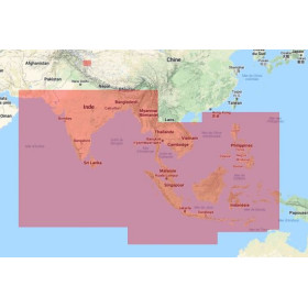
For more than 30 years, more than a million sailors around the world have trusted C-MAP electronic cards. C-MAP by Jeppesen vector charts offer unparalleled navigation details and work with many brands of chartplotters and PC navigation software. Navigation capabilities and proprietary added-value data make C-MAP by Jeppesen solutions a must.
Update Charts:
Why update your charts? Jeppesen updates its charts daily, due to new information coming from several official sources. You can be sure that his charts offer the most accurate data available. In addition to navigation data changes, your charts also cover the following updates:
- buoys, beacons and lighthouses.
- The littoral zones and the depths of the shallows.
- Canals, commercial shipping lanes and restricted or dangerous areas.
- Marina facilities.
- Port Services.
- Photos and more.
All C-Map digital charts are edited to order and benefit from the latest updates, for reasons of obsolescence they are not taken back or exchanged.
Compatibility check procedure :
- 1st verification : This digital nautical chart is only compatible with certain systems. WE HIGHLY RECOMMAND TO CHECK COMPATIBILITY WITH YOUR EQUIPMENT: COMPUTER /SOFWARE / ECDIS / PLOTTER... by referring to the compatibility tables found in the appendix.
- 2nd verification: When purchasing, please specify the brand + name + the reference of the device or software to be used with this digital chart, in the text field next to the mode of transport for your parcel. We will double-check compatibility. Without this information, this step will not be processed.