Du 14 au 20/01 inclus, nous serons sur un salon, les commandes passées pendant cette période seront expédiées à partir du 21/01.
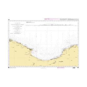
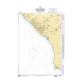
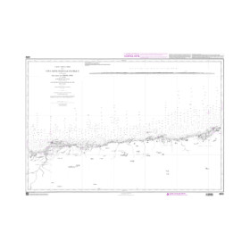
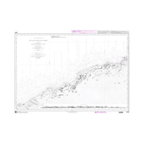
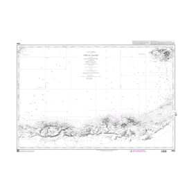
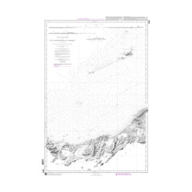
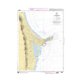
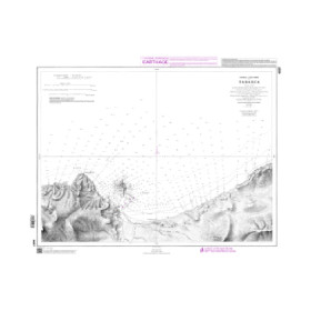
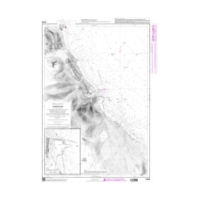
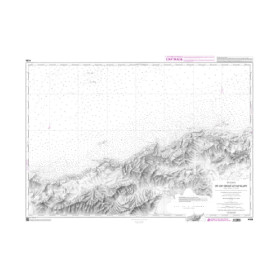
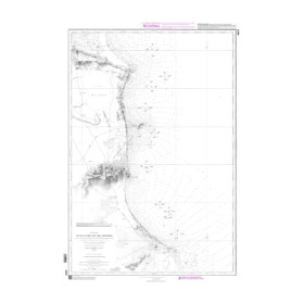
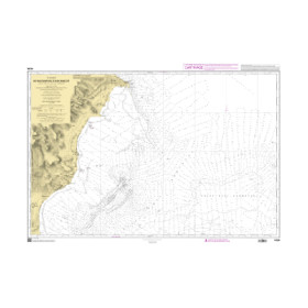
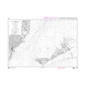
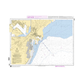
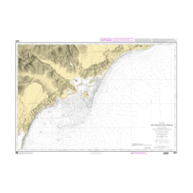
Shom raster Geotiff digital nautical chart
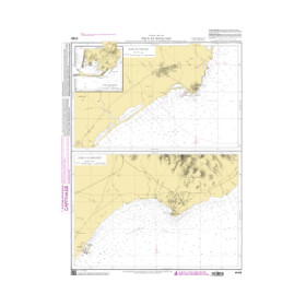
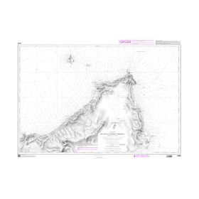
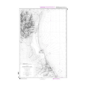
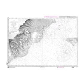
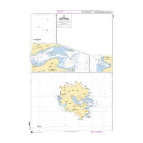
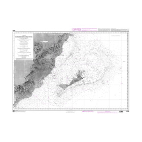
Shom raster digital charts are in geotiff format, with a resolution of 300 dpi. They are the image of paper nautical charts and meet the obligations to carry nautical charts for pleasure craft less than 24 meters in length. For other categories of vessels they can only constitute an aid to navigation.
-
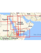
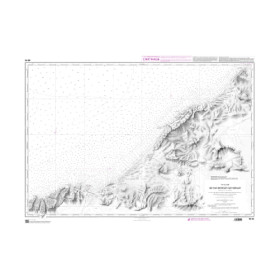
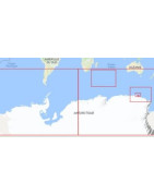
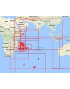
Gulfs of Suez, Aden, Persian, Oman, Red and Arabian Seas
Les cartes numériques Shom raster sont au format géotiff, avec une résolution de 300 dpi. Elles sont l’image des cartes marines papier et satisfont aux obligations d’emport de cartes marines pour les navires de plaisance de longueur inférieure à 24 mètres. Pour les autres catégories de navires elles ne peuvent constituer qu’une aide à la navigation.
Toutes les cartes marines, papier ou numérique, sont éditées à la commande et bénéficient des dernières mises à jour. Conformément aux dispositions de l’article L221-28 du Code de la consommation, le droit de rétractation ne peut être exercé pour les fourniture de biens susceptibles d'être obsolètes rapidement. Ces cartes ne sont ni reprises, ni échangées. En conséquence, ces commandes sont conclues de façon définitive dès la passation de la commande par le Client selon les modalités précisées aux présentes CGV.
Suite à votre commande nous vous enverrons un lien via Wetransfer sur votre mail pour télécharger votre carte.
Vous pouvez lire les cartes Raster et ENC S57 avec des logiciels comme QGIS (Système d'Information Géographique) et GlobalMapper (modélisation d'ondes de vagues). Pour les ENC S63 nous n'avons pas d'information. Ces logiciels sont pour faire de la cartographie et non de la navigation.
Avant de choisir votre logiciel de navigation, il est intéressant de consulter notre notre comparatif des logiciels de navigation.
-
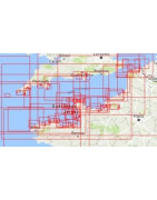
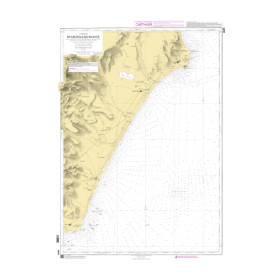
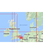
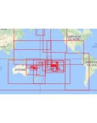
English Channel
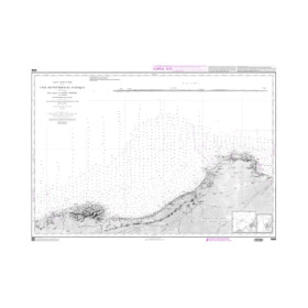
Les cartes numériques Shom raster sont au format géotiff, avec une résolution de 300 dpi. Elles sont l’image des cartes marines papier et satisfont aux obligations d’emport de cartes marines pour les navires de plaisance de longueur inférieure à 24 mètres. Pour les autres catégories de navires elles ne peuvent constituer qu’une aide à la navigation.
Toutes les cartes marines, papier ou numérique, sont éditées à la commande et bénéficient des dernières mises à jour. Conformément aux dispositions de l’article L221-28 du Code de la consommation, le droit de rétractation ne peut être exercé pour les fourniture de biens susceptibles d'être obsolètes rapidement. Ces cartes ne sont ni reprises, ni échangées. En conséquence, ces commandes sont conclues de façon définitive dès la passation de la commande par le Client selon les modalités précisées aux présentes CGV.
Suite à votre commande nous vous enverrons un lien via Wetransfer sur votre mail pour télécharger votre carte.
Vous pouvez lire les cartes Raster et ENC S57 avec des logiciels comme QGIS (Système d'Information Géographique) et GlobalMapper (modélisation d'ondes de vagues). Pour les ENC S63 nous n'avons pas d'information. Ces logiciels sont pour faire de la cartographie et non de la navigation.
Avant de choisir votre logiciel de navigation, il est intéressant de consulter notre notre comparatif des logiciels de navigation.
-
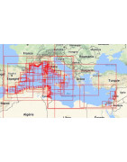
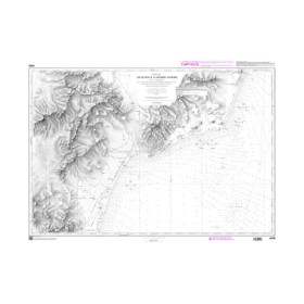
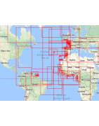
Mediterranean Sea, Black Sea, Sea of Marmara
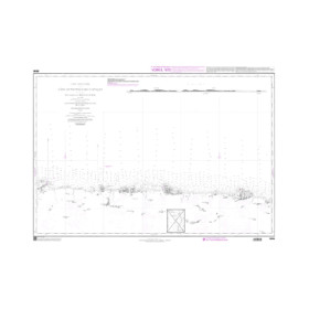
Les cartes numériques Shom raster sont au format géotiff, avec une résolution de 300 dpi. Elles sont l’image des cartes marines papier et satisfont aux obligations d’emport de cartes marines pour les navires de plaisance de longueur inférieure à 24 mètres. Pour les autres catégories de navires elles ne peuvent constituer qu’une aide à la navigation.
Toutes les cartes marines, papier ou numérique, sont éditées à la commande et bénéficient des dernières mises à jour. Conformément aux dispositions de l’article L221-28 du Code de la consommation, le droit de rétractation ne peut être exercé pour les fourniture de biens susceptibles d'être obsolètes rapidement. Ces cartes ne sont ni reprises, ni échangées. En conséquence, ces commandes sont conclues de façon définitive dès la passation de la commande par le Client selon les modalités précisées aux présentes CGV.
Suite à votre commande nous vous enverrons un lien via Wetransfer sur votre mail pour télécharger votre carte.
Vous pouvez lire les cartes Raster et ENC S57 avec des logiciels comme QGIS (Système d'Information Géographique) et GlobalMapper (modélisation d'ondes de vagues). Pour les ENC S63 nous n'avons pas d'information. Ces logiciels sont pour faire de la cartographie et non de la navigation.
Avant de choisir votre logiciel de navigation, il est intéressant de consulter notre notre comparatif des logiciels de navigation.
-
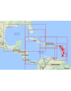
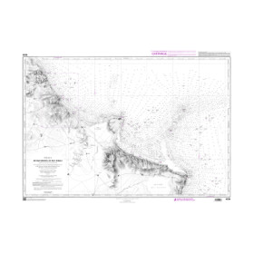
Caribbean Sea, Gulf of Mexico
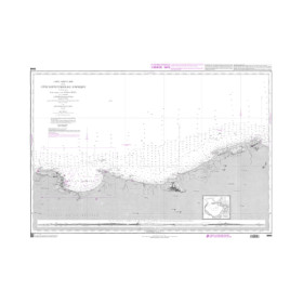
Les cartes numériques Shom raster sont au format géotiff, avec une résolution de 300 dpi. Elles sont l’image des cartes marines papier et satisfont aux obligations d’emport de cartes marines pour les navires de plaisance de longueur inférieure à 24 mètres. Pour les autres catégories de navires elles ne peuvent constituer qu’une aide à la navigation.
Toutes les cartes marines, papier ou numérique, sont éditées à la commande et bénéficient des dernières mises à jour. Conformément aux dispositions de l’article L221-28 du Code de la consommation, le droit de rétractation ne peut être exercé pour les fourniture de biens susceptibles d'être obsolètes rapidement. Ces cartes ne sont ni reprises, ni échangées. En conséquence, ces commandes sont conclues de façon définitive dès la passation de la commande par le Client selon les modalités précisées aux présentes CGV.
Suite à votre commande nous vous enverrons un lien via Wetransfer sur votre mail pour télécharger votre carte.
Vous pouvez lire les cartes Raster et ENC S57 avec des logiciels comme QGIS (Système d'Information Géographique) et GlobalMapper (modélisation d'ondes de vagues). Pour les ENC S63 nous n'avons pas d'information. Ces logiciels sont pour faire de la cartographie et non de la navigation.
Avant de choisir votre logiciel de navigation, il est intéressant de consulter notre notre comparatif des logiciels de navigation.
-
North Sea, Norwegian Sea
Les cartes numériques Shom raster sont au format géotiff, avec une résolution de 300 dpi. Elles sont l’image des cartes marines papier et satisfont aux obligations d’emport de cartes marines pour les navires de plaisance de longueur inférieure à 24 mètres. Pour les autres catégories de navires elles ne peuvent constituer qu’une aide à la navigation.
Toutes les cartes marines, papier ou numérique, sont éditées à la commande et bénéficient des dernières mises à jour. Conformément aux dispositions de l’article L221-28 du Code de la consommation, le droit de rétractation ne peut être exercé pour les fourniture de biens susceptibles d'être obsolètes rapidement. Ces cartes ne sont ni reprises, ni échangées. En conséquence, ces commandes sont conclues de façon définitive dès la passation de la commande par le Client selon les modalités précisées aux présentes CGV.
Suite à votre commande nous vous enverrons un lien via Wetransfer sur votre mail pour télécharger votre carte.
Vous pouvez lire les cartes Raster et ENC S57 avec des logiciels comme QGIS (Système d'Information Géographique) et GlobalMapper (modélisation d'ondes de vagues). Pour les ENC S63 nous n'avons pas d'information. Ces logiciels sont pour faire de la cartographie et non de la navigation.
Avant de choisir votre logiciel de navigation, il est intéressant de consulter notre notre comparatif des logiciels de navigation.
-
Antarctic Ocean
Les cartes numériques Shom raster sont au format géotiff, avec une résolution de 300 dpi. Elles sont l’image des cartes marines papier et satisfont aux obligations d’emport de cartes marines pour les navires de plaisance de longueur inférieure à 24 mètres. Pour les autres catégories de navires elles ne peuvent constituer qu’une aide à la navigation.
Toutes les cartes marines, papier ou numérique, sont éditées à la commande et bénéficient des dernières mises à jour. Conformément aux dispositions de l’article L221-28 du Code de la consommation, le droit de rétractation ne peut être exercé pour les fourniture de biens susceptibles d'être obsolètes rapidement. Ces cartes ne sont ni reprises, ni échangées. En conséquence, ces commandes sont conclues de façon définitive dès la passation de la commande par le Client selon les modalités précisées aux présentes CGV.
Suite à votre commande nous vous enverrons un lien via Wetransfer sur votre mail pour télécharger votre carte.
Vous pouvez lire les cartes Raster et ENC S57 avec des logiciels comme QGIS (Système d'Information Géographique) et GlobalMapper (modélisation d'ondes de vagues). Pour les ENC S63 nous n'avons pas d'information. Ces logiciels sont pour faire de la cartographie et non de la navigation.
Avant de choisir votre logiciel de navigation, il est intéressant de consulter notre notre comparatif des logiciels de navigation.
-
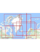
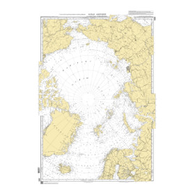
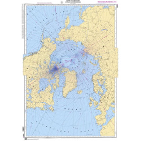
Arctic Ocean
Les cartes numériques Shom raster sont au format géotiff, avec une résolution de 300 dpi. Elles sont l’image des cartes marines papier et satisfont aux obligations d’emport de cartes marines pour les navires de plaisance de longueur inférieure à 24 mètres. Pour les autres catégories de navires elles ne peuvent constituer qu’une aide à la navigation.
Toutes les cartes marines, papier ou numérique, sont éditées à la commande et bénéficient des dernières mises à jour. Conformément aux dispositions de l’article L221-28 du Code de la consommation, le droit de rétractation ne peut être exercé pour les fourniture de biens susceptibles d'être obsolètes rapidement. Ces cartes ne sont ni reprises, ni échangées. En conséquence, ces commandes sont conclues de façon définitive dès la passation de la commande par le Client selon les modalités précisées aux présentes CGV.
Suite à votre commande nous vous enverrons un lien via Wetransfer sur votre mail pour télécharger votre carte.
Vous pouvez lire les cartes Raster et ENC S57 avec des logiciels comme QGIS (Système d'Information Géographique) et GlobalMapper (modélisation d'ondes de vagues). Pour les ENC S63 nous n'avons pas d'information. Ces logiciels sont pour faire de la cartographie et non de la navigation.
Avant de choisir votre logiciel de navigation, il est intéressant de consulter notre notre comparatif des logiciels de navigation.
-
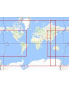
Atlantic Ocean
Les cartes numériques Shom raster sont au format géotiff, avec une résolution de 300 dpi. Elles sont l’image des cartes marines papier et satisfont aux obligations d’emport de cartes marines pour les navires de plaisance de longueur inférieure à 24 mètres. Pour les autres catégories de navires elles ne peuvent constituer qu’une aide à la navigation.
Toutes les cartes marines, papier ou numérique, sont éditées à la commande et bénéficient des dernières mises à jour. Conformément aux dispositions de l’article L221-28 du Code de la consommation, le droit de rétractation ne peut être exercé pour les fourniture de biens susceptibles d'être obsolètes rapidement. Ces cartes ne sont ni reprises, ni échangées. En conséquence, ces commandes sont conclues de façon définitive dès la passation de la commande par le Client selon les modalités précisées aux présentes CGV.
Suite à votre commande nous vous enverrons un lien via Wetransfer sur votre mail pour télécharger votre carte.
Vous pouvez lire les cartes Raster et ENC S57 avec des logiciels comme QGIS (Système d'Information Géographique) et GlobalMapper (modélisation d'ondes de vagues). Pour les ENC S63 nous n'avons pas d'information. Ces logiciels sont pour faire de la cartographie et non de la navigation.
Avant de choisir votre logiciel de navigation, il est intéressant de consulter notre notre comparatif des logiciels de navigation.
-
Indian Ocean
Les cartes numériques Shom raster sont au format géotiff, avec une résolution de 300 dpi. Elles sont l’image des cartes marines papier et satisfont aux obligations d’emport de cartes marines pour les navires de plaisance de longueur inférieure à 24 mètres. Pour les autres catégories de navires elles ne peuvent constituer qu’une aide à la navigation.
Toutes les cartes marines, papier ou numérique, sont éditées à la commande et bénéficient des dernières mises à jour. Conformément aux dispositions de l’article L221-28 du Code de la consommation, le droit de rétractation ne peut être exercé pour les fourniture de biens susceptibles d'être obsolètes rapidement. Ces cartes ne sont ni reprises, ni échangées. En conséquence, ces commandes sont conclues de façon définitive dès la passation de la commande par le Client selon les modalités précisées aux présentes CGV.
Suite à votre commande nous vous enverrons un lien via Wetransfer sur votre mail pour télécharger votre carte.
Vous pouvez lire les cartes Raster et ENC S57 avec des logiciels comme QGIS (Système d'Information Géographique) et GlobalMapper (modélisation d'ondes de vagues). Pour les ENC S63 nous n'avons pas d'information. Ces logiciels sont pour faire de la cartographie et non de la navigation.
Avant de choisir votre logiciel de navigation, il est intéressant de consulter notre notre comparatif des logiciels de navigation.
-
Pacific Ocean
Les cartes numériques Shom raster sont au format géotiff, avec une résolution de 300 dpi. Elles sont l’image des cartes marines papier et satisfont aux obligations d’emport de cartes marines pour les navires de plaisance de longueur inférieure à 24 mètres. Pour les autres catégories de navires elles ne peuvent constituer qu’une aide à la navigation.
Toutes les cartes marines, papier ou numérique, sont éditées à la commande et bénéficient des dernières mises à jour. Conformément aux dispositions de l’article L221-28 du Code de la consommation, le droit de rétractation ne peut être exercé pour les fourniture de biens susceptibles d'être obsolètes rapidement. Ces cartes ne sont ni reprises, ni échangées. En conséquence, ces commandes sont conclues de façon définitive dès la passation de la commande par le Client selon les modalités précisées aux présentes CGV.
Suite à votre commande nous vous enverrons un lien via Wetransfer sur votre mail pour télécharger votre carte.
Vous pouvez lire les cartes Raster et ENC S57 avec des logiciels comme QGIS (Système d'Information Géographique) et GlobalMapper (modélisation d'ondes de vagues). Pour les ENC S63 nous n'avons pas d'information. Ces logiciels sont pour faire de la cartographie et non de la navigation.
Avant de choisir votre logiciel de navigation, il est intéressant de consulter notre notre comparatif des logiciels de navigation.
-
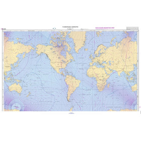
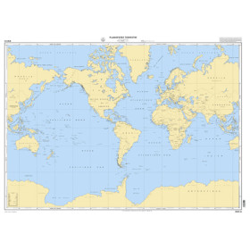
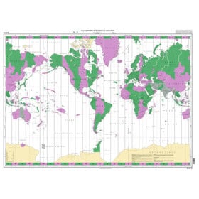
Planisphere
Les cartes numériques Shom raster sont au format géotiff, avec une résolution de 300 dpi. Elles sont l’image des cartes marines papier et satisfont aux obligations d’emport de cartes marines pour les navires de plaisance de longueur inférieure à 24 mètres. Pour les autres catégories de navires elles ne peuvent constituer qu’une aide à la navigation.
Toutes les cartes marines, papier ou numérique, sont éditées à la commande et bénéficient des dernières mises à jour. Conformément aux dispositions de l’article L221-28 du Code de la consommation, le droit de rétractation ne peut être exercé pour les fourniture de biens susceptibles d'être obsolètes rapidement. Ces cartes ne sont ni reprises, ni échangées. En conséquence, ces commandes sont conclues de façon définitive dès la passation de la commande par le Client selon les modalités précisées aux présentes CGV.
Suite à votre commande nous vous enverrons un lien via Wetransfer sur votre mail pour télécharger votre carte.
Vous pouvez lire les cartes Raster et ENC S57 avec des logiciels comme QGIS (Système d'Information Géographique) et GlobalMapper (modélisation d'ondes de vagues). Pour les ENC S63 nous n'avons pas d'information. Ces logiciels sont pour faire de la cartographie et non de la navigation.
Avant de choisir votre logiciel de navigation, il est intéressant de consulter notre notre comparatif des logiciels de navigation.

 Click here to open our interactive map and select your charts