No products available yet
Stay tuned! More products will be shown here as they are added.

The Nautic Way Maritime Bookstore offers a wide choice of on-board books for all your navigations.
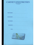
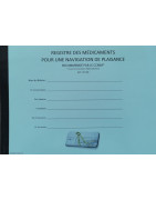
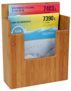
These logbooks meet the regulations concerning the mandatory documents to have on board a boat.
The logbook is obligatory and appears in the list of the armament and safety equipment necessary for the semi-offshore navigation, that is to say more than 6 miles of coasts. It must respect a framework and is made compulsory by law. The text of Division 240 regulating boating is clear: "Article 240-2.07 of Division 240) describes the logbook as "a logbook containing the relevant elements for monitoring navigation and safety of the ship."
A little history...
For many years, his main interest was helping to maintain goodwill, but that was before the arrival of GPS! The road was maintained by coastal and astronomical bearings, and in the absence of these landmarks, one passed to dead reckoning. It was therefore necessary to regularly plot a point on the map and record all events in the logbook.
With the GPS, knowing your position is easy and immediate, the logbook is no longer the essential tool for navigation, but becomes the witness of the navigation carried out by the crew and their boat.
Why keep a logbook?
It is a legal obligation because it is an important administrative document. It bears witness to the events on board and the measures taken during navigation. It is the memory of the events of the boat.
In case of damage, this document takes all its importance because according to the law, it is authentic, until proven otherwise.
An old detailed regulation
Today, article 240-2.07 of Division 240 describes the logbook as "a logbook containing the relevant elements for the monitoring of the navigation and the safety of the ship" without giving more information, the old version (ordered March 11, 2008) was more didactic.
How to write it?
What should we write? All the important elements… knowing that the spirit of the law wants to appeal to common sense:
The Nautic Way Maritime Bookstore offers a wide choice of on-board books for all your navigations.
These logbooks meet the regulations concerning the mandatory documents to have on board a boat.
The logbook is obligatory and appears in the list of the armament and safety equipment necessary for the semi-offshore navigation, that is to say more than 6 miles of coasts. It must respect a framework and is made compulsory by law. The text of Division 240 regulating boating is clear: "Article 240-2.07 of Division 240) describes the logbook as "a logbook containing the relevant elements for monitoring navigation and safety of the ship."
A little history...
For many years, his main interest was helping to maintain goodwill, but that was before the arrival of GPS! The road was maintained by coastal and astronomical bearings, and in the absence of these landmarks, one passed to dead reckoning. It was therefore necessary to regularly plot a point on the map and record all events in the logbook.
With the GPS, knowing your position is easy and immediate, the logbook is no longer the essential tool for navigation, but becomes the witness of the navigation carried out by the crew and their boat.
Why keep a logbook?
It is a legal obligation because it is an important administrative document. It bears witness to the events on board and the measures taken during navigation. It is the memory of the events of the boat.
In case of damage, this document takes all its importance because according to the law, it is authentic, until proven otherwise.
An old detailed regulation
Today, article 240-2.07 of Division 240 describes the logbook as "a logbook containing the relevant elements for the monitoring of the navigation and the safety of the ship" without giving more information, the old version (ordered March 11, 2008) was more didactic.
How to write it?
What should we write? All the important elements… knowing that the spirit of the law wants to appeal to common sense:
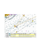
La Librairie Maritime Nautic Way a sélectionné 5 éditeurs de logiciels de navigation : du plaisancier au professionnel, de la navigation côtière à la traversée des océans, du cabotage au tour du monde en passant par la régate et la course hauturière, avec Adrena, MaxSea, Noé, ScanNav, Seapro.
Vous aurez toujours la meilleure solution de navigation à votre bord.
Vous pouvez installer ces logiciels à bord de votre bateau sur PC et/ou Mac en fonction de leurs particularités.
Les fichiers météo GRIB sont notamment commercialisés et téléchargeables sur Squid.
Logiciel | Ordinateur | C-map | |||||||||||||||
| 4D Max Local | 4D Max Wide | 4D Max+ Local | 4D Max+ Wide | Max Wide | Max Megawide | Max Bathy | Max-N Local | Max-N Wide | Max-N Bathy | Max-N+ Local | Max-N+ Wide | ||||||
| PC | N | N | N | N | N | N | N | O* | O* | N | N | N | N | N | N | N | |
PC | N | N | N | N | N | N | N | O* | O* | N | N | N | N | N | N | N | |
| PC | N | N | N | N | N | N | N | O* | O* | N | N | N | N | N | N | N | |
| PC | N | N | N | N | N | N | N | O* | O* | N | N | N | N | N | N | N | |
| PC | N | N | N | N | N | O | O | O | O | O | N | N | N | N | N | N | |
| PC | O | N | N | N | N | N | N | N | N | N | N | N | N | N | N | N | |
| PC* | N | N | N | N | N | N | N | N | N | N | N | N | N | N | N | N | |
| PC* | N | N | N | N | N | N | N | N | N | N | N | N | N | N | N | N | |
| PC* | N | N | N | N | N | N | N | N | N | N | N | N | N | N | N | N | |
| PC* | N | N | N | N | N | N | N | N | N | N | N | N | N | N | N | N | |
Pour les zones Local C-MAP il est nécessaire de passer par un lecteur C-MAP (elles ne sont pas disponibles sur CD).
* Les logiciels Adrena nécéssitent une préparation particulière des cartes C-map, merci de nous contacter en direct pour avoir un devis.
| Logiciel | Ordinateur | Navionics | NV Charts | Shom raster | Admiralty raster | Primar vectorielle ENC (S57/S63) | Livechart | SnMap | Mapmedia | ||||
| Navionics+ XL9 | Navionics+ Small | Platinium+ XL | Platinium+ XL3 | Géotiff | ARCS | ||||||||
| Adrena Octopus | PC | N | N | N | N | N | N | N | N | N | N | O | N |
| Adrena First | PC | N | N | N | |||||||||
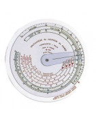
The Nautic Way Maritime Bookstore offers a rule for calculating the tide.
To our knowledge there is only one model of tide calculation rule.
The tide calculation rule makes it possible to know in a few seconds, without calculation or risk of error, the variations in height of the tide according to the rule of twelfths.
This is bound to be the model for you.
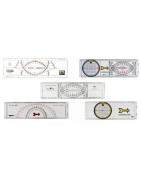
The Nautic Way Maritime Bookstore offers an exceptional choice of navigation rules.
The navigation ruler will be essential for you to plot your route, plot your position on a nautical chart, and determine the course to follow.
There are different kinds of rulers, which manufacturers have evolved over the years to improve accuracy and reading reliability.
There is bound to be a model for you, it's all a matter of habit.

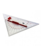
The Nautic Way Maritime Bookstore offers several calculator rule models.
The calculator rule will be useful for purists.
Slide circle, search and rescue route calculator, Vectormaster ruler, speed/distance calculator ruler, race slide ruler and Compute-a-course protractor, distance and time slide ruler.
There is bound to be a model for you.
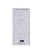
The Nautic Way Maritime Library offers a nautical chart correction rule.
Looking for a nautical chart correction ruler?
To our knowledge there is only one model of nautical chart correction normograph.
The Nautical Chart Correction Normograph will allow you to correct your nautical charts by plotting updates.
This is bound to be the model for you.
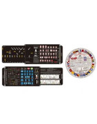
The Nautic Way Maritime Bookstore offers several memo rules.
The memo rules make it easy and quick to find the meaning of flags, navigation lights, position lights.
Signal disk, beacon ruler, ship lights ruler, route and beacon ruler, lights and marks ruler for ships at sea.
There is bound to be a model for you.

The Nautic Way Maritime Bookstore offers GPS rules.
We offer several types of GPS ruler.
The GPS ruler will allow you in a few seconds to transfer a waypoint read on the GPS to the marine chart.
There is bound to be a model for you.
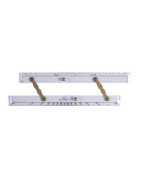
The Nautic Way Maritime Bookstore offers parallel rulers of several sizes.
The parallel ruler will allow you to plot a route on your nautical chart.
Aluminum parallel ruler, plexiglass parallel ruler, triple parallel ruler.
There is bound to be a model for you.
The Nautic Way Maritime Bookstore offers rolling rulers in several sizes.
The rolling ruler will allow you to plot a route on your nautical chart.
Bi-rola rolling ruler, compact rolling ruler.
There is bound to be a model for you.
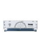
The Nautic Way Maritime Bookstore offers protractors of several sizes.
The navigation protractor will come in handy when working on your navigation map.
Semi circular protractor, square protractor, half square protractor, professional protractor, protractor with handle and 3 arm protractor.
There is bound to be a model for you.
The Nautic Way Maritime Bookstore offers magnifying glasses and weights for nautical charts.
A magnifying glass to place on your nautical chart is always practical to see certain details.
In addition, this avoids, in the case of a flat chart, that it rolls up on your chart table.
It is also a nice gift to offer...
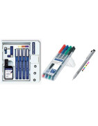
The Nautic Way Maritime Bookstore offers several types of pencils for working on nautical charts.
Mars® Matic pencils will allow you to make very precise corrections on nautical charts.
The felt pen kit allows you to write on the ChartCover and FolioCover and to erase your marks.
The integrated LED pen allows you to write during long dark nights.
There is bound to be a model for you.
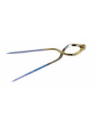
The Nautic Way Maritime Bookstore offers navigation compasses.
The navigation compass, called dry point compass, is essential on a chart table. In several sizes, straight or lyre, in brass or brass / stainless steel, divider or in an elegant version.
The drypoint compass or "compass divider" is a traditional geometry instrument, used on a paper nautical chart, in addition to the navigation ruler, it allows you to measure, control and report your distances and positions. The navigator expresses the distances recorded on the map in miles. This nautical mile, also called nautical or nautical mile, corresponds to one minute of latitude (1,852 m). It will therefore be found on the latitude scale located to the right and left of the map. Each mile being itself subdivided into tenths of a mile.
We advise you, for more precision in your readings, to use a quality dry point compass, equipped with fine stainless steel points. Once stored in its case, your instrument will be protected from all risks of accidental defoaming of the tips.
The body of the compass is most often made of brass. It consists of 2 branches, 15-20 cm long, connected to each other by a joint. For your comfort, it is essential that the hardness of this joint can be adjusted using a soft friction screw.
Depending on the intended use, there are different types of compasses.
The compasses that we market are those used and tested in school boats.
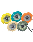
The Nautic Way Maritime Bookstore offers several models of bearing compasses.
The bearing compass in navigation makes it possible to aim and "raise" the magnetic direction of a remarkable point located on the coast or at sea (lighthouse, beacon, bell tower, water tower, antenna, ...). This point is called a "bitter". The angle recorded will be plotted on the nautical chart taking into account the local declination.
We have selected for you the famous bearing compass Iris 50 from Plastimo, known worldwide, available in several colors.
Indispensable on board your boat.
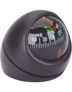
The steering compass indicates the angle between the direction of the North which is its origin and the axis of the boat in the clockwise direction.
The helmsman must follow an angle, a course, to arrive at the right destination.
Compulsory on board as soon as you move more than 2 miles from a shelter.
There are several types of compasses:
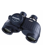
The Nautic Way Maritime Bookstore has selected several brands of marine binoculars: from yachtsmen to professionals, from coastal navigation to ocean crossings.
You will always have the best navigation solution on board.
Choosing Steiner is equipping yourself with binoculars for life. Since 1947, Steiner has been handcrafting high-end dedicated marine binoculars. Guaranteed for up to 30 years, the Steiners offer above-average viewing comfort and solidity. They are waterproof, filled with a gas that prevents any formation of condensation inside, and have an incredible luminosity, you can see better at night with Steiners than with your own eyes!
At Steiner, there are mainly 2 ranges of marine binoculars: the Navigator and the Commander. Each of these ranges comes in 4 models: diameter of the optics 30 or 50 and available with or without compass.
For the navy, the best magnification is x7 (above the movements of the boat interfere with vision). Other characteristics such as the diameter of the optics (which lets more or less light through) must be taken into account.
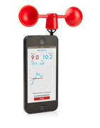
The Nautic Way Maritime Bookstore offers several models of portable anemometer.
Apparatus indicating the force of the wind, and for some its direction.
There is bound to be a model for you.
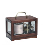
The Nautic Way Maritime Bookstore offers several barograph models.
They will be useful on board your boat, or at home, to follow the weather.
There is bound to be a model for you.
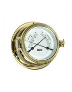
The Nautic Way Maritime Bookstore offers several models of barometer, thermometer, clock.
We have selected for you a whole range of clocks, barometers, thermometers, ...: Admiral, Anniversary, Atlantis, Bluewater, Cutter, Endurance, Gimballed, Martinique, Nautilus, Orion, Trident, ...
In chrome, brass, and in several diameters, they will be useful on board your boat, or at home, to follow the weather.
There is bound to be a model for you.
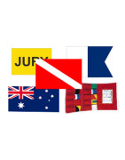
The Nautic Way Maritime Bookstore offers several markup and flag stickers.
Marking and flag stickers make it easy and quick to find the meaning of flags, navigation lights, position lights.
There is bound to be an adhesive for you.
Find the works concerning the pavilion on this page.
On a boat, the word flag does not exist, only flags are used.
Some rules of the maritime code
The National Pavilion
This pavilion is also called "the colors".
It is used to identify the nationality of a vessel. It is the largest of all flags and is proportional to the size of the ship. It is mandatory and is sent to the very rear of the boat, the stern, on a staff (specific pole slightly inclined to the rear) with sufficient height to be able to execute salutes and possibly lower the flag. It can also be displayed on the mizzenmast or at the end of the mainsail horn for cutters.
The National flag is always fixed on a halyard to allow the salute. By default on a sailboat, it is positioned on the backstay, but that is bad taste. Out of respect for your country and the countries visited, you must have a flag in good condition.
Did you know ? The proportions of the National Pavilion were defined by the painter David, it consists of 3 bands which are not of the same width: blue 30%, white 33%, red 37%. Thus the pavilion gives the impression of having three equal bands when it flutters in the wind.
The club pavilion
It is the flag of your yacht club or sailing club, we also say club handlebars.
It settles at the highest point of a boat. In the past they were installed at the top of the mast but with the appearance of aerials, it is allowed to be carried on the halyard of the spreader, on the starboard side, but if this halyard is already occupied by the courtesy flag, it will go on the spreader halyard on the port side. Abroad it is hoisted on the spreader halyard on the port side.
It is a great courtesy when visiting another association or club during events, meetings, gatherings, regattas, or other... to offer a club handlebar.
The courtesy pavilion
It is a mark of respect for the country you are visiting.
It is hoisted onto the spreader halyard, on the starboard side, of the forwardmost mast. It is mandatory and must be installed as soon as you enter the territorial waters of the country visited. To hoist it to port, as some of our neighbors do, whom we will not mention, is an insult to the country visited.
It is smaller than the national pavilion. As a courtesy, we wear it from sunrise to sunset and from 8 a.m. to 8 p.m. once in port.
The free practice request pavilion
This is flag Q (in memory of the time when ships remained in Quarantine).
We send it into the spreaders on the port side. It indicates that you are requesting the right to enter and land in the waters of the country of arrival. You must then go to the customs offices to complete the formalities, see our article on clearances. Since the creation of the European Union, this practice is no longer necessary in Europe, but remains valid in other countries. Once the formalities have been completed, the flag is lowered.
The owner's pavilion
This pavilion is free, you can create it according to your imagination.
It is sent when the owner is on board, under the spreaders on the starboard side (if they are already used, it is sent on the port side). It passes to port as soon as the courtesy flag is hoisted. If the owner is absent, it is replaced by a blue rectangle, and if the owner is having lunch (not to be disturbed), it is replaced by a white rectangle.
The grand bulwark
It is a question of sending all the flags of the "international code of signals" on a single halyard going from the bow to the back of the boat passing through the masthead, on port holidays, receptions, ceremonies …), from 8 a.m. to 8 p.m. The goal is to decorate the boat, so never when sailing.
Composed of 40 pavilions in this order to avoid any unwelcome words or interpretations:
There is bound to be a model for you.
| Bateau à moteur | Bateau à voile | |||
| Longueur du bateau | Private & Club Signal sizes | Yacht Ensign sizes | Private & Club Signal sizes | Yacht Ensign sizes |
| -20 pieds | 20 x 30 cm | 30 x 50 cm | - | - |
| 20 pieds | 25 x 40 cm | 30 x 50 cm | 25 x 40 cm | 40 x 60 cm |
| 25 pieds | 25 x 40 cm | 40 x 60 cm | 25 x 40 cm | 40 x 60 cm |
| 30 pieds | 30 x 50 cm | 40 x 60 cm | 30 x 50 cm | 70 x 100 cm |
| 35 pieds | 30 x 50 cm | 70 x 100 cm | 40 x 60 cm | 70 x 100 cm |
| 40 pieds | 40 x 60 cm | 70 x 100 cm | 40 x 60 cm | 70 x 100 cm |
| 45 pieds | 40 x 60 cm | 70 x 100 cm | 40 x 60 cm | 80 x 120 cm |
| 50 pieds | 40 x 60 cm | 80 x 120 cm | 50 x 80 cm | 80 x 120 cm |
| 55 pieds | 40 x 60 cm | 80 x 120 cm | 50 x 80 cm | 80 x 120 cm |
| 60 pieds | 50 x 75 cm | 80 x 120 cm | 50 x 80 cm | 80 x 120 cm |
| 70 pieds | 50 x 75 cm | 100 x 150 cm | 70 x 100 cm | 100 x 150 cm |
| 80 pieds | 70 x 100 cm | 100 x 150 cm | 70 x 100 cm | 100 x 150 cm |
| 90 pieds | 70 x 100 cm | 130 x 200 cm | 80 x 120 cm | 130 x 200 cm |
| 100 pieds | 80 x 120 cm | 130 x 200 cm | 80 x 120 cm | 130 x 200 cm |
Storage rack for VHF, navigation ruler, binoculars, pencil case, navigation map, tablet and iPad,...\nSomething to perfectly organize your chart table so that everything stays in its place!

The Nautic Way Maritime Bookstore offers a wide choice of pouches, flexible or rigid plastic cases to best protect your nautical charts while sailing.

The Nautic Way Maritime Bookstore offers a range of pouches, boxes, waterproof bags.
On your back or on your shoulder, for a day trip or for a hike, on a canoe or on a boat, you will find many capacities that will meet your needs.
You will be able to protect your phone, VHF, camera, clothes from water.
Find waterproof and shockproof cases for iPhone, Huawei, Samsung, iPad tablet, waterproof pouches and diving boxes on this page.
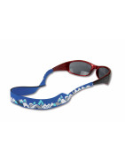
The Nautic Way Maritime Bookstore offers a wide choice of sunglasses as well as spectacle cords, thus protected, you no longer risk them falling into the water.
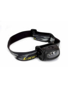
The Nautic Way Maritime Bookstore offers a range of flashlights or headlamps.
Different powers, for different uses: diving lamp, waterproof, flash, distress, torch, dynamo, including the famous Mag-lite and Lago, led or not.
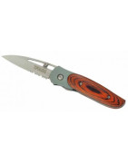
The Nautic Way Maritime Bookstore offers a range of sailor's knives: Wichard, ..., with shackle, floating, wooden handle, splicer, bottle opener, screwdriver, ...
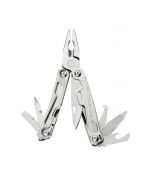
The Nautic Way Maritime Bookstore offers a range of multi-function pliers, including the famous Leatherman....
Accessory for the bridge
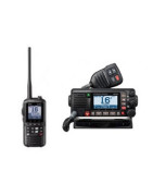
Find the VHF on sale in our maritime bookshop Nautic Way.
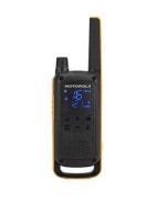
Javerne, à Mayotte, reçoit les talkies walkies motorola T82 Extreme commandés sur Nautic Way, et expédiés par Colissimo. Démonstration avec le mode Vox activé et les oreillettes, qui permettent de communiquer les mains libres. Enfin les manoeuvres peuvent se passer sans friction dans l'équipage !
When maneuvering on deck, it is not always easy to communicate as soon as the boat exceeds 10 m. and that the team members are far from the coxswain, especially if there is noise: waves, wind, engine, sails breaking, ...
Taking or raising a mooring, docking, reefing or simply lowering a sail can become complicated , even dangerous if the crew does not hear the coxswain's orders, or if the coxswain does not understand the crew members' instructions.
The solution is to equip hands-free walkie-talkies to finally understand each other easily.
in contact with a crew member on shore Walkie talkies are available in an unlicensed version, for boaters, and in a licensed version for professionals, allowing private channels and significantly higher power. These devices must be programmed to communicate on these dedicated channels.
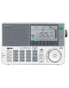
For many boaters sailing around the world, a shortwave radio system is indispensable on board.
A SSB radio can be used for very long distances, it allows to receive weather reports, especially during crossings with difficult conditions.
SSB stands for Single Side Band. An SSB radio modulates a certain type of wave during transmission, also known as shortwave. Shortwave radio systems on board ships are part of the International Marine Distress and Safety System (SMDSS), established by the international SOLAS convention which defines standards relating to safety and the safeguard of human life in sea.
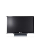
The Nautic Way Maritime Bookstore offers rugged screens for computers that may become essential on board your boat.
Reinforced, they are not afraid of the sudden movements of boats and will have a longer life.
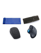
The Nautic Way Maritime Bookstore offers waterproof keyboards and mice that can become essential on board your boat.
More practical, they are not afraid of the wet sleeves of your sailing jacket.
The Nautic Way Maritime Bookstore offers GPS antennas to connect to your computer which may become essential on board your boat. GPS antenna 20 channels, 56 channels, ...
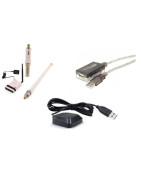
Computer accessories to connect to WIFI which can become essential on board your boat, adapters, antenna kit, external antenna, ...
And also computer accessories that may become essential on board your boat, USB adapters, WIFI, converter, shielded VGA cable, card reader, ...

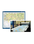
 Click here to open our interactive map and select your charts
Stay tuned! More products will be shown here as they are added.