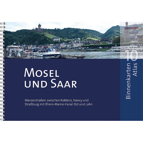
KartenWerft - BinnenKarten Atlas 10 - Mosel und Saar
search
  • googlemap
  • KartenWerft - BinnenKarten Atlas 10 - Mosel und Saar
  • KartenWerft - BinnenKarten Atlas 10 - Mosel und Saar
  • KartenWerft - BinnenKarten Atlas 10 - Mosel und Saar
  • KartenWerft - BinnenKarten Atlas 10 - Mosel und Saar
  • KartenWerft - BinnenKarten Atlas 10 - Mosel und Saar
  • KartenWerft - BinnenKarten Atlas 10 - Mosel und Saar

KartenWerft - BinnenKarten Atlas 10 - Mosel und Saar

€48.75
Tax included
KartenWerft
En langue danoise Carte papier folio + numérique En langue allemande En langue anglaise
En stock
The Imray charts are folded in a format close to the A4 and delivered in sturdy PVC pockets.
11099

Data sheet

Year
2021
Scale
Folio
Picto
Carte papier folio + numérique
En langue allemande
En langue anglaise
En langue danoise
Classification scale paper chart
Folio
Navigation area
Mer Baltique
Chart type
new
New
Last items in stock
100% secure payments
Description détaillée

Waterways between Koblenz, Nancy and Strasbourg with the Rhine-Marne Canal East and Lahn.

Area sections included: Moselle, Saar with Saar Canal, Rhine-Marne Canal East and Lahn.

The inland map atlases appear in a new edition at irregular intervals of two to five years. The included BinnenKarte Digital are continuously updated and are up-to-date upon installation. Thanks to the RevierService, which is included free of charge, they remain up-to-date for one year from the initial installation.

  • INTERNAL MAPS ATLAS 10 in handy A3 format, ring-bound
  • 44 pages of content
  • 30 map pages
  • 38 inland maps at a scale of 1:40,000
  • Area overview and planning map for uncomplicated trip planning
  • BINNENKARTEN DIGITAL 10 for the app KartenWerft Navgo (for Android and iOS)
  • 365-day REVIERS ERVICE consisting of updates to maps and district information as well as district reports
  • Professional cartography in an attractive layout
  • Easy to use thanks to a clear structure, catchy symbols and north alignment of all cards
  • Comprehensive textual and visual presentation of the respective district sections
  • Water protection through high-quality and transparent atlas pocket

INLAND CHARTS included :

  • 10.0 | 10.0A Area overview & planning map | map legend
  • 10.1 | 10.2 Koblenz and Lahnstein | Winningen to LÖf
  • 10.3 | 10.4 Treis-Karden to Cocehem | Senheim to Enkirch
  • 10.5 | 10.6 Traben-Trarbach to Bernkastel-Kues | Wintrich to Schweich
  • 10.7 | 10.8 Trier | Konz to Grevenmacher
  • 10.9 | 10.10 Wincheringen to Schengen | Apache to Koenigsmacker
  • 10.11 | 10.12 Thionville bis Malroy | Metz bis Corny-sur-Moselle
  • 10.13 | 10.14 Pagny-sur-Moselle to Pompey | Liverdun bis Toul
  • 10.15 | 10.16 Neuves-Maisons bis Nancy | Nancy
  • 10.17 | 10.18 Varangéville bis Xures | Lagarde bis Niederviller
  • 10.19 | 10.20 Arzviller to Saverne | Waltenheim to Vendenheim
  • 10.21 | 10.22 Straßburg | Saarburg
  • 10.23 | 10.24 Merzig | Dillingen and Saarlouis
  • 10.25 | 10.26 Saarbrucken | Güdingen to Saargemünd
  • 10.27 | 10.28 Wittring bis Harskirchen | Mittersheim bis Houillon
  • 10.29 | 10.30 Bad Ems to Nassau | Diez and Limburg

All BINNENKARTEN are also available as laminated single sheets. The most popular BINNENMAPS from the area are listed below and can be ordered there. In addition, we have the other BINNENKARTEN available in small numbers. These are available on request.

Loading...