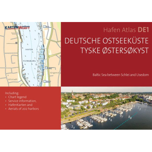
KartenWerft - SeeKarten Atlas DE1 - Deutsche Ostseeküste
search
  • googlemap
  • KartenWerft - SeeKarten Atlas DE1 - Deutsche Ostseeküste
  • KartenWerft - SeeKarten Atlas DE1 - Deutsche Ostseeküste
  • KartenWerft - SeeKarten Atlas DE1 - Deutsche Ostseeküste
  • KartenWerft - SeeKarten Atlas DE1 - Deutsche Ostseeküste
  • KartenWerft - SeeKarten Atlas DE1 - Deutsche Ostseeküste
  • KartenWerft - SeeKarten Atlas DE1 - Deutsche Ostseeküste
  • KartenWerft - SeeKarten Atlas DE1 - Deutsche Ostseeküste
  • KartenWerft - SeeKarten Atlas DE1 - Deutsche Ostseeküste
  • KartenWerft - SeeKarten Atlas DE1 - Deutsche Ostseeküste

KartenWerft - SeeKarten Atlas DE1 - Deutsche Ostseeküste

€58.76
Tax included
KartenWerft
En langue danoise Carte papier folio + numérique En langue allemande En langue anglaise
En stock
The Imray charts are folded in a format close to the A4 and delivered in sturdy PVC pockets.
20599

Data sheet

Year
2022
Scale
Folio
Picto
Carte papier folio + numérique
En langue allemande
En langue anglaise
En langue danoise
Classification scale paper chart
Folio
Navigation area
Mer Baltique
Chart type
new
New
Last items in stock
100% secure payments
Description détaillée

Seekarten DE1 integrates the paper version and the digital version.

Baltic Sea between Schlei and Usedom.

The SeeKarte is published annually in a new edition in the spring before the start of the season.

  • SEA CHARTS ATLAS DE1 in handy A3 format, ring-bound
  • 5 REGION MAPS on a scale of 1:240.000
  • 15 COASTAL MAPS ranging from 1:120.000 to 1:80.000
  • 59 DETAIL MAPS at a scale of 1:40.000 to 1:20.000
  • PORT ATLAS DE1 (A4 format) with AERIAL PHOTOS and PORT MAPS on a scale of 1:5,000 - 1:7,500 of 201 ports
  • SEEKARTEN DIGITAL DE1 for the app KartenWerft Navgo (for Android and iOS)
  • 365-day REVIERS ERVICE consisting of updates to the district notices and district reports
  • Professional cartography in an attractive layout
  • Titles and texts in German and Danish, terms and brief information in English
  • Easy to use thanks to a clear structure and catchy symbols
  • Water protection through high-quality and transparent atlas pocket
  • The SEAMAPS are based on licensed data from the Federal Maritime and Hydrographic Agency (BSH).

Included NAUTICAL CHARTS :

  • DE1.0 | DE1.0A Area overview | Wind and current map
  • DE1.1 | DE1.2 Bay of Kiel | Fehmarnbelt and Bay of Lübeck
  • DE1.3 | DE1.4 Mecklenburg Bay | Bodden and Rügen
  • DE1.5 | DE1.6 Pomeranian Bay | Bay of Kiel West
  • DE1.7 | DE1.8 Inner loop | Middle Schlei Southwest
  • DE1.9 | DE1.10 Middle Schlei Northeast | outer loop
  • DE1.11 | DE1.12 EckernfÖrde Bay | Bay of Kiel Southwest
  • DE1.13 | DE1.14 Brunsbüttel to Hochdonn | Hohenhorn to Oldenbüttel
  • DE1.15 | DE1.16 Breiholz ??to Rendsburg | Borgstedt to Holtenau
  • DE1.17 | DE1.18 Kiel inner fjord | Kiel outer fjord
  • DE1.19 | DE1.20 Bay of Kiel South | fehmarn
  • DE1.21 | DE1.22 Fehmarn Sound | Orth Bay; Castle; Heiligenhafen & Grossenbrode
  • DE1.23 | DE1.24 Mecklenburg Bay Northwest | Bay of Lübeck
  • DE1.25 | DE1.26 Neustadt Bay | Untertrave
  • DE1.27 | DE1.28 Mecklenburg Bay South | pool
  • DE1.29 | DE1.30 Wismar Bay | Wismar and Salzhaff
  • DE1.31 | DE1.32 Mecklenburg Bay East | cadets
  • DE1.33 | DE1.34 Warnemünde | Rostock
  • DE1.35 | DE1.36 Hiddensee West | Cape Arkona
  • DE1.37 | DE1.38 Saal Bodden | Bodstedter and Barther Bodden
  • DE1.39 | DE1.40 Grabow | Kubitzer Bodden
  • DE1.41 | DE1.42 Hiddensee | Vitter Bodden
  • DE1.43 | DE1.44 Wieker Bodden | Large Jasmunder Bodden
  • DE1.45 | DE1.46 Strelasund West | Strelasund Mitte
  • DE1.47 | DE1.48 Strelasund East | Danish Wiek
  • DE1.49 | DE1.50 Bay of Greifswald | Rügischer Bodden
  • DE1.51 | DE1.52 Land and East Low | Peenestrom North
  • DE1.53 | DE1.54 Prorer Wiek | Pomeranian Bay West
  • DE1.55 | DE1.56 Pomeranian Bay South | Swinoujscie and Dievenow
Loading...