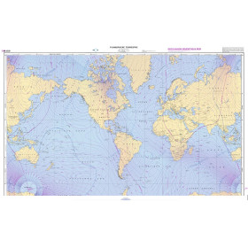
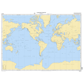
Digital nautical chart
Digital nautical charts, Navionics, C-map, Shom raster geotiff, Admiralty raster geotiff, Admiralty raster ARCS, NV Charts, ENC, Livechart, SnMap, Mapmedia, ... digital nautical charts for yachtsmen and merchant marine professionals.
-
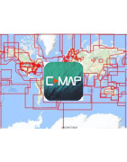
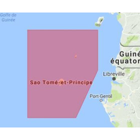
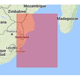
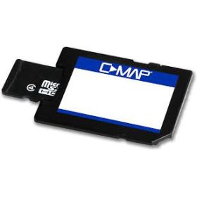
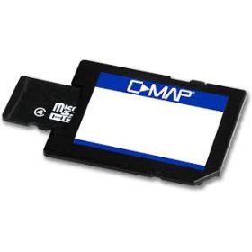
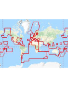
C-Map digital nautical chart
Les cartes électroniques C-map offrent, depuis 1985, une couverture géographique mondiale et proposent des fonctionnalités avancées pour la navigation telles qu’un système de guidage automatique, des images satellites, des vues 3D, etc... Ces cartes C-Map sont utilisables sur tous les traceurs à lecteur C-Map et peuvent être mises à jour si besoin. Elles apportent un confort de navigation irréprochable en mer, en Europe et dans le monde entier. Avec les C-Map, vous pourrez naviguer de nombreux milles avec votre bateau de plaisance, découvrir de merveilleux mouillages, faire de la navigation côtière ou hauturière.
Toutes les cartes marines, papier ou numérique, sont éditées à la commande et bénéficient des dernières mises à jour. Conformément aux dispositions de l’article L221-28 du Code de la consommation, le droit de rétractation ne peut être exercé pour les fourniture de biens susceptibles d'être obsolètes rapidement. Ces cartes ne sont ni reprises, ni échangées. En conséquence, ces commandes sont conclues de façon définitive dès la passation de la commande par le Client selon les modalités précisées aux présentes CGV.
-> Les logiciels Adrena et Rose Point nécessitent une préparation particulière des cartes C-Map.
- Pour Adrena : merci de consulter la page des logiciels Adrena.
- Pour Rose Point : merci de vous adresser directement à cet éditeur pour acheter les cartes.
-> Depuis mai 2020, C-Map ne commercialise plus les cartes NT et NT+, ainsi que les formats FP card et C card.
Toutes les cartes que nous expédions sont vérifiées et testées par notre programmateur avant expédition. Si vous connaissez des problèmes de positions ou d'échelles, c'est probablement parce que votre lecteur (plotter) n'est pas à jour !
Compatibilité des cartes numériques C-Map avec les plotters
Il est important de bien vérifier la compatibilité des cartes avec votre appareil, toutes les cartes marines sont éditées à la commande et bénéficient des dernières mises à jour, pour des raisons d'obsolescence elles ne sont ni reprises, ni échangées.
- Lors de votre achat, merci de nous indiquer dans la zone de texte prévue à cet effet (face aux choix du mode de transport de votre colis) : la marque + le modèle + l'année de fabrication + les références de l’appareil ou logiciel destiné à recevoir cette carte numérique, nous ferons une contre-vérification de compatibilité. Sans indication de votre part, cette étape ne sera pas traitée.
-
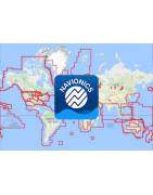
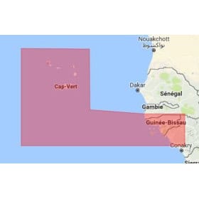
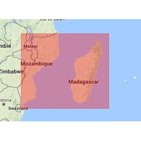
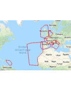
Navionics digital nautical chart
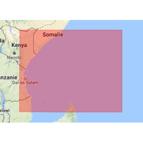
Javerne, Kenya receives Navionics charts ordered on Nautic Way, and shipped by DHL
Since January 1, 2022, Navionics no longer sells charts in Compact Flash format
Navionics History
In 1984, Navionics revolutionized recreational boating by marketing the world's first digital chart reader, called Geonav. Almost 40 years later, Navionics has the world's largest nautical and inland waterway chart database.
In 2017, Garmin bought Navionics, although Garmin already has its own electronic cartography called BlueChart. It was therefore necessary for the cartographers of Navionics and Garmin to merge. From now on, Navionics and BlueChart offer similar charts concerning geographical footprints (coverage area), colors, etc., but each of these brands remains dedicated: BlueChart for Garmin plotters and Navionics for Simrad, Lowrance, Humminbird plotters,. ..
Navionics charts change name
At the start of 2022, Navionics is completely revising its digital chart catalog.
The charts change their name, their numbering and the geographic footprints are simplified, there are 2 charts sizes and 2 levels of detail: Large and Regular. For the colors used, they are the same in both universes.
- The Navionics+ XL9 become the Navionics+ Large
- Navionics+ Small becomes Navionics+ Regular
- The Platinium+ XL become the Platinium+ Regular
- The Platinium+ XL3 become the Platinium+ Large
Among the innovations, we note:
- The improvement of the autoguidance function (which is now called Autoguidance +), which is no longer content to be a simple algorithm, but calculates the route according to the boat's draft and integrates the routes already taken by the users.
- Charts are updated daily. When purchasing, you benefit from a one-year subscription including updates and the ability to synchronize a mobile with the chartplotters via the ActiveCaptain or Navionics Boating applications.
- A high-end version, called Vision+, includes all the standard features of Garmin Navionics+, plus terrain shading, 3D views, high-resolution satellite images, aerial photos, etc. This version is particularly awaited by fisherman.
More generally
Navionics electronic charts are ideal for recreational boating, they are accessible to everyone and easy to use. The marine cartography offered by Navionics offers global coverage and very good value for money. These electronic charts are compatible with most devices and nautical chart readers. With Navionics charts, you will be able to sail many miles with your pleasure boat, discover wonderful anchorages, do coastal or offshore navigation.
Compliance and guarantee
All the Navionics charts that we sell come from Navionics. They are checked and tested by our programmer before shipping. If you are experiencing position or scale problems, it is probably because your plotter is not up to date!
All nautical charts, paper or digital, are produced to order and benefit from the latest updates. In accordance with the provisions of article L221-28 of the Consumer Code, the right of withdrawal cannot be exercised for the supply of goods likely to become obsolete quickly. These charts are neither returned nor exchanged. Consequently, these orders are definitively concluded upon placing the order by the Customer in accordance with the terms specified in these General Terms and Conditions.
- We do not sell Navionics applications for iPad and other tablets, as well as nautical charts for these applications. They can be downloaded directly from iTunes.
Navionics / Platinum+ comparison table
Comparaison Navionics+ Platinium+ CONTENU EAUX CÔTIÈRES X X CONTENU EAUX INTÉRIEURES 42.000 lacs 42.000 lacs CARTES NAUTIQUES DÉTAILLÉES X X SONARCHART™ BATHYMÉTRIE HD X X MISES À JOUR QUOTIDIENNES X X AUTOROUTING DOCK-TO-DOCK X X PLOTTER SYNC X X COMMUNITY EDITS X X RÉGLAGES CARTOGRAPHIE X X CARTOGRAPHIE SONARCHART LIVE X X RELIEF SHADING X SUPERPOSITION SATELLITE AVEC SONARCHART SHADING X PHOTOGRAPHIE AÉRIENNE X VUE 3D X PHOTOS PANORAMIQUES X Updating Navionics charts
- When purchasing a new chart
-
- When buying a new chart, you get one year of free updates.
- The Navionics charts that we sell are up to date, they can be used directly on your plotter.
- When you receive your Navionics chart, you must follow the instructions by connecting to the Navionics website to activate free updates, using the USB adapter supplied with your chart.
- The validity of updates starts from the chart programming date, so this procedure must be done upon receipt of your chart.
Navionics has released hundreds of thousands of updates since 2014. These updates include improvements to shorelines and contours, changes to buoys, sandbars, the addition of new rocks, submerged structures, new points of interest and more…
It is therefore important that you keep your digital chart up to date.
- Updating your chart that is several years old
-
- Your chart no longer benefits from the year of free updates, you can still update it by replacing it with a so-called update chart, which is generally 50% of the price of a new chart, depending on the following conditions:
-
-
- In order to update your Navionics chart, you must buy the chart you want from our e-shop, making sure to choose an update chart and not a new one.
- Send us by post, with acknowledgment of receipt, your old chart so that it is locked, we will send you an updated chart by return.
- Who replaces what?
- Navionics Silver chart: there is no update because it is generally a chart that was offered with the reading device
- Navionics Gold or Navionics+ XL9 chart: updated via Navionics+ Large, even if you want a different navigation area than the chart you send us
- Navionics+ Small chart: updated via Navionics Regular, even if you want a different navigation area than the chart you send us
- Navionics Platinium+ XL chart: updated via Navionics Platinium+ Large, even if you want a different navigation area than the chart you send us
- Navionics Platinium+ XL3 chart: updated via Navionics Platinium+ Regular, even if you want a different navigation area than the chart you send us
-
Compatibility of Navionics digital charts with plotters
New for 2019, Navionics is increasing the capacity of its memory charts, it is therefore important to check the compatibility of the charts with your device, all nautical charts are published to order and benefit from the latest updates, for reasons of obsolescence they are neither returned nor exchanged.
- When purchasing, please indicate to us in the text box provided for this purpose (facing the choice of mode of transport for your package), the brand + model + year of manufacture + device references or software intended to receive this digital charts, we will do a compatibility cross-check. Without your indication, this step will not be processed.
-
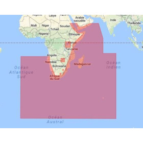
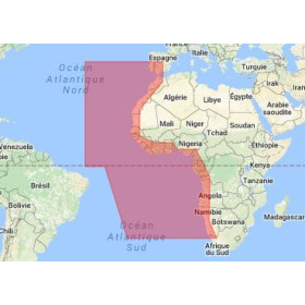
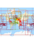
Primar Vector ENC digital Nautical Chart (S57/S63)
ENC charts (S57/S63) are digital nautical charts generally used by professionals on ECDIS or computers with SeaPro type software. Professionals seem to be abandoning raster nautical charts in favor of ENCs.
ENC charts are published by all hydrographic services around the world: Shom, Admiralty, etc.
The coverage areas coming from several Hydrographic Services (Shom, Admiralty, Japan, South Africa, Brazil, etc.) and each publisher applying its own price, we need to know the map(s) you want.
Duration: on certain ECDIS, the cards may no longer be usable when the subscription period expires.
-
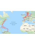
Shom raster Geotiff digital nautical chart
Shom raster digital charts are in geotiff format, with a resolution of 300 dpi. They are the image of paper nautical charts and meet the obligations to carry nautical charts for pleasure craft less than 24 meters in length. For other categories of vessels they can only constitute an aid to navigation.
All nautical charts, paper or digital, are produced to order and benefit from the latest updates. In accordance with the provisions of article L221-28 of the Consumer Code, the right of withdrawal cannot be exercised for the supply of goods likely to become obsolete quickly. These charts are neither returned nor exchanged. Consequently, these orders are definitively concluded upon placing the order by the Customer in accordance with the terms specified in these General Terms and Conditions.
Following your order we will send you a link via Wetransfer to your email to download your chart.
You can read Raster and ENC S57 charts with software like QGIS (Geographic Information System) and GlobalMapper (wave modeling). For ENC S63 we have no information. This software is for mapping and not navigation.
Before choosing your navigation software, it is interesting to consult our comparison of navigation software.
Compatibility of Shom raster Geotiff digital marine charts with navigation software
Logiciel Ordinateur Shom raster Adrena Octopus PC N Adrena First PC N Adrena Standard PC N Adrena Pro PC N MaxSea Time Zero PC N Noé PC N Scannav PC O SeaPro Lite PC* O SeaPro Standart PC* O SeaPro Performance PC* O SeaPro Plus PC* O * Compatible avec Windows XP, 7, 8 et 10.
Scannav : fonctionne sous PC Windows XP à Win10, tablette Windows avec interface tactile. Ne fonctionne pas sous MacOs en natif, mais fonctionne sans problème sous Mac via Parallels. Android : une version simplifiée existe et fonctionne avec les mêmes cartes SnMap. Ipad/Iphone : pas de version à ce jour.
-
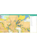
NV Charts digital nautical chart for software NV Charts
NV Charts is the largest German publisher of nautical charts, for over 30 years, it has been publishing nautical charts and guides, with its team of hydrographers, cartographers and nautical geographers who combine their know-how.
All nautical charts, paper or digital, are published to order and benefit from the latest updates. In accordance with the provisions of Article L221-28 of the Consumer Code, the right of withdrawal cannot be exercised for the supply of goods likely to become obsolete quickly. These charts are neither taken back nor exchanged. Consequently, these orders are definitively concluded upon placing the order by the Customer according to the terms specified in these General Terms and Conditions.
Before choosing your navigation software, it is interesting to consult our comparison of navigation software.
-
Livechart digital nautical chart for software SeaPro
All marine charts, paper or digital, are published to order and benefit from the latest updates. In accordance with the provisions of Article L221-28 of the Consumer Code, the right of withdrawal cannot be exercised for the supply of goods likely to become obsolete quickly. These charts are neither returned nor exchanged. Consequently, these orders are definitively concluded upon placing the order by the Customer according to the terms specified in these General Terms and Conditions.
Compatibility of LiveChart digital charts with navigation software
Logiciel Ordinateur Livechart Adrena Octopus PC N Adrena First PC N Adrena Pro PC N Adrena Standard PC N Time Zéro Noé PC NV Charts ScanNav PC SeaPro Lite PC* O SeaPro standard PC* O SeaPro performance PC* O SeaPro Plus PC* O * Compatible avec Windows XP, 7, 8 et 10.
** Nécessite l'option Navionics pour toute version.
Scannav : fonctionne sous PC Windows XP à Win10, tablette Windows avec interface tactile. Ne fonctionne pas sous MacOs en natif, mais fonctionne sans problème sous Mac via Parallels. Android : une version simplifiée existe et fonctionne avec les mêmes cartes SnMap. Ipad/Iphone : pas de version à ce jour. Navonics : support les différents formats sauf les Silver (réservées à certains traceurs) et pour les Platinum (la 3D n'est pas exploitée). -
SnMap digital nautical chart for software ScanNnav
All marine charts, paper or digital, are published to order and benefit from the latest updates. In accordance with the provisions of Article L221-28 of the Consumer Code, the right of withdrawal cannot be exercised for the supply of goods likely to become obsolete quickly. These charts are neither returned nor exchanged. Consequently, these orders are definitively concluded upon placing the order by the Customer according to the terms specified in these General Terms and Conditions.
Compatibility of SnMap digital charts with navigation software
Logiciel Ordinateur SnMap Adrena Octopus PC O Adrena First PC O Adrena Pro PC O Adrena Standard PC O Time Zéro Noé PC NV Charts ScanNav PC O SeaPro Lite PC* SeaPro standard PC* SeaPro performance PC* SeaPro Plus PC* * Compatible avec Windows XP, 7, 8 et 10.
** Nécessite l'option Navionics pour toute version.
Scannav : fonctionne sous PC Windows XP à Win10, tablette Windows avec interface tactile. Ne fonctionne pas sous MacOs en natif, mais fonctionne sans problème sous Mac via Parallels. Android : une version simplifiée existe et fonctionne avec les mêmes cartes SnMap. Ipad/Iphone : pas de version à ce jour. Navonics : support les différents formats sauf les Silver (réservées à certains traceurs) et pour les Platinum (la 3D n'est pas exploitée). -
Carte marine numérique C-Map for software Adrena
-
Carte marine numérique SnMap de ScanNav for software Adrena

 Click here to open our interactive map and select your charts