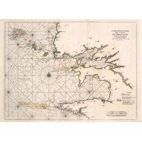
Shom is the Hydrographic and Oceanographic Service of the French Navy.
shom-9176NQG
Data sheet
- Year
- 1972
- Author
- Shom
- Scale
- 1:1.118.400
- Picto
- Carte papier roulée
En langue française
- Classification scale paper chart
- Offshore
- Book in version
- paper version
Specific References
- ean13
- 4000000070016
New


 100% secure payments