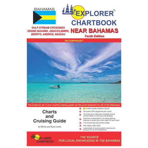
Explorer chartbook - Near Bahamas
search
  • googlemap
  • Explorer chartbook - Near Bahamas

Explorer chartbook - Near Bahamas

€130.45
Tax included
En langue anglaise
En stock
This new 10th edition of the Explorer Chartbook Near Bahamas adds a new chart to the collection, bringing you the most up-to-date charts and cruising guide information for the islands stretching from the Gulf Stream across to the Abacos and down to New Pr
PIL0623S

Data sheet

Year
10th edition
Picto

En langue anglaise
New
Last items in stock
100% secure payments
Description détaillée

This new 10th edition of the Explorer Chartbook Near Bahamas adds a new chart to the collection, bringing you the most up-to-date charts and cruising guide information for the islands stretching from the Gulf Stream across to the Abacos and down to New Providence. Each settlement's Need-to-Know Info has been revised and updated reflecting post-Dorian rebuilding efforts so that you can confidently explore this beloved cruising ground.

FEATURES:

  • Covers Gulf Stream Crossings, Grand Bahama, Abacos, Bimini, Berry Islands, Andros, New Providence/Nassau
  • Tide Tables through 2022-2023
  • 81 cruiser-friendly Explorer Charts
    • Overview Planning Chart of the Bahamas
    • (6) Small Scale charts
    • (13) Medium Scale charts
    • (39) Large Scale charts
    • (23) Closeup charts
  • Chart Detail:
    • On-scene GPS waypoints and routes
    • 1/10-minute grid and border scales
    • Shaded depth contours
    • New and corrected hydrographic data
    • Updated variation on compass roses
    • Extensive hydrographic and topographical features to scale, plus road maps for land travel
    • Chart page overlaps
    • Notes on "Joins page..."
  • Printed on water- and tear-resistant material
  • The most up-to-date and complete source of information on services and facilities (Need-to-Know Info)
  • Latest table of recommended marinas and services for all of the Bahamas
  • Special Articles including:
    • Crossing the Gulf Stream
    • Customs and Immigration
    • Bahamas Weather
    • Anchoring
    • History and Description
    • Reading the Water
    • Communications
    • Provisioning
    • Fishing Regulations
    • Flight Services
    • Extensive Help Menu
    • Emergency Medical Services and Evacuation
    • Bahamas National Parks
    • Hurricane Dorian Update
    • Good Neighbor Checklist
    • Navigating Andros' East Coast
    • Waypoint List

All Chartbooks are water- and tear-resistant. Use special care!

  • Ink softens and can be scratched off if wet. Rinse off any water and pat dry carefully.
  • Store out of sunlight.
  • Write with soft lead pencil and erase gently.
Loading...